Mozirska koča na Golteh - Dom na Smrekovcu
Starting point: Mozirska koča na Golteh (1356 m)
| Latitude/Longitude: | 46,37150°N 14,90410°E |
| |
Walking time: 1 h 55 min
Difficulty: easy marked way
Elevation gain: 19 m
Elevation difference along the route: 300 m
Map: Kamniške in Savinjske Alpe 1:50.000
Recommended equipment (summer):
Recommended equipment (winter):
Views: 36.779
 | 1 person like this post |
Access to starting point:
From Mozirje towards Radegunda, at the inn Vid right towards Šmihel and follow the road signs in the direction of Golte and Mozirska koča.
Route description:
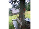
A little before the mountain hut Mozirska koča, on the mountain pasture Morava, a footpath starts which leads towards the mountain hut Dom na Smrekovcu. We will find the beginning of the path near the chapel, where blazes in the direction of the path Pot po Golteh point us to the left. The path which is further ascending through the forest quickly brings us to the ice cave (a cave in which snow lingers long into the summer). After the next few minutes of ascent we come out of the forest on the vast mountain pasture Hleviška planina. Here the path turns right and in a gentle diagonal ascent brings us to a rougher road. We continue on the mountain pasture ahead to a smaller saddle, where there is the next junction. Here we continue straight downwards on the path in the direction of Smrekovec (right Boskovec). The path ahead first descends on a panoramic grassy slope, then passes into the forest. After approximately 20 minutes of descent, the path brings us to the saddle Kal (1318m), where we cross the forest road (possible continuation also on the road). The marked footpath then steeply ascends through dense forest and continues on Kalski greben. The solitary path on Kalski greben later starts descending and brings us after some time to the saddle Atelsko sedlo, where we step on the forest road which runs from Ljubno towards the mountain hut Dom na Smrekovcu. Here we continue right in the direction of the mountain hut Dom na Smrekovcu, the road then quickly brings us to the next crossroad, where we go left upwards (again direction Dom na Smrekovcu). This road, which gradually emerges from the forest, we then follow to the mentioned mountain hut.

Along the route: Kal (1318m), Kalski greben (1375m), Atelsko sedlo (1317m)
The trip can be extended to the following destinations: Smrekovec
Photos:
 1
1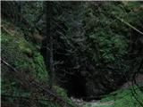 2
2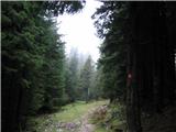 3
3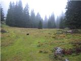 4
4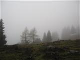 5
5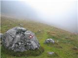 6
6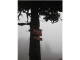 7
7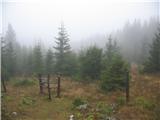 8
8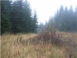 9
9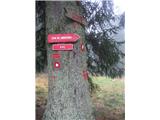 10
10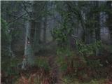 11
11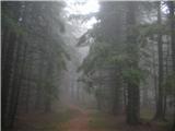 12
12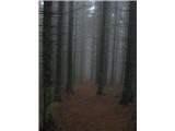 13
13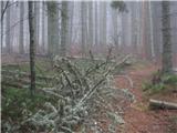 14
14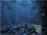 15
15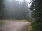 16
16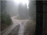 17
17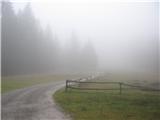 18
18 19
19
Discussion about the trip Mozirska koča na Golteh - Dom na Smrekovcu
|
| JTrogar6. 07. 2010 |
The elevation difference along the path is by no means 19m but in my estimation close to 300m.
Mozirska koča 1350m - Isteje 1470m - Kal 1318m - Kalski greben 1375m - Atelsko sedlo - Dom na Smrekovcu 1375m plus some more up and down and we are at 300m.
And best regards from under the beautiful Mozirska planina, Janez.
|
|
|
|
| damijanp6. 07. 2010 |
Indeed, it is stated in the data that the elevation gain along the path is 300 m. 19 m is between the starting point and the destination. 
LP, Damijan
|
|
|
|
| Tadej6. 07. 2010 |
The elevation difference data was corrected after JTrogar's post.
|
|
|
|
| alesd16. 08. 2010 |
what is the path like for children aged 8 and 5. Otherwise used to hiking
|
|
|
|
| geppo16. 08. 2010 |
Walking is through the forest (road possible too) and I see no problems if they are used to walking.
Best regards, you can pick mushrooms along the way too....
|
|
|
|
| miamia11. 08. 2014 |
This weekend we hiked this trail with a 4.5-year-old and a 1.5-year-old. Halfway there's quite a steep descent (Kal) and then immediately steeply uphill, most of the trail is gently uphill or downhill, and also flat. Along the Kalski greben to Atelsko sedlo we ate blueberries in the forest along the way and picked chanterelles. When we reached the hut, we unfortunately ran out of strength to the top of Smrekovec, as it took us 3 hours to get here, the whole trail took us less than 7 hours. Pleasant, quite long, but overall not overly strenuous (except for the husband, who had to carry the younger child most of the way).
|
|
|
|
| radagremvhribe6. 08. 2015 |
like miamia, I also picked strawberries along the way, blueberries are already harvested, so the path took me much longer than stated, at the hut I recommend the tried ones, i.e. blueberry strudel and mushroom soup, both very good, on the way back I wanted to avoid the ascent to Kalski greben, so I got lost on the road and probably walked more than otherwise, but nothing wrong, recommend for these hot days
|
|
|
|
| nejcf30. 12. 2022 18:34:18 |
For the last mountain visit of this year we walked the described path and also ascended to Smrekovec. It was just right to be in the sun, in Ljubljana there has been little of it lately. Both huts were open, surprisingly few people for the holiday season.
|
|
|
To post a comment you must log in:
If you do not yet have a username, you must first
register.