Starting point: Mrzli studenec (1280 m)
| Latitude/Longitude: | 46,41460°N 14,33140°E |
| |
Walking time: 2 h
Difficulty: easy pathless terrain
Elevation gain: 720 m
Elevation difference along the route: 720 m
Map: Karavanke - osrednji del 1:50.000
Recommended equipment (summer):
Recommended equipment (winter): ice axe, crampons
Views: 11.437
 | 2 people like this post |
Access to starting point:
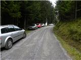
From the highway Ljubljana - Jesenice we take the exit Ljubelj. Further, we drive to the center of Tržič and follow the road through the Dolžanova Gorge to the village Jelendol, where signs for the mountain pastures Kofce, Šija and Pungrat direct us to the left. The road then loses its asphalt surface and starts to ascend steeply. We follow this road at the crossroads in the direction of the mountain pasture Kofce. When we notice signs for Kofce and the chapel by the road, we park on the parking lot by the road (to here from Jelendol approximately 4.7 km).
If we miss this starting point we can reach the mountain hut Dom na Kofcah also via two nearby paths, which are well marked (also possible via a worse road).
Route description:
From the parking lot, we head onto the footpath in the direction of the mountain hut Dom na Kofcah and the chapel. The relatively steep path brings us after approximately 20 minutes of walking out of the forest onto a clearing at the edge of which we notice the chapel.
Further, we continue on a cart track, which climbs over a strip of forest and brings us higher onto the grassy slopes of the mountain pasture Kofce. From here to the mountain hut Dom na Kofcah we have only a few minutes of pleasant walking.
From the mountain hut, we continue in the direction of Veliki vrh and Kladivo on an initially somewhat less visible path, which starts to ascend over a panoramic meadow. After 15 minutes of walking from the mountain hut Dom na Kofcah we reach a nice viewpoint at the cross.
The path then descends slightly and brings us in a few minutes to the steeper slopes of Košuta. The path then ascends through a strip of dwarf pines, which brings us to a junction. We continue straight ahead (right to Kladivo and Kofce gora) on the path, which ascends diagonally over increasingly steep slopes. The path, which continues over the bare slope, soon brings us to a short steep section, where a steel cable assists us (easy). Once we pass this section, the path turns slightly to the left and continues relatively steeply ascending over the grassy slope. The increasingly panoramic path then brings us into a small valley, up which we climb almost to the border ridge, where the ridge path joins us from the right. The path then from the valley passes again onto the southern slopes, where it bypasses the peak »Toplar (2000m)« on the south side. Right at this spot, we leave the marked path leading to Veliki vrh and head right into pathless terrain. After three minutes of steep but easy ascent over pathless terrain, we step onto Toplar.
Starting point - Kofce 30 minutes, Kofce - Toplar 1:30.

Photos:
 1
1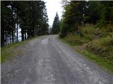 2
2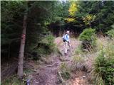 3
3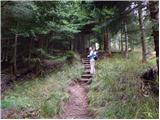 4
4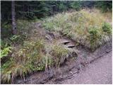 5
5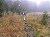 6
6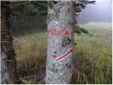 7
7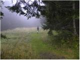 8
8 9
9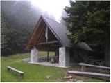 10
10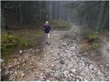 11
11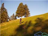 12
12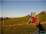 13
13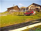 14
14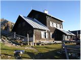 15
15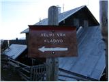 16
16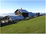 17
17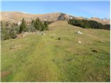 18
18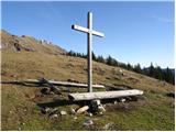 19
19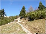 20
20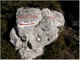 21
21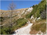 22
22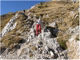 23
23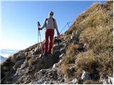 24
24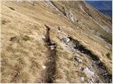 25
25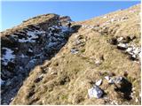 26
26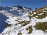 27
27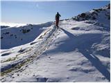 28
28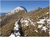 29
29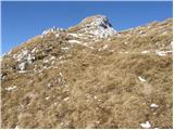 30
30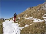 31
31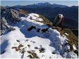 32
32
Discussion about the trip Mrzli studenec - Toplar
To post a comment you must log in:
If you do not yet have a username, you must first
register.