Mrzli studenec - Veliko Kladivo
Starting point: Mrzli studenec (1280 m)
| Latitude/Longitude: | 46,41460°N 14,33140°E |
| |
Walking time: 2 h 15 min
Difficulty: partly demanding marked way
Elevation gain: 814 m
Elevation difference along the route: 900 m
Map: Karavanke - osrednji del 1:50.000
Recommended equipment (summer):
Recommended equipment (winter): ice axe, crampons
Views: 45.055
 | 2 people like this post |
Access to starting point:
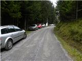
From the highway Ljubljana - Jesenice, we take the exit Ljubelj. Further, we drive to the center of Tržič and follow the road through the Dolžanovo gorge to the village Jelendol, where signs for the mountain pastures Kofce, Šija and Pungrat direct us to the left. The road then loses its asphalt surface and starts to ascend steeply. We follow this road at the crossroads in the direction of the mountain pasture Kofce. When we notice signs for Kofce and the chapel by the road, we park on the parking lot by the road (to here from Jelendol approximately 4.7 km).
If we miss this starting point, we can reach the mountain hut Dom na Kofcah also via two nearby paths, which are well marked (possible also via a bad road).
Route description:
From the parking lot, we head onto the footpath in the direction of the mountain hut Dom na Kofcah and the chapel. The relatively steep path brings us after approximately 20 minutes of walking out of the forest onto a clearing, on the edge of which we notice the chapel.
Further, we continue on a cart track that ascends over a belt of forest and brings us higher onto the grassy slopes of the mountain pasture Kofce. From here to the mountain hut on Kofcah, we have only a few minutes of pleasant walking.
From the mountain hut, we continue in the direction of Veliki vrh and Kladivo on an initially somewhat less visible path that starts to ascend across a panoramic meadow. After 15 minutes of walking from the mountain hut Dom na Kofcah, we reach a nice viewpoint by the cross.
The path then descends slightly and brings us in a few minutes to the steeper slopes of Košuta. The path then ascends through a belt of dwarf pines, where it brings us to a junction. We continue right (straight to Veliki vrh) on the path to which an unmarked but signed path from the mountain pasture Šija joins after just a few meters. We continue left uphill on the path that ascends steeply and quickly brings us to an exposed passage. Without fixed protection, we cross a short but crumbly and slightly exposed ledge, after which we enter a belt of dwarf pines. The path ahead ascends through a short belt of dwarf pines, then continues along the side ridge of Košuta. An increasingly panoramic and quite steep path joins the ridge path higher up.
We continue right in the direction of Kladivo (left Veliki vrh, straight uphill Kofce gora 10 steps) on a path that starts to descend slightly along the edge of the ridge. The very panoramic ridge path, which runs on and along the main ridge, is slightly exposed ahead at a few spots, but the passages do not cause problems when dry.
A little further ahead, the path approaches an indistinct summit (Malo Kladivo), to which a short steep ascent brings us.
From Malo Kladivo, the path starts to descend and quickly brings us to a smaller saddle between both Kladivos. Here, an easy unmarked path from the mountain pasture Šija joins from the right (return option), and we continue straight on the path that starts to ascend more steeply up the summit slope of Kladivo. After 10 minutes of steep and slippery walking, the path brings us to the panoramic summit.
Starting point - Kofce 30 minutes, Kofce - Kofce gora 1:00, Kofce gora - Kladivo 45 minutes.

Photos:
 1
1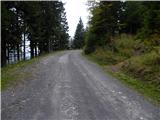 2
2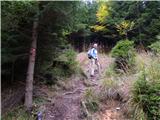 3
3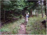 4
4 5
5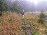 6
6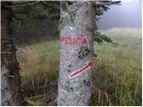 7
7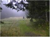 8
8 9
9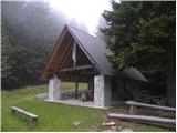 10
10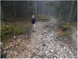 11
11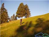 12
12 13
13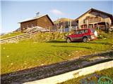 14
14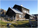 15
15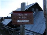 16
16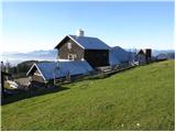 17
17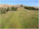 18
18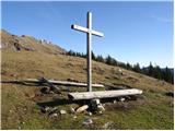 19
19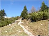 20
20 21
21 22
22 23
23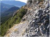 24
24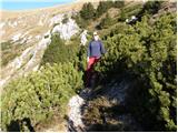 25
25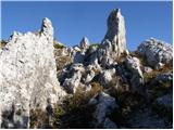 26
26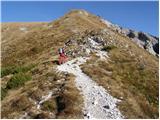 27
27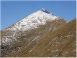 28
28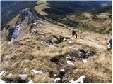 29
29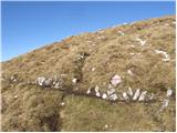 30
30 31
31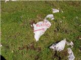 32
32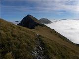 33
33 34
34 35
35 36
36 37
37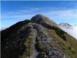 38
38 39
39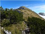 40
40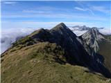 41
41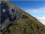 42
42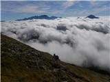 43
43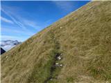 44
44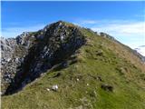 45
45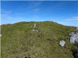 46
46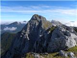 47
47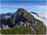 48
48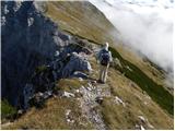 49
49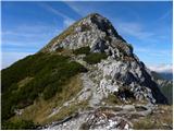 50
50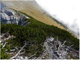 51
51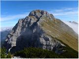 52
52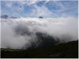 53
53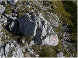 54
54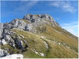 55
55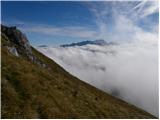 56
56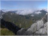 57
57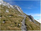 58
58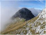 59
59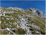 60
60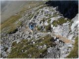 61
61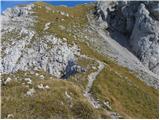 62
62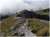 63
63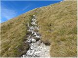 64
64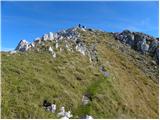 65
65 66
66 67
67
Discussion about the trip Mrzli studenec - Veliko Kladivo
|
| Parkeljc2. 07. 2010 |
Today I treated myself to an adventure on the described path. To V. Kladivo via M. Kladivo I needed just under an hour and a half, then along the ridge westwards via Kofce mountain and Toplar to V. vrh. For this section about 50 min, then descent to planina Kofce another good 40 min and to starting point another 15 min. Nice tour, no doubt, but due to afternoon swelter no clear view. Need to get up earlier,  . .
|
|
|
|
| istrumel27. 12. 2015 |
Yesterday I was up there, incredibly nice weather, views too, but on Kofce a crowd of people, perfect escape from the fog.
|
|
|
|
| KSG16. 10. 2020 |
Hiked this year. Very nice path, in combination with Veliki vrh. Some photo impressions from the path collected here: https://bit.ly/2H9EV5C
|
|
|
|
| orchigu4. 09. 2021 22:07:48 |
Today hiked the circular path Mrzli studenec - Dom na Kofcah - Veliki vrh/Košuta - Toplar - Kofce gora - Mali turn - Malo kladivo - planina Sija - Mrzli studenec. Phenomenal circular tour, but on the path between Sija and Kladivo there's a fallen spruce and a slightly slippery trail, stones "peel" off the ground so watch your steps. For descent this path might be a bit strenuous on the joints. On the way we also spotted a viper :O the circular tour was a full-day affair with longer stops at both huts and shorter ones at peaks and in between for photos, walking at average pace total 4h20min (we parked the car a bit lower so 20min up and down on the road). Hiked with two dogs used to mountains (mountain rescuers), but even small puppies could manage up. Huge crowds, both huts fully packed on such a nice sunny Sunday. Struklji I recommend more at Sija in my humble opinion
Road to Mrzli studenec open, newly paved below, higher up some parts typically mountainous and rough, but passable - even with a lowered car 
|
|
|
|
| Salsagirl14. 06. 2022 06:23:14 |
I'm curious about what the road to Mrzli studenec is like. And as I've noticed, there is no chapel anywhere, just a sign for it.
|
|
|
|
| Lapuh20713. 07. 2023 08:12:33 |
In the heat of the last days, we decided to head to Košuta upon the forecast of a clear and even hotter Wednesday. Still in the dark, we set off towards Gorenjska, but noticed lightning somewhere in the Julijci  Soon it became clear that a real thunderstorm was coming, and somewhere around Kranj it really washed us out. But since we don't turn around on the AC, we continued towards Jelendol and then up to the left. At Mrzli studenec it was just dripping, and on Kofce there were no more drops. We were the only ones climbing to the ridge, except for a couple of chamois. The path is quite good, the views were getting better and better, and on Veliko Kladivo we even sunbathed. On the descent to Šija, the weather started drizzling again, and we hurried to the štruklje. From and to Kofce we walked completely alone all the time, but we ate the štruklje in a large group, in the hut, because it started raining outside again. A bit wet back to the car. Soon it became clear that a real thunderstorm was coming, and somewhere around Kranj it really washed us out. But since we don't turn around on the AC, we continued towards Jelendol and then up to the left. At Mrzli studenec it was just dripping, and on Kofce there were no more drops. We were the only ones climbing to the ridge, except for a couple of chamois. The path is quite good, the views were getting better and better, and on Veliko Kladivo we even sunbathed. On the descent to Šija, the weather started drizzling again, and we hurried to the štruklje. From and to Kofce we walked completely alone all the time, but we ate the štruklje in a large group, in the hut, because it started raining outside again. A bit wet back to the car.
PS the road from Jelendol up is quite... given this year's weather
PPS Ah, Salsagirl: the chapel is still there where it was. Maybe it's time to visit an optician 
|
|
|
|
| Salsagirl9. 09. 2023 17:20:16 |
Lapuh207 - correct, the chapel is still there where it was. I don't need an optician.
Today I went to Veliko Kladivo. Where the macadam starts, the road is disastrous in several sections. You don't know where to drive. Unfortunately, the rain has done its damage.
|
|
|
|
| di9. 07. 2026 17:54:06 |
Today we went to Veliko Kladivo. Where the macadam starts, the road is terrible in several parts.
|
|
|
To post a comment you must log in:
If you do not yet have a username, you must first
register.