Murnovo - Virnikov Grintovec
Starting point: Murnovo (1100 m)
Walking time: 1 h 30 min
Difficulty: easy marked way
Elevation gain: 554 m
Elevation difference along the route: 554 m
Map: Karavanke - osrednji del 1:50.000
Recommended equipment (summer):
Recommended equipment (winter): ice axe, crampons
Views: 29.966
 | 2 people like this post |
Access to starting point:
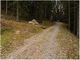
From the highway Ljubljana - Jesenice, take the exit Kranj - east and follow the road ahead in the direction of Jezersko. In the hamlet Bajte, which is located approximately 1 km after the inn Kanonir, turn left in the direction of the Krtina hospital, on a narrower asphalt road, which we then follow to the first crossroad. Here we continue right in the direction of the Spodnji Virnik farm (straight to Lehnjak quarry and Krtina hospital). The road, which further ascends along the Murnov graben stream, loses its asphalt surface and gradually begins to ascend more and more steeply. Soon we come to the next crossroad, where we continue on the right road (straight to Spodnji Virnik). We then follow the ascending road to a larger meadow, where to the left below the road we notice the Murn homestead. We continue another 10 meters or so and the road brings us to a crossroad at which we notice signposts for Virnikov Grintovec. Here we continue very sharply right and then a little higher park at a suitable place beside the road.
Route description:
From the starting point, we descend a few steps, and then head onto the footpath in the direction of Virnikov Grintovec. The path ahead ascends along the edge of the forest, slightly higher turns right and enters a dense forest, where it continues in a traverse ascent to the right. After a few minutes of easy walking, the path ascends a bit more steeply for a short time, then brings us to a marked junction, where we join the marked path from Zgornje Jezersko.
At the junction, we continue sharply left and continue the ascent along a pleasant forest path, which higher flattens out completely and turns slightly right, crossing the slopes of Žarkove peči (1411 m). After a few minutes of easy walking, we step out of the forest onto a larger clearing (Žingerc saddle 1345 m), where the path from the Austrian side joins from the right.
We continue in the direction of Virnikov Grintovec along the path that enters the forest, which then begins to ascend more and more steeply. The fairly steep path brings us higher to the main ridge, where it turns left. On the ridge, from which beautiful views open up to the surrounding peaks, the steepness also eases. We follow this occasionally very scenic path, which is slippery in places (no major danger when dry), all the way to the summit of Virnikov Grintovec.

Along the route: Žingerc (1345m)
Photos:
 1
1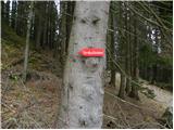 2
2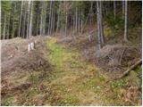 3
3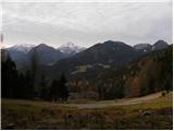 4
4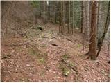 5
5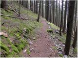 6
6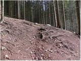 7
7 8
8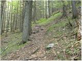 9
9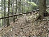 10
10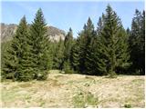 11
11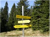 12
12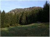 13
13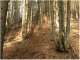 14
14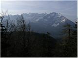 15
15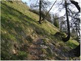 16
16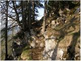 17
17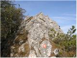 18
18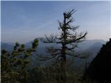 19
19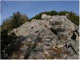 20
20 21
21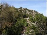 22
22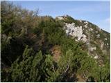 23
23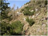 24
24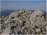 25
25 26
26
Discussion about the trip Murnovo - Virnikov Grintovec
|
| Sara23616. 08. 2020 |
This path no longer exists due to the new road and house above Murnova homestead. The new path leads past Murnova homestead (do not turn sharply right, continue on the cart track into the forest), where after 50 m we reach a junction marked for Virnikov Grintavec. Continue sharply right (below us is a log cabin) on the cart track. After 10 m on the left we notice an arrow with marking leading steeply into the forest, but do not follow it as it ends midway in the forest on a steep slope. Continue on the new cart track ahead, then reach the marked path to the summit.
|
|
|
To post a comment you must log in:
If you do not yet have a username, you must first
register.