Starting point: Na Poklonu (688 m)
| Latitude/Longitude: | 46,16430°N 14,20260°E |
| |
Walking time: 2 h 15 min
Difficulty: easy marked way
Elevation gain: 337 m
Elevation difference along the route: 425 m
Map: Škofjeloško in Cerkljansko hribovje 1:50.000
Recommended equipment (summer):
Recommended equipment (winter):
Views: 4.410
 | 1 person like this post |
Access to starting point:
A) We drive to Poljane nad Škofjo Loko, from where at the traffic-light intersection we continue in the direction of the settlement Javorje. When we arrive in Javorje, from the intersection past the inn Gostilna Blegoš we continue right in the direction of Jarčje Brdo and Mlaka (left Blegoš and Stari vrh). There follows a traverse drive to the right, and when we reach the ridge and the intersection, where on the signs we notice some directions of hiking paths, we park in a suitable place by the road.
B) We drive into Selška dolina, where at the inn Gostilna pr Birt (Praprotno 17) we leave the main road and continue driving in the direction of the ski area Stari vrh. In the settlement Zgornja Luša we go left in the direction of Jarčje Brdo, Krivo Brdo and Mlaka, and at the next intersection slightly right in the direction of Jarčje Brdo and Mlaka. Further on, the road becomes steeper and takes us to Jarčje Brdo and later to Mlaka. When Mlaka ends, we quickly reach an intersection, where we go left (right Zapreval and Stari vrh) in the direction of Škofja Loka and Lubnik. After a short traverse descent, when we reach the next intersection, where to the right a road branches off toward the settlement Javorje, and straight ahead the road continues toward the settlement Gabrška Gora, we park in a suitable place at the intersection.
Route description:
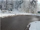
From the starting point Na Poklonu we continue on the road in the direction of the settlement Gabrška Gora and the hiking path to Lubnik. The road along which we walk first bypasses Božičev grič on the left side, then takes us to the saddle Predole, where first from the left an unmarked path from the hamlet Podpreval joins, and some 10 steps further ahead the road forks.
We continue on the left road in the direction of Lubnik (slightly right Gabrška Gora), which then gently to moderately ascends, meanwhile making some hairpin turns. Higher we reach a marked junction in the area called Vrhovčevo, located at 834 meters above sea level. At the mentioned intersection a marked path to Gabrška gora branches off to the right, while we continue straight on the macadam road, which bypasses Vrhovčev grič and Tavčarjev vrh on the right side, then past the abandoned homestead Dolinček takes us to the slopes of the peak Pleše, which the road also bypasses on the right side. The road then leads us past two NOB monuments as well, then at a smaller intersection we continue slightly left in the direction of the homestead pri Zalubnikarju. About 100 meters further we arrive at a small saddle, where we join the path from the settlement Praprotno.
We continue right in the direction of Lubnik, on a path that quickly brings us to another macadam road, along which we continue the gentle ascent in the already familiar direction toward Lubnik. The macadam road then enters the forest, where it crosses the slopes to the right. Somewhat higher a marked path from Breznice pod Lubnikom also joins from the right, while we continue slightly left on the increasingly worse road, partly already a cart track. We continue the ascent on an ever worse and gradually also steeper cart track, which we also leave, and continue the ascent on the marked hiking path (due to the numerous cart tracks, orientation is somewhat more difficult in a few places). Higher, a few more hiking paths join from the right, while we follow the occasionally steeper path all the way to the summit of Lubnik, a summit from which a beautiful view opens up.
Starting point - Vrhovčevo 50 minutes, Vrhovčevo - Lubnik 1:25.

Along the route: Predole (695m), Vrhovčevo (834m)
Photos:
 1
1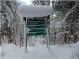 2
2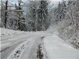 3
3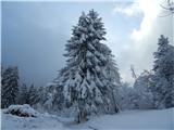 4
4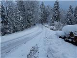 5
5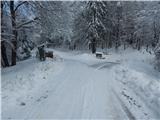 6
6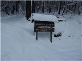 7
7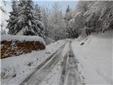 8
8 9
9 10
10 11
11 12
12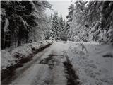 13
13 14
14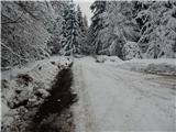 15
15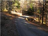 16
16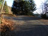 17
17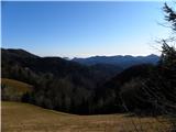 18
18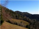 19
19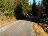 20
20 21
21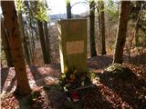 22
22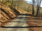 23
23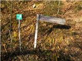 24
24 25
25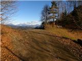 26
26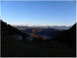 27
27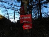 28
28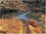 29
29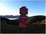 30
30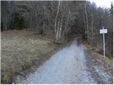 31
31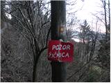 32
32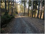 33
33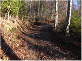 34
34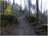 35
35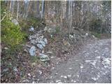 36
36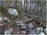 37
37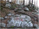 38
38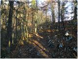 39
39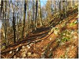 40
40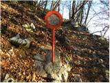 41
41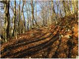 42
42 43
43 44
44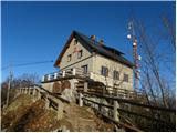 45
45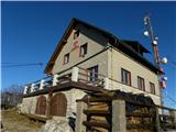 46
46 47
47
Discussion about the trip Na Poklonu - Lubnik
To post a comment you must log in:
If you do not yet have a username, you must first
register.