Niederalpl Ort - Graf-Meran-Haus (through Rodel valley)
Starting point: Niederalpl Ort (970 m)
| Latitude/Longitude: | 47,67972°N 15,41100°E |
| |
Route name: through Rodel valley
Walking time: 2 h 45 min
Difficulty: partly demanding marked way
Elevation gain: 866 m
Elevation difference along the route: 970 m
Map:
Recommended equipment (summer):
Recommended equipment (winter): ice axe, crampons
Views: 146
 | 1 person like this post |
Access to starting point:
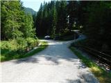
From the border crossing Šentilj we continue driving on the highway towards Gradec / Graz and forward towards Linz and Salzburg. We soon leave Highway A9 and continue driving slightly to the right towards Vienna/Wien, proceeding on Highway S35. From this highway, we then merge onto Highway S6, still following the signs for Vienna. We leave the highway at exit Mürzzuschlag-West, then follow the road to the town center, from where we follow the signs for Neuberg an der Mürz and Mürzsteg, and then continue straight towards the settlement and the Niederalpl mountain pass. In the settlement Niederalpl we pass the bus stop; on the other side of the settlement the road turns left. A short distance further the road begins to curve right and becomes steeper; here we turn left at the yellow hiking signs and 50 m ahead park at the gravel parking lot.
Route description:
From the parking lot, we head onto a macadam road in the direction of the summit Hohe Veitsch and the valley Rodelboden, first passing a barrier gate and then gently ascending. A little further ahead, at a crossroads we take the right-hand road and soon turn right onto a footpath which higher up crosses a forest road. After crossing the road we continue for a short time along a cart track, then the path leads us onto a gradually steeper trail that runs along the right side of the Rodel valley. Higher up, the forest gives way to a belt of dwarf pines where the path continues through the middle of the valley, mostly straight upwards. Higher still, a rocky step interrupts the direct passage through the centre of the valley, so the trail swings slightly right and climbs steeply for a few minutes.
On this section extra caution is needed because of the steepness to avoid slipping. When we return to the small valley the path briefly flattens. When the small valley becomes steep again, the path turns left onto steep grassy slopes over which we ascend diagonally for a short stage.
The path ahead continues over grassy terrain surrounded by dwarf pines. A little further on it makes a sharp turn right out of the small valley and then leads us with ever nicer views of the nearby peaks. Next comes an ascent through dwarf pines from where a beautiful view opens towards the nearby peak Großer Wildkamm; a little further on an unmarked path branches off to it.
We continue left and again keep left a little further ahead where another path joins us from our starting point (or rather the path that starts at the Niederalpl pass).
We continue the ascent at first still through dwarf pines, then over a grassy slope which brings us to a marked junction.
We continue straight ahead towards Meranhaus (right leads to the summit Hohe Veitsch and then on to Meranhaus over the summit). We still climb to the next junction a few minutes away, after which the path levels out and we continue straight towards Meranhaus (left to Seebodenhütte, right to the summit Hohe Veitsch).
This is followed by a short diagonal descent with beautiful views over the Hohe Veitsch plateau; lower down we cross another path.
Here too we continue straight. A little further on we briefly ascend again before descending towards Meranhaus which is now only a few minutes away.
Description and pictures refer to the conditions in August 2025.

Photos:
 1
1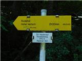 2
2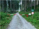 3
3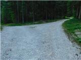 4
4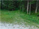 5
5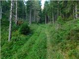 6
6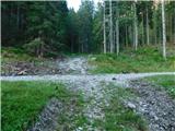 7
7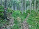 8
8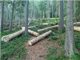 9
9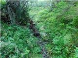 10
10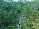 11
11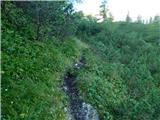 12
12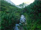 13
13 14
14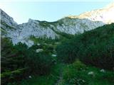 15
15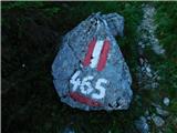 16
16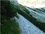 17
17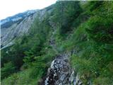 18
18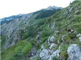 19
19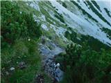 20
20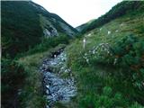 21
21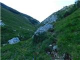 22
22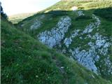 23
23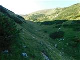 24
24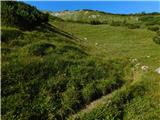 25
25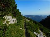 26
26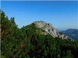 27
27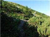 28
28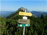 29
29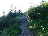 30
30 31
31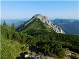 32
32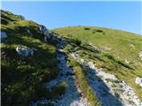 33
33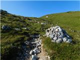 34
34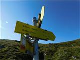 35
35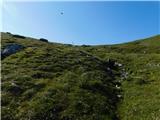 36
36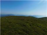 37
37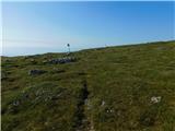 38
38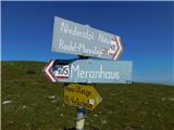 39
39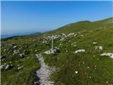 40
40 41
41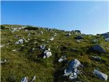 42
42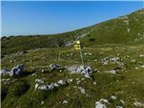 43
43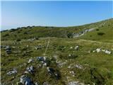 44
44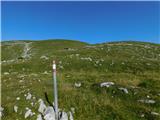 45
45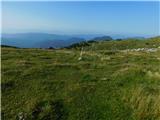 46
46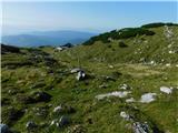 47
47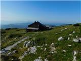 48
48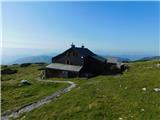 49
49
Discussion about the trip Niederalpl Ort - Graf-Meran-Haus (through Rodel valley)
To post a comment you must log in:
If you do not yet have a username, you must first
register.