Nova Štifta - Koča na Kamnem griču
Starting point: Nova Štifta (624 m)
| Latitude/Longitude: | 45,74510°N 14,66310°E |
| |
Walking time: 1 h 35 min
Difficulty: easy marked way
Elevation gain: 392 m
Elevation difference along the route: 480 m
Map:
Recommended equipment (summer):
Recommended equipment (winter):
Views: 6.301
 | 2 people like this post |
Access to starting point:
We drive on a regional road from Ljubljana towards Kočevje or vice versa. At the village Žlebič, we will notice signs for Nova Štifta and Sodražica, which direct us to the right (from Kočevje and Ribnica, left). We then drive to the village Lipovščica, where a sign for Nova Štifta directs us left uphill onto an ascending road. We follow this road to the parking lot near the church in Nova Štifti.
Route description:
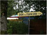
From the parking lot near the church we continue on the road in the direction of the mountain hut Dom na Travni Gori. Already after a few dozen steps of walking, the road brings us to the first crossroad, where we continue straight (left downwards, village Ravni Dol). We continue walking on a gently sloping macadam road, which leads us past the quarry to the next crossroad, where we continue straight onto a footpath (the footpath is located between the two roads). The path ahead first ascends moderately, then relatively steeply through a dense forest. Higher up, the path crosses a forest road and rejoins it after a short ascent. Here we continue left along the road, which we leave after a few dozen steps as the blazes direct us left onto a cart track. The cart track first gently ascends across a partly overgrown meadow, then brings us to the chapel and the NOB monument. A short gentle descent follows, and the path brings us back to a macadam road, which we follow to the left. A little further on, the road forks, and we continue left on the lower road, which brings us to the Dom na Travni Gori mountain hut in two minutes of walking.
From the hut we continue right across the meadow, where we quickly reach another macadam road, which we arrive at right at a smaller crossroad. From the crossroad we continue left on the macadam road, which continues without major changes in elevation. The path ahead leads us past mountain signposts, and from there we walk along the road for approximately 500 meters or to the spot where the blazes at some sort of parking lot direct us right. After a few meters of walking, at the spot where the path enters the forest, we also notice the mountain signs for the Koča na Kamnem griču hut.
The path ahead first ascends along a gentle and usually quite muddy cart track, which after a few minutes ascends more steeply. When the steepness eases, we reach a poorly marked junction, where we continue right. We continue walking along an increasingly wider but poorly marked cart track, which after a short descent turns into a macadam road that quickly brings us to the next junction. We continue left along the poorer macadam road in the direction of Kamni grič. At a small turning area the road turns into a cart track, and here we continue straight (poorly marked) along a pleasant cart track that leads us out of the forest onto pleasant grassy slopes. On the other side of the meadow we reach a marked junction, where we continue right in the direction of the hut, which is another 5 minutes' ascent away along a moderately steep cart track ascending across the aforementioned meadow.
Nova Štifta - Dom na Travni Gori 45 minutes, Dom na Travni Gori - Koča na Kamnem griču 50 minutes.

Photos:
 1
1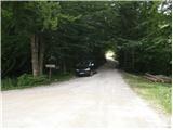 2
2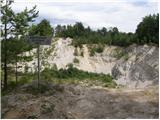 3
3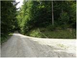 4
4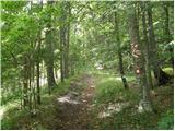 5
5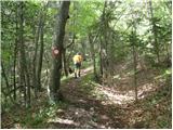 6
6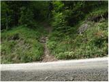 7
7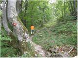 8
8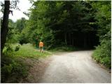 9
9 10
10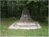 11
11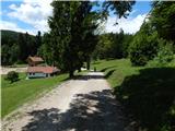 12
12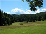 13
13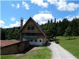 14
14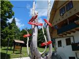 15
15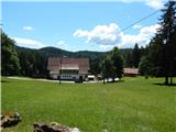 16
16 17
17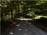 18
18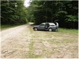 19
19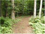 20
20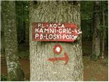 21
21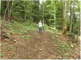 22
22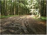 23
23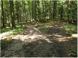 24
24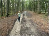 25
25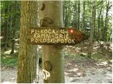 26
26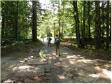 27
27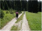 28
28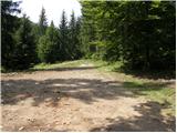 29
29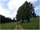 30
30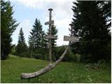 31
31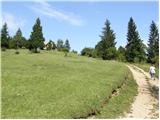 32
32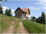 33
33 34
34
Discussion about the trip Nova Štifta - Koča na Kamnem griču
To post a comment you must log in:
If you do not yet have a username, you must first
register.