Obertauern - Zehnerkarspitze
Starting point: Obertauern (1738 m)
| Latitude/Longitude: | 47,24952°N 13,55424°E |
| |
Walking time: 2 h 10 min
Difficulty: difficult marked way
Elevation gain: 644 m
Elevation difference along the route: 644 m
Map:
Recommended equipment (summer):
Recommended equipment (winter): ice axe, crampons
Views: 2.591
 | 2 people like this post |
Access to starting point:
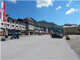
Through the Karawanks Tunnel, we drive into Austria, then we continue driving on the highway towards Salzburg. We leave the highway at the exit for Sankt Michael (the exit is located between the two larger tunnels). We then follow the signs for Obertauern and Radstadt. The road leads us through the settlements Sankt Michael, Sankt Margarethen and Mauterndorf. We follow the ascending road all the way to the Obertauern pass, where there is also the eponymous ski center. On the pass, we drive to the marked bridge number 5 (Brücke 5). We park on one of the parking lots near the bridge.
Route description:
From the starting point, we go on a narrow asphalt road which is closed to traffic. The road is located after the bridge number 5 and at first leads towards the southwest. The road ascends by grassy slopes and at a smaller cottage turns to the left. The ascending road then soon brings us to a crossroads.
Left on a macadam road leads the path towards the summit Herbertspitze and Gamsleitenspitze, and we continue right and still ascend on the road by the ski slope. Higher, the road turns a little to the left and then runs through a valley by huge scarps which protect the ski slope from avalanches. The road then brings us to the intermediate station of the chairlift from where a nice view opens up again towards the summit Gamsspitzl. Further the road runs below the slopes of the peak Gamsleitenspitze towards the west. Later the road turns a little to the right and only a short ascent follows to the bar Gamsmilchbar by which there is also the upper station of the cableway and an artificial lake intended for snowmaking.
We continue on a marked path which quickly brings us to a marked junction by the lake. Left leads the path towards the summit Gamsleitenspitze, and we continue right and after a short ascent we come to another junction.
This time to the right branches off the path towards the summit Gamsspitzl, and we continue left following the signs »Zehnerkarspitze«. The path from the junction then in a gentle ascent crosses slopes towards the west and brings us below the south wall of the peak Gamsspitzl. Here the path ascends over a short crumbly slope over which some caution is needed. Further we cross slopes for a short time, then the path turns right and starts to ascend more steeply towards the notch on the north side of the peak Zehnerkarspitze. On this part there is quite a lot of gravel on the path and in the last part towards the notch it is necessary to climb a few meters on steep rocks. The path is very steep for those few meters but not exposed.
On the notch where a view opens up towards the west we continue left on a well-marked ridge. The path then runs along a fairly wide ridge all the way to the top.

Photos:
 1
1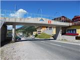 2
2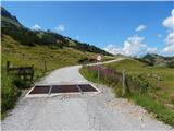 3
3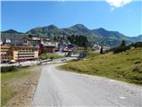 4
4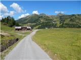 5
5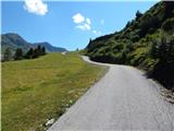 6
6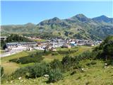 7
7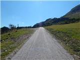 8
8 9
9 10
10 11
11 12
12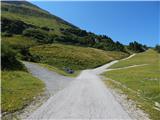 13
13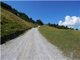 14
14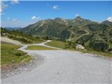 15
15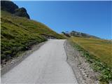 16
16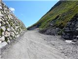 17
17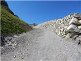 18
18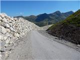 19
19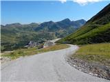 20
20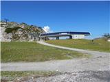 21
21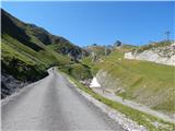 22
22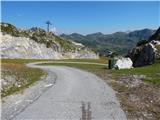 23
23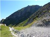 24
24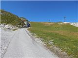 25
25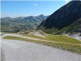 26
26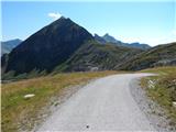 27
27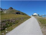 28
28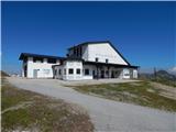 29
29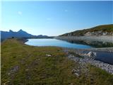 30
30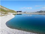 31
31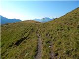 32
32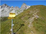 33
33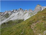 34
34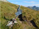 35
35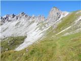 36
36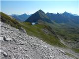 37
37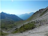 38
38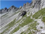 39
39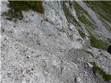 40
40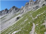 41
41 42
42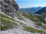 43
43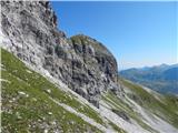 44
44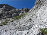 45
45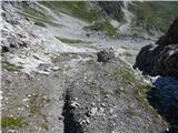 46
46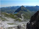 47
47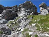 48
48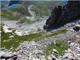 49
49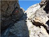 50
50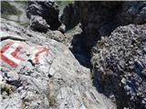 51
51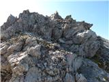 52
52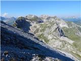 53
53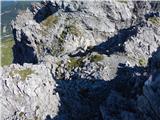 54
54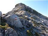 55
55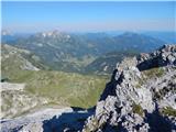 56
56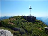 57
57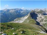 58
58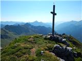 59
59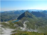 60
60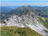 61
61
Discussion about the trip Obertauern - Zehnerkarspitze
To post a comment you must log in:
If you do not yet have a username, you must first
register.