Olševek - Apnišče (west path)
Starting point: Olševek (471 m)
| Latitude/Longitude: | 46,27910°N 14,44230°E |
| |
Route name: west path
Walking time: 55 min
Difficulty: easy unmarked way
Elevation gain: 269 m
Elevation difference along the route: 275 m
Map:
Recommended equipment (summer):
Recommended equipment (winter):
Views: 1.740
 | 1 person like this post |
Access to starting point:
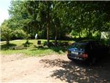
A) From the Ljubljana–Jesenice highway, take the Brnik exit; once you reach the Mengeš–Kranj road, continue left towards Kranj. Drive along the main road towards Kranj to the first roundabout, from which take the first exit right towards Šenčur. Through Šenčur, continue on the main road, then, upon reaching the Kranj–Zgornje Jezersko road, turn right towards Jezersko. In the settlement of Hotemaže, leave the main road and continue straight ahead (right off the main road) towards the settlement of Olševek. When you arrive in Olševek, initially follow the main road; from the junction of several roads, continue left onto the road towards the sports club. Before the children's playground and sports field, veer slightly left and park behind the NOB memorial.
B) First, drive to Kranj, then continue towards Zgornje Jezersko. In the settlement of Hotemaže, leave the main road and continue straight ahead (right off the main road) towards the settlement of Olševek. When you arrive in Olševek, initially follow the main road; from the junction of several roads, continue left onto the road towards the sports club. Before the children's playground and sports field, veer slightly left and park behind the NOB memorial.
C) b) From the Jesenice–Ljubljana highway, take the Kranj West exit, then continue towards Kokrica, later Britof. Still in Kokrica, at the unmarked junction with the priority road, continue left; then, upon arriving in Britof, follow the signs for Zgornje Jezersko. In the settlement of Hotemaže, leave the main road and continue straight ahead (right off the main road) towards the settlement of Olševek. When you arrive in Olševek, initially follow the main road; from the junction of several roads, continue left onto the road towards the sports club. Before the children's playground and sports field, veer slightly left and park behind the NOB memorial.
Route description:
From the starting point at the end of Olševek, continue on the road that enters the forest, which splits after a minute or two of walking. Continue on the left road (straight to Štefanja gora and Apnišče past the šterna), along which you also notice signs for Apnišče. Along the road, where you notice some boards of the Olševek educational trail, continue walking for a while. On the flat section, the educational trail branches off to the left from the road, but we continue straight on the road, which at the end of the flat section turns left and begins to ascend more steeply. Further on, the increasingly poor road turns right; here we leave it and continue straight onto the cart track, along which we notice a sign in the shape of the letter A. The path continues along the cart track, which occasionally ascends steeply through the forest; at the junctions, follow the otherwise unmarked path in the direction of Apnišče (the junctions are mostly marked with the inscription Apnišče or the letter A). Higher up, the cart track turns into a forest footpath, along which we ascend to the summit of Apnišče in a few minutes.
Description and pictures refer to the condition in 2017 (May).

Photos:
 1
1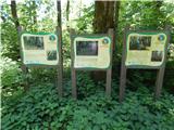 2
2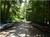 3
3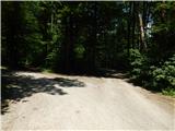 4
4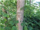 5
5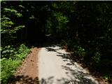 6
6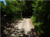 7
7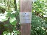 8
8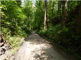 9
9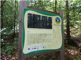 10
10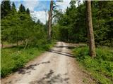 11
11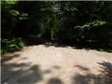 12
12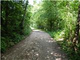 13
13 14
14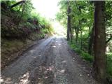 15
15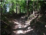 16
16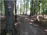 17
17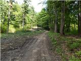 18
18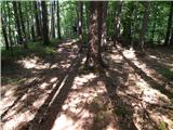 19
19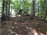 20
20 21
21
Discussion about the trip Olševek - Apnišče (west path)
To post a comment you must log in:
If you do not yet have a username, you must first
register.