Starting point: Olševek (471 m)
| Latitude/Longitude: | 46,27910°N 14,44230°E |
| |
Walking time: 1 h 15 min
Difficulty: easy unmarked way
Elevation gain: 249 m
Elevation difference along the route: 265 m
Map: Karavanke - osrednji del 1:50.000
Recommended equipment (summer):
Recommended equipment (winter):
Views: 1.160
 | 1 person like this post |
Access to starting point:
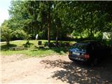
A) From the Ljubljana–Jesenice highway, take the Brnik exit. When we reach the Mengeš–Kranj road, continue left towards Kranj. On the main road towards Kranj, drive to the first roundabout, from where we continue on the first exit right in the direction of Šenčur. Through Šenčur, continue on the main road; then, when we reach the Kranj–Zgornje Jezersko road, continue right in the direction of Jezersko. In the settlement Hotemaže, leave the main road and continue driving straight (right from the main road) in the direction of the settlement Olševek. When we get to Olševek, at first follow the main road; from the crossroad of multiple roads, continue left on the road in the direction of the sports club. Before the playground and sports field, continue slightly left and then park behind the NOB memorial.
B) First, drive to Kranj, then continue driving in the direction of Zgornje Jezersko. In the settlement Hotemaže, leave the main road and continue driving straight (right from the main road) in the direction of the settlement Olševek. When we get to Olševek, at first follow the main road; from the crossroad of multiple roads, continue left on the road in the direction of the sports club. Before the playground and sports field, continue slightly left and then park behind the NOB memorial.
C) From the Jesenice–Ljubljana highway, take the Kranj West exit, then continue driving towards Kokrica, later Britof. Still in Kokrica at the unmarked crossroad with the priority road, continue left; then, when we get to Britof, follow the signs for Zgornje Jezersko. In the settlement Hotemaže, leave the main road and continue driving straight (right from the main road) in the direction of the settlement Olševek. When we get to Olševek, at first follow the main road; from the crossroad of multiple roads, continue left on the road in the direction of the sports club. Before the playground and sports field, continue slightly left and then park behind the NOB memorial.
Route description:
From the starting point at the end of Olševek, continue on the road that goes into the forest, after which it splits after a minute or two of walking. Continue on the left road (straight to Štefanja gora and Apnišče past the šterna), along which we also notice signs for Apnišče. On the road, along which we notice some boards of the Olševek educational trail, walk for some more time. On the flat section, the educational trail branches off to the left from the road, but we continue straight on the road, which at the end of the flat section turns left and begins to ascend more steeply. Further on, the increasingly poor road turns right; here we leave it and continue on the left cart track (straight to Apnišče), which shortly ahead crosses a small stream. This is followed by a traverse ascent to the left; higher up we arrive at Betlehem, where there is a small hut and a beehive. Slightly above the hut, we reach a poorer road, which we follow to the left (straight to Štefanja gora and Apnišče); on it, we ascend diagonally to a wider macadam road that connects Možjanca with Štefanja Gora.
Follow the road to the left, and in a few minutes arrive at Možjanca, where there are the Rožmarin refreshment hut and the church of St. Nicholas.
From the church, ascend along the road to the junction by the ecological island, where continue left in the direction of the viewpoint (right to Kopa, Davovec and Krvavec). Follows an ascent to the weekend settlement, where leave the road and continue slightly left on the cart track in the direction of the Jamna peč viewpoint. Follows easy walking on the cart track, then go left and quickly arrive at the viewpoint, where there is mainly in snow a risk of slipping.
Olševek - Možjanca 1:05, Možjanca - Jamna peč 0:10.

Photos:
 1
1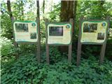 2
2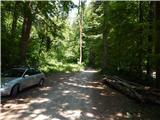 3
3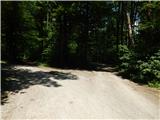 4
4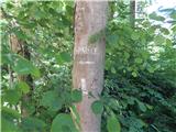 5
5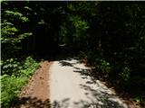 6
6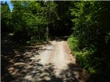 7
7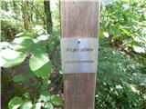 8
8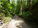 9
9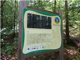 10
10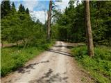 11
11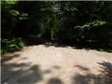 12
12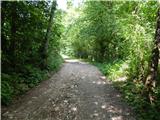 13
13 14
14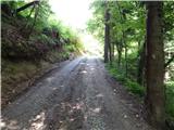 15
15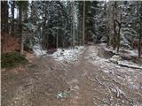 16
16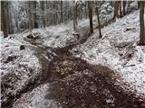 17
17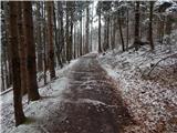 18
18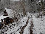 19
19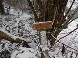 20
20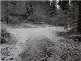 21
21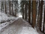 22
22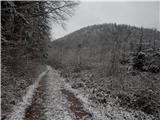 23
23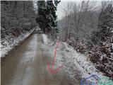 24
24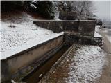 25
25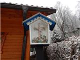 26
26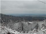 27
27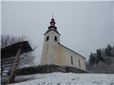 28
28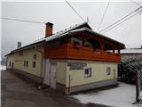 29
29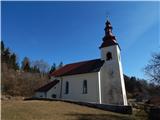 30
30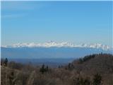 31
31 32
32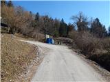 33
33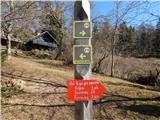 34
34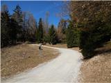 35
35 36
36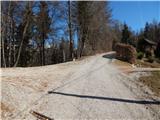 37
37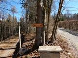 38
38 39
39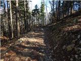 40
40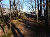 41
41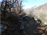 42
42 43
43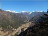 44
44
Discussion about the trip Olševek - Jamna peč
To post a comment you must log in:
If you do not yet have a username, you must first
register.