Starting point: Osor (2 m)
| Latitude/Longitude: | 44,69262°N 14,39192°E |
| |
Walking time: 2 h 40 min
Difficulty: partly demanding marked way
Elevation gain: 586 m
Elevation difference along the route: 610 m
Map:
Recommended equipment (summer):
Recommended equipment (winter):
Views: 5.980
 | 3 people like this post |
Access to starting point:
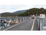
From highway Rupa - Rijeka or Zagreb - Rijeka we drive towards Rijeka, and from there we follow the signs for island Krk. When the highway ends, we descend to Krk Bridge. On island Krk we then follow the signs for island Cres and Lošinj and ferry port Valbiska. At the mentioned port we then go with the ferry to the settlement Merag on island Cres (126 kunas – July 2020). On island Cres we then follow the signs for Mali Lošinj all the way to the settlement Osor where over a short swing bridge we reach island Lošinj. Immediately after the bridge we turn right and we park on a smaller parking lot. The mentioned parking lot is often occupied, so we can park already on a large parking lot, which is situated at the roundabout in the settlement Osor approximately 300 meters before the bridge.
Route description:
Immediately behind the bridge, which connects islands Cres and Lošinj we head onto the ascending road through camp Preko mosta. At the beginning of the mentioned road we will also notice the blazes. After a short ascent the camp ends, and we still continue on the road which further becomes macadam. By the road there are also blazes and a big signpost with the inscription »Osoršćica«.
We continue on the macadam road and soon reach a marked junction where to the left a path branches off towards the abandoned village Tržić, which is about 20 minutes' walk away. We continue on the road for a short while longer, then the signpost for the mountain hut and summit Televrina directs us left into the forest.
Further on, the path mostly runs through low forest alongside a stone fence. To the right then branches off the path towards Mali Tržić, we continue straight ahead and follow the signs for the mountain hut. The path then rises a bit more and leads us to a marked junction.
From the left a path joins us from the settlement Nerezine via Tržić, sharply right downhill leads the path to the road, we continue slightly right and follow the signs for the mountain hut and summit Televrina. From the junction a relatively level path runs westwards and after about 15 minutes brings us to the next marked junction.
To the right leads a somewhat longer path past the mountain hut, we continue left where the sign for summit Televrina directs us. From the junction the path mostly runs through low forest and begins to ascend somewhat more steeply. A little higher we exit the forest onto a slope covered in shrubbery from where a nice view also begins to open up towards the sea and settlement Osor. This is followed by an ascent through a strip of forest, then the path takes us onto ever less vegetated slopes with a very nice view of the surroundings. Here the path turns slightly left and ascends relatively steeply up the slope. Such a path then brings us to the logbook box.
From the logbook box only a short ascent remains to the junction where we join the macadam road.
To the left the road leads towards the transmitter, right slightly downhill the road leads towards the mountain hut and further into the valley towards settlement Osor, we cross the road and continue on the footpath towards summit Televrina.
From the junction we ascend a panoramic slope partly vegetated with low shrubbery. The path then turns slightly left and runs along a wide ridge towards the indistinct summit Kalek on which there is also a larger cairn. From the summit we continue further south and the terrain becomes somewhat more vegetated, soon the path brings us into low forest where there is a marked junction.
Right downhill leads the path towards Veli jami, we continue ahead along the ridge towards summit Televrina. Further the path continues along the ridge and crosses several more strips of low forest. Later we leave the ridge to the right and the path brings us to a short secured section named »Slovenčica«. The secured section is very short and not overly demanding. The path then brings us back onto the ridge which we follow all the way to summit Televrina.
In summer months there is intense heat on the trail, so it is recommended to start very early, and sufficient drinks must be carried.

Along the route: Kalek (451m)
Photos:
 1
1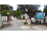 2
2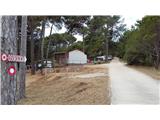 3
3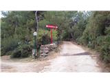 4
4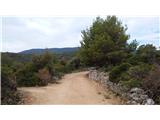 5
5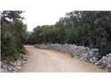 6
6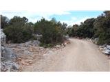 7
7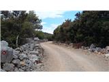 8
8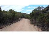 9
9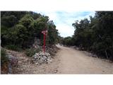 10
10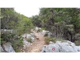 11
11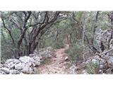 12
12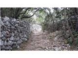 13
13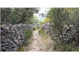 14
14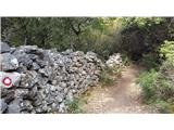 15
15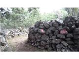 16
16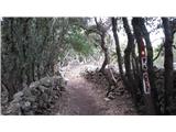 17
17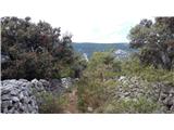 18
18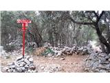 19
19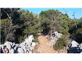 20
20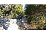 21
21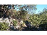 22
22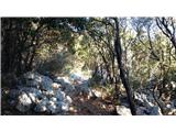 23
23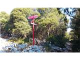 24
24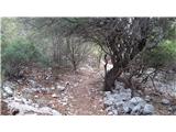 25
25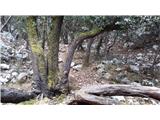 26
26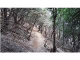 27
27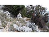 28
28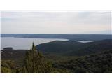 29
29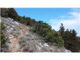 30
30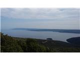 31
31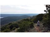 32
32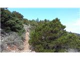 33
33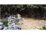 34
34 35
35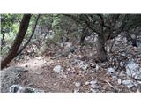 36
36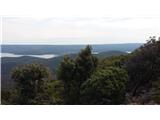 37
37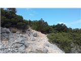 38
38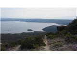 39
39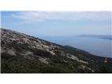 40
40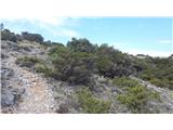 41
41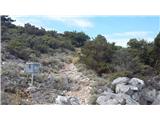 42
42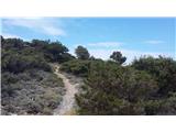 43
43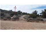 44
44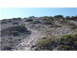 45
45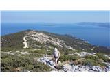 46
46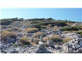 47
47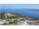 48
48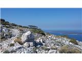 49
49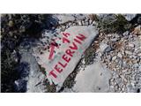 50
50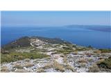 51
51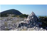 52
52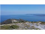 53
53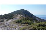 54
54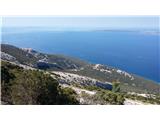 55
55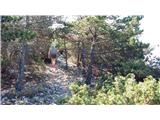 56
56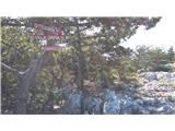 57
57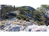 58
58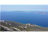 59
59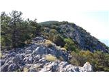 60
60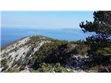 61
61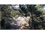 62
62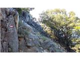 63
63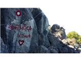 64
64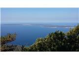 65
65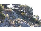 66
66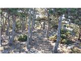 67
67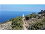 68
68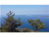 69
69 70
70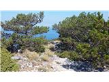 71
71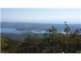 72
72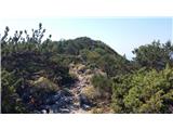 73
73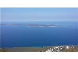 74
74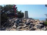 75
75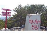 76
76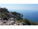 77
77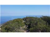 78
78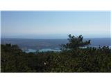 79
79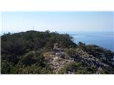 80
80
Discussion about the trip Osor - Televrina
|
| anathevet2. 05. 2022 18:04:10 |
Here, today my husband and I were at the top. We're not big mountaineers and we were up in 2 hours. The path is exceptionally well marked, you can't get lost. But especially along the ridge it's quite windy, so a windbreaker is never too much. The "climbing part" is practically non-existent, just two big rocks. Great view, of course.
|
|
|
To post a comment you must log in:
If you do not yet have a username, you must first
register.