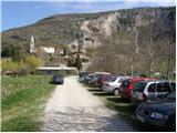
Starting point: Osp (57 m)
| Latitude/Longitude: | 45,57130°N 13,85700°E |
| |
Walking time: 3 h 30 min
Difficulty: easy marked way
Elevation gain: -39 m
Elevation difference along the route: 400 m
Map: Primorje in Kras 1:50.000
Recommended equipment (summer):
Recommended equipment (winter):
Views: 16.092
 | 4 people like this post |
Access to starting point:
From the highway Ljubljana - Koper we go to the exit Črni Kal and follow the road ahead towards Črni Kal and Osp. At the beginning of the ascent towards Črni Kal, the road towards the village Osp branches off to the left. The road then runs by the columns of the viaduct and after a short descent brings us to the village Osp, where we park on a parking lot near the camp.
Route description:
From the parking lot, we continue on the road by which we've parked. The road over a small bridge quickly brings us to the first crossroad, where we continue right and then immediately left. Further, we gently ascend on a rough but well-marked road. After a few minutes of the ascent, the blazes point us to the right on a footpath which ascends through a lane of quite overgrown forest. When we come out of the forest, we step on ample grassy slopes from which we clearly see the antenna tower on Tinjan. The path then goes again into the forest, where it moderately ascends over numerous but well-marked crossings. A little below the summit of Tinjan we again step on the road which we follow past a water supply structure to a turn with a view. At the beginning of the turn the blazes point us to the left upwards and the path in a moderate ascent quickly brings us to the top.
From Tinjan we continue right on the road, which slightly descends and brings us on a relatively well-marked road to the village Zgornje Škofije. Further, the path brings us to an orientationally somewhat harder part. In the village Spodnje Škofije there is a larger number of crossroads, where we have to carefully follow here and there rarer blazes. Behind the village the path goes through a yard of one of the houses, behind which we leave the road for some time. The path continues through bushes, all the way to the village Hrvatini. Here we again carefully follow the blazes, which bring us to the other side of the village. Behind the village for some time we walk on a macadam road, from which a path descends right downwards to Ankaran. When we arrive in Ankaran, before the multiple sclerosis center we turn right on a marked path, which then after a shorter labyrinth of paths brings us to the destination. We get the stamp for the transverzala in the bar Korta.

Along the route: Tinjan (374m), Zgornje Škofije (109m), Spodnje Škofije (41m), Hrvatini (119m)
Photos:
 1
1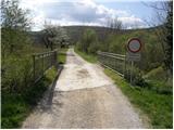 2
2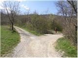 3
3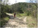 4
4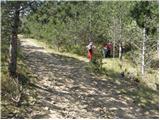 5
5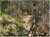 6
6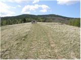 7
7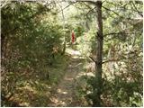 8
8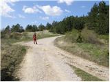 9
9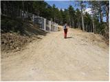 10
10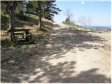 11
11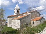 12
12 13
13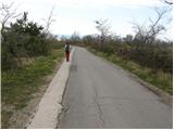 14
14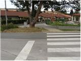 15
15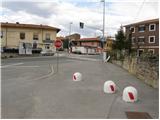 16
16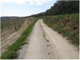 17
17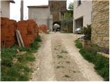 18
18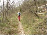 19
19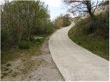 20
20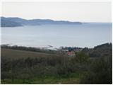 21
21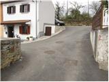 22
22 23
23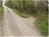 24
24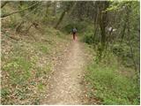 25
25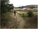 26
26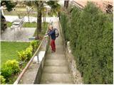 27
27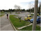 28
28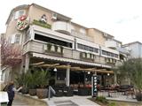 29
29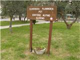 30
30
Discussion about the trip Osp - Ankaran
|
| klavdy66. 09. 2009 |
Nice finish to SPP, which can be followed by swimming.
|
|
|
|
| iztok18. 03. 2012 |
Yesterday we took advantage of the nice sunny day and went on the last section of the Slovenian Mountain Trail from Socerb to Ankaran. Praise to the markers for the well-marked path
|
|
|
|
| claire19. 07. 2014 |
The stamp for Tinjan is also located in the bar.
|
|
|
|
| modrook1216. 03. 2017 |
I'm interested how the path is marked? How realistic is this time?
|
|
|
|
| modrook1219. 03. 2017 |
primoza, thanks for the info. Today my wife and I walked this trail. The trail is excellently marked. We were a bit annoyed by a lot of walking on the asphalt road. Otherwise a super trip.
|
|
|
To post a comment you must log in:
If you do not yet have a username, you must first
register.