Osp - Socerb Castle (via Spodnji kras)
Starting point: Osp (57 m)
| Latitude/Longitude: | 45,57130°N 13,85700°E |
| |
Route name: via Spodnji kras
Walking time: 1 h 25 min
Difficulty: easy marked way
Elevation gain: 380 m
Elevation difference along the route: 380 m
Map: Primorje in Kras 1:50.000
Recommended equipment (summer):
Recommended equipment (winter):
Views: 41.284
 | 1 person like this post |
Access to starting point:
From the highway Ljubljana - Koper we take the exit Črni Kal and follow the road ahead towards Črni Kal and Osp. At the beginning of the ascent towards Črni Kal, a road towards the village Osp branches off to the left. The road then runs past the columns of the viaduct and after a short descent brings us to the village Osp, where the described path begins.
Route description:
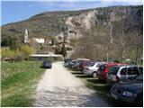
We walk to the center of the village and then ascend to the fire station, where we continue left towards the church. Just a few steps before the church, the path turns sharply right and ascends to the last houses in the village, where the blazes guide us left onto a cart track which ascends above the village. After a short ascent the marked path leaves the cart track and continues right into a somewhat more overgrown forest. Further we ascend on a moderately steep path, which soon emerges from the forest onto panoramic grassy slopes. The steepness then eases and the path brings us to a poorer macadam road. Here on a rock we notice a blaze which directs us across a meadow towards the village Kastelec. The path then first descends gently across an extensive meadow, then ascends on an ever-widening cart track to the asphalt road in the mentioned village. We continue left and follow the road for about 10 minutes to a crossroads, where a road branches off to the right uphill towards Socerb. The road then quickly brings us to the village Socerb, where it takes us past the chapel quickly to the summit.

Photos:
 1
1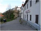 2
2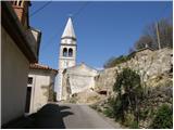 3
3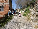 4
4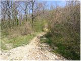 5
5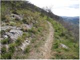 6
6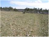 7
7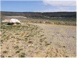 8
8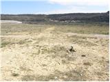 9
9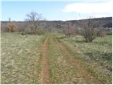 10
10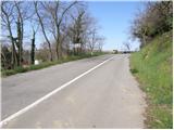 11
11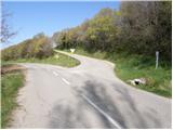 12
12 13
13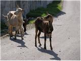 14
14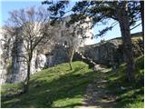 15
15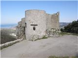 16
16
Discussion about the trip Osp - Socerb Castle (via Spodnji kras)
|
| TGO1. 08. 2009 |
Where is the stamp? At the castle?
|
|
|
|
| andrejjerina1. 08. 2009 |
At the castle, on the wall, if not otherwise, you get it in the buffet in Ankaran! LP Andrej
|
|
|
|
| Fazo1. 08. 2009 |
At the tower you see in the last picture, go left down the steps, and it's right there on the right side, by the roses... hard to find if you don't know where to look. at least for me it was. at least for me it was.
|
|
|
|
| klavdy66. 09. 2009 |
The stamp is really hard to find. Best to get it in Ankaran at Korta bar. From Socerb there is a magnificent view of the Slovenian coast.
|
|
|
|
| janezz25. 03. 2012 |
We two made a pleasant circular trip. A bit further from Osp there is a fork (the cart track straight goes towards Socerb), we chose the path towards Kastelc, which is on the fifth picture. The path continues as described above, only in Kastelc the marked path goes past the church and left through the forest. At the top there is a junction where you turn left and along the pasture and across it you reach the asphalt road, which soon leads to Socerb. For the return, descend through the village to the main road, where on the right you already see the signpost for Osp. Descend almost straight to the village Prebeneg, which is already on the Italian side, then the path turns left and descends on the right side of a small canyon into a beautiful pine forest. The path then crosses the stream and soon you reach the junction where the path from Osp splits towards Kastelc and Socerb.
|
|
|
|
| claire19. 07. 2014 |
For the stamp you need an ink pad - it is located at the beginning of the castle, at the stairs. Otherwise, you can get an oval stamp in the restaurant, which is not always open.
|
|
|
|
| pinatina20. 01. 2015 |
One potential little problem on this trail that might bother some...on the meadow before the kastelc that the marked trail crosses, horses were grazing on Sunday ...about 15 on the left pasture, at least one on the right...since I have no experience with encountering horses, I wanted to avoid crossing like that, so my colleague and I had to bypass the pasture...we chose the path on the left side facing the kastelc..."path" - the pasture is very wild here, then it turns into bushes and at the end there's a fence with a working electric fence that needs to be overcome ...about 15 on the left pasture, at least one on the right...since I have no experience with encountering horses, I wanted to avoid crossing like that, so my colleague and I had to bypass the pasture...we chose the path on the left side facing the kastelc..."path" - the pasture is very wild here, then it turns into bushes and at the end there's a fence with a working electric fence that needs to be overcome 
is it meant to go through among the horses?
|
|
|
|
| Kigeot26. 01. 2015 |
It bothered me too that the marked path is blocked by an electric fence, and there are horses in the pasture. When I was there, the horses were grazing only on one side... So I climbed through the fence with the electric fence... hehe, it reminded me of Mission Impossible movies  ) )
|
|
|
|
| Lisica22. 12. 2015 |
Žiga is not hard to find, as it's built into the wall, practically you run into it when going along the castle stairs. It is true that you need a cushion... but that's nothing unusual, you always have to have it with you - NNNP. 
|
|
|
|
| planinec218. 04. 2016 |
I go this path many times past the horses and tell you, they are not at all dangerous... they rather step aside for me... and for me it's perfectly arranged since where the pasture starts there are gates with handles so that it opens and closes easily behind you, at the end the same... so I really see no problem if the pasture is crossed and in summer there are no horses there at all
|
|
|
|
| modrook1220. 03. 2017 |
has anyone recently made a circular path osp - socerb - kastelec - osp? how is it marked? how much time is needed to walk it? is it suitable for a 4-year-old child?
|
|
|
|
| modrook1223. 03. 2017 |
does anyone know this path?
|
|
|
|
| miri23. 03. 2017 |
It is marked. I don't know your mountaineer, but given his age you could carry him a bit. Or turn back on the path. Any coercion can backfire. Offer him what he likes.
Good luck to both,Miri
|
|
|
|
| modrook1223. 03. 2017 |
thanks for the info. Last October he conquered Porezen alone via the hunter's path
|
|
|
|
| branko.temlin25. 03. 2017 |
On 22.03.2017 I hiked Tinjan-Osp-Socerb, on pdmaticams-drustvo.si/ there is a track and photos of the partially circular trail.
|
|
|
|
| modrook122. 04. 2017 |
today we had a family outing. We started in Osp and continued towards Prebenica and to the top of Socerb. We continued towards Kastelec and back to Osp. Nice circular trail, well marked. Four-year-old son walked the trail without a problem
|
|
|
|
| gumbek26. 03. 2026 11:01:39 |
stamp is on the signboard at the entrance to the parking lot at the castle ...
|
|
|
To post a comment you must log in:
If you do not yet have a username, you must first
register.