Ossario del Pordoi - Piz Boe (Via Ferrata Vallon)
Starting point: Ossario del Pordoi (2200 m)
| Latitude/Longitude: | 46,49125°N 11,82799°E |
| |
Route name: Via Ferrata Vallon
Walking time: 5 h
Difficulty: very difficult marked way
Via ferrata: C
Elevation gain: 952 m
Elevation difference along the route: 1110 m
Map: Tabacco 07 1:25.000
Recommended equipment (summer): helmet, self belay set
Recommended equipment (winter): helmet, self belay set, ice axe, crampons
Views: 2.080
 | 2 people like this post |
Access to starting point:
Access from Gorenjska: Via the border crossings Rateče or Predel to Trbiž / Tarvisio and then continue on the motorway in the direction of Udine to the Tolmezzo exit. From Tolmezzo we follow the road in the direction of the village Ampezzo and mountain pass Passo della Mauria. The road then descends and brings us to a crossroads, where we continue left (also right possible) in the direction of Cortina d'Ampezzo. At all following crossroads we follow the signs for Cortina d'Ampezzo.
In Cortina d'Ampezzo we then follow the signs for the alpine pass Passo di Falzarego. We follow this ascending road to the mentioned pass. At the pass we come to a crossroads, where we continue on the left road in the direction of Marmolada and settlement Arabba (right Alta Badia). The road further descends for quite some time, then brings us to a crossroads, where we continue right in the direction of pass Passo Pordoi (left Marmolada). We follow the relatively wide and ascending road all the way to the mentioned pass. At the pass we then turn right onto the narrow asphalted road towards the ossuary of German soldiers (Cimitero Militare Germanico). We park at the parking lot at the end of the mentioned road.
From the Primorska side: We drive on the motorway towards Venice / Venezia. At Portogruaro we leave the motorway towards Venice and continue right on the motorway towards Pordenone. At the next motorway junction near Conegliano we continue right towards Belluno. Near Belluno the motorway ends, and at the following crossroads we continue in the direction of Cortina d'Ampezzo. Further we follow the above description.
Route description:
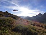
From the parking lot we continue on a well-maintained path towards the ossuary where 8582 German soldiers who fell in the First World War and 849 soldiers who fell in the Second World War are buried. At the ossuary we then continue left where the signposts for the via ferrata Via Ferrata Cesare Piazzetta direct us. The path then leads through a panoramic grassy slope and soon begins to ascend somewhat more steeply. For a short time the path then crosses a steeper slope to the right, then it starts ascending the slope upwards again. The path, which is mostly marked with red arrows, then ascends until we approach the mighty wall where we join path 626.
Here we continue right and after a short traverse the path brings us to a sign that marks the start of the extremely demanding path Via Ferrata Cesare Piazzetta. We continue on the easy path that traverses the slopes below vertical walls towards the east. The path then traverses such a slope for some time more and in doing so rises and falls slightly a few times. From the path a view also soon opens towards hut Ütia Franz Kostner and after a short descent we reach a marked junction.
To the left upwards branches path 638, which via gully Rissa di Pigolerz leads towards summit Piz Boe. At the junction we continue on path 626, which continues traversing slopes below precipitous walls. Along the path we will also notice some ruins from the time of the First World War, and the path also leads past a smaller lake. The path then turns slightly to the left and after a short descent brings us to another junction.
This time path Lichtenfels (path 672) branches to the left towards summit Piz Boe, we continue right towards hut Ütia Franz Kostner. From the junction the path descends a little more and to the right downwards also branches the path towards Arabba. Then follows only a short ascent to the hut, which we can see from the path for some time.
At the hut we then head left towards the north and descend slightly on the wide path. When we reach a junction we head left onto path 638.
A little after the junction the path turns left and ascends towards the scree where we are again at a junction.
This time we leave path 638 and head right onto the path called Roda de Valun. The path then runs towards the northwest and through scree brings us into a valley surrounded by precipitous peaks. Here the path first traverses scree on the left side of the valley in ascent, then brings us to flatter terrain where there is also a junction.
To the right leads easy circular path Roda de Valun, we continue left towards the secured via ferrata Via Ferrata Vallon where a large inscription on the rock directs us. The path, which here is marked with red-blue blazes, then ascends the scree and brings us to the wall where the secured path begins. Before entering the secured section of the path we equip ourselves with a helmet and self-belay set.
The secured path in the initial section turns right and ascends steeply several times along the steel cable. The steel cables in this section are quite loose and the distance between the bolts to which the steel cables are attached is also relatively large. The path then turns slightly to the left for a short time and brings us below even steeper slopes. Here we continue right again and after several diagonal ascents on the exposed slope the path brings us to a hanging bridge. Over the bridge we cross a small waterfall then the ascent becomes somewhat more demanding. Behind the bridge the path ascends almost vertically left upwards and some arm strength is also needed for progress (difficulty C). The demanding section is relatively short anyway and the secured path soon ends and brings us to gentler slopes where there is also a small lakelet.
Here the path turns right and ascends an undemanding slope from which a view opens towards summit Piz Boe and numerous other nearby peaks. The path then turns left and ascends gently on the rocky slope on the right side of the valley. On the left side we will also notice a somewhat larger lake here, located below the western slopes of peak Pizes dl Valun. We continue on the relatively gentle path towards the south, which slowly turns slightly right. When we approach summit Piz Lech Dlace we reach a junction.
The right path bypasses summit Piz Lech Dlace on the west side and then joins path 672. We continue left and traverse the slope towards the east side of the mentioned summit. When we join path 672 the slope becomes somewhat steeper and an ascent towards the ridge follows. Here on a shorter section of the path steel cables also assist us. On the ridge we then continue right and soon reach summit Piz Lech Dlace on which there is a larger cairn.
From the summit we continue along the ridge and after a short descent we reach a saddle where there is a junction. From the right another path from secured path Via Ferrata Vallon joins us here. Likewise to the right also branches the transverse path towards hut Rifugio Boe, from the left an unmarked trail past lake Eissee joins.
We continue straight and begin ascending the rocky slope again. Slightly higher the path slowly turns left and brings us to the ridge from where a view opens towards the west. We continue along the ridge towards the south and then traverse steeper slopes along the ridge. On a shorter section a steel cable also assists us. When we reach the ridge again we reach the somewhat less known summit Cresta Strenta, which at 3124 m is the second highest summit in the Sella group.
We continue towards the south and further the path runs along the gentler western side of the ridge. Soon from the right the path from hut Rifugio Boe also joins and to the summit only a short undemanding ascent follows.

Photos:
 1
1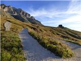 2
2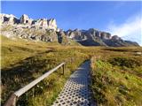 3
3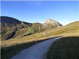 4
4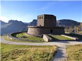 5
5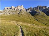 6
6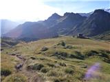 7
7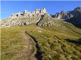 8
8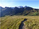 9
9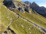 10
10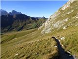 11
11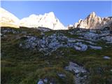 12
12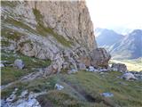 13
13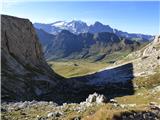 14
14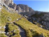 15
15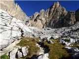 16
16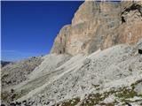 17
17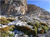 18
18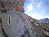 19
19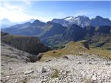 20
20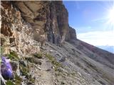 21
21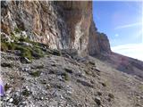 22
22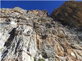 23
23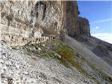 24
24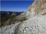 25
25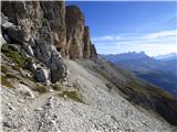 26
26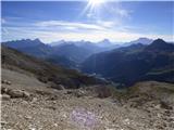 27
27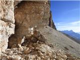 28
28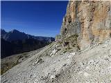 29
29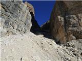 30
30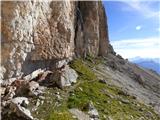 31
31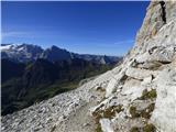 32
32 33
33 34
34 35
35 36
36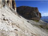 37
37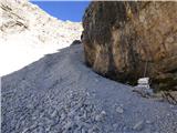 38
38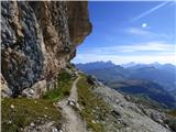 39
39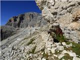 40
40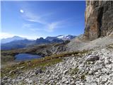 41
41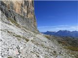 42
42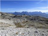 43
43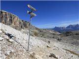 44
44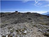 45
45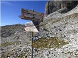 46
46 47
47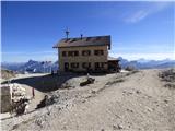 48
48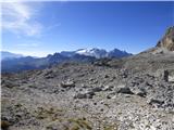 49
49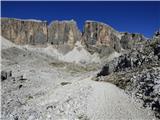 50
50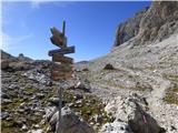 51
51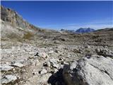 52
52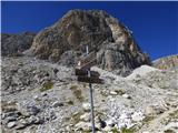 53
53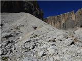 54
54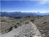 55
55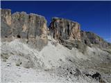 56
56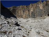 57
57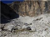 58
58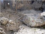 59
59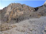 60
60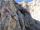 61
61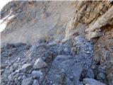 62
62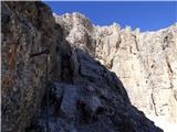 63
63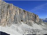 64
64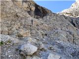 65
65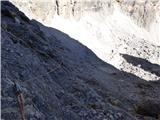 66
66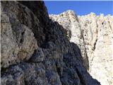 67
67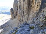 68
68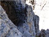 69
69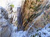 70
70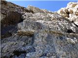 71
71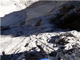 72
72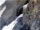 73
73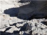 74
74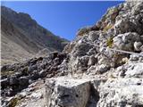 75
75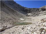 76
76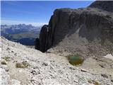 77
77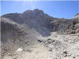 78
78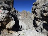 79
79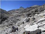 80
80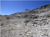 81
81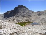 82
82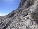 83
83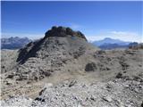 84
84 85
85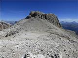 86
86 87
87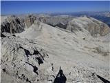 88
88 89
89 90
90 91
91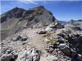 92
92 93
93 94
94 95
95 96
96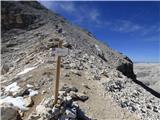 97
97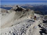 98
98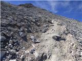 99
99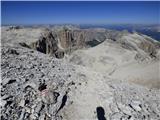 100
100 101
101 102
102 103
103 104
104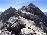 105
105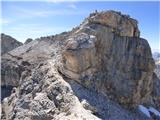 106
106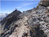 107
107 108
108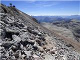 109
109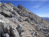 110
110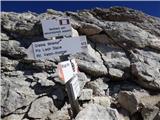 111
111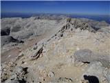 112
112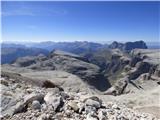 113
113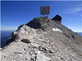 114
114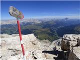 115
115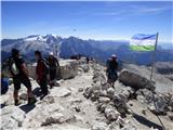 116
116 117
117 118
118 119
119
Discussion about the trip Ossario del Pordoi - Piz Boe (Via Ferrata Vallon)
To post a comment you must log in:
If you do not yet have a username, you must first
register.