Starting point: Otlica (815 m)
| Latitude/Longitude: | 45,92700°N 13,90980°E |
| |
Walking time: 1 h
Difficulty: easy marked way
Elevation gain: 97 m
Elevation difference along the route: 130 m
Map: Goriška - izletniška karta 1:50.000
Recommended equipment (summer):
Recommended equipment (winter):
Views: 3.991
 | 1 person like this post |
Access to starting point:
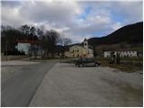
A) From central Slovenia we first drive to Logatec, then continue driving in the direction of Idrija. At Kalce near Logatec we turn left in the direction of Col, then continue driving on a winding road towards Col. At Col we turn right and then after 100 m left in the direction of Predmeja. Further we drive on an occasionally somewhat narrower and also partly winding road, which we follow to the settlement Otlica, where at the church of the Guardian Angels we turn left in the direction of Otliško okno. We park about 50 meters ahead on a parking lot by the cemetery.
B) We drive to Idrija, from there we continue driving towards Logatec. In the settlement Godovič we leave the main road towards Logatec and continue driving right in the direction of Črni Vrh, Col and Ajdovščina. We follow the mentioned road to Col, where signs for Predmeja direct us to the right. Further we drive on an occasionally somewhat narrower and also partly winding road, which we follow to the settlement Otlica, where at the church of the Guardian Angels we turn left in the direction of Otliško okno. We park about 50 meters ahead on a parking lot by the cemetery.
C) From the expressway Razdrto - Nova Gorica we take the exit Ajdovščina and follow the road ahead towards the village Lokavec (to Lokavec we come from the center of Ajdovščina, or from the old road Ajdovščina - Nova Gorica, where at the place Cesta we turn right). From Lokavec we continue driving on an ascending winding road in the direction of Predmeja. When the road flattens somewhat, we come to a junction, where we continue right towards Predmeja and Col. On the road towards Col we drive to Otlica, where at the church of the Guardian Angels we turn right towards the nearby cemetery. We park on a parking lot by the cemetery.
Route description:
From the parking lot we continue on the right side of the cemetery on a narrower asphalt road in the direction of Otliško okno. On the road we walk only for a short time as signs for Otliško okno direct us left onto a grassy cart track, which a little further crosses a strip of bushes, then along the pasture fence we quickly arrive near the nearby house. Here we continue right on a wider cart track, on which in a few steps we arrive at the marked junction.
From the junction we go right in the direction of Predmeja and Čavna and continue on a gently sloping path, which on the right side bypasses the nearby Otliški maj. A little further a path joins, which leads from Otliško okno over the top of Majski dol, and we continue straight. Further we continue along the edge of the Gora plateau, and the path leads us through a few shorter strips of forest and bushes. Later the path moderately ascends and brings us to Dolski maj in a few minutes, from which a nice view opens towards Vipava valley, Čavn and Golaki.

Photos:
 1
1 2
2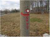 3
3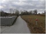 4
4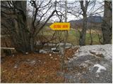 5
5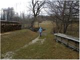 6
6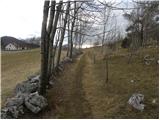 7
7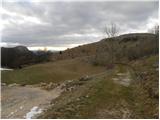 8
8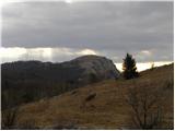 9
9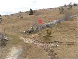 10
10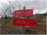 11
11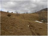 12
12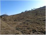 13
13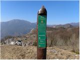 14
14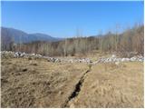 15
15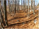 16
16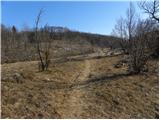 17
17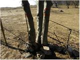 18
18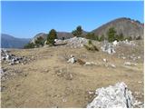 19
19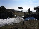 20
20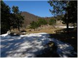 21
21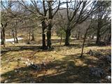 22
22 23
23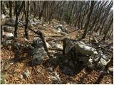 24
24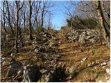 25
25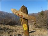 26
26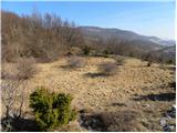 27
27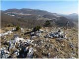 28
28 29
29
Discussion about the trip Otlica - Dolski maj
To post a comment you must log in:
If you do not yet have a username, you must first
register.