Otočec - Sveta Marija (Trška Gora) (via Stari grad)
Starting point: Otočec (194 m)
| Latitude/Longitude: | 45,83490°N 15,22380°E |
| |
Route name: via Stari grad
Walking time: 1 h 15 min
Difficulty: easy marked way
Elevation gain: 234 m
Elevation difference along the route: 265 m
Map: Dolenjska - Gorjanci in Kočevski Rog 1:50.000
Recommended equipment (summer):
Recommended equipment (winter):
Views: 4.380
 | 4 people like this post |
Access to starting point:
A) From the highway Ljubljana - Obrežje, take the exit Novo mesto - east, then continue driving in the direction of Otočec. Further on, drive along the old road towards Brežice, then quickly arrive at a junction where you continue right in the direction of the settlement Lešnica. After Lešnica, arrive at Otočec, but drive to the other side of the settlement, where you park in the parking lot by the cemetery.
B) From the highway Obrežje - Ljubljana, take the exit Kronovo (exit no. 28), then continue driving in the direction of Otočec Castle. From the nearby roundabout, also continue in the direction of the Otočec Castle exit. Further on, drive along the old road towards Novo mesto, then after the Petrol gas station turn right in the already familiar direction. Two successive junctions follow, where you go left twice, then after the underpass right in the direction of Otočec (left - Otočec Castle). Approximately 1 km of driving follows, then you arrive at Otočec, where you park in the parking lot by the cemetery.
Route description:
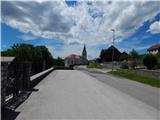
From the starting point, we continue past the church and for some time continue along the road in the direction of Novo mesto. Soon we arrive at a chapel, where a road branches off to the left towards Ratež and Gumberk, then at the next intersection, a few dozen steps away, we continue right past the NOB monument. We continue through the underpass, then on the other side of the underpass we continue left (right - Paha and Herinja vas). At the next intersection we continue right, then we walk past the confectionery Hočevar and past the primary school Otočec and along the fields arrive at the end of Otočec and a few steps further to an unmarked intersection.
We continue straight ahead along the road that descends to the underpass under the highway (via the left road we can reach Trška Gora). On the other side of the underpass, the road turns right, then in a gentle ascent in a few minutes brings us to the place where we leave the asphalt road. From the road we continue left in the direction of the Castle Forest Educational Trail (Grajska gozdna učna pot) and the path S cvičkom med vinogradi. From the meadow the path quickly enters the forest, through which it begins to ascend moderately. In a few minutes of moderate and in the upper part crosswise ascent, we arrive at the viewpoint and Stari grad castle, owned by Krka d.d.
Behind the castle the road temporarily descends slightly, then brings us to the settlement Zagrad pri Otočcu, where we continue straight past the recycling island. The path further leads past a smaller hamlet, where a path branches off to the right to Beceletova jama cave, we continue straight and then behind the neat gardens continue left in the direction of Trška Gora. The path further leads over a small bridge over which we cross the Lešnica stream, then the path soon enters the forest, where at junctions we follow the blazes. After the initial ascent a short descent follows, where we arrive at a poorly marked junction, where we continue straight onto the hayfield where we follow the old grass-overgrown cart track, which is quite hard to follow. When we climb to the top of the meadow we reach another road, which we reach right at a small intersection. From the intersection we continue straight onto the "side" road, from which we immediately go left into the forest. For a few minutes we ascend through the forest, then we reach one of the houses, a few steps further also the asphalt road. Along the road we ascend in the direction of Trška Gora, beautiful views opening up to us on the vineyards and Gorjanci on the other side of the Krka River. Higher up the asphalt temporarily ends, and at several intersections we continue straight or slightly right. When we see the church of St. Mary on Trška Gora already relatively close, we first cross a few dozen meters to the right, then continue left onto the narrow asphalt road that ascends through the forest. The road ends at the nearby house, we continue straight along the path that higher continues along the fence. We follow this path all the way to the church of St. Mary on Trška Gora, from which a beautiful view opens up.
Description and pictures refer to the condition in 2016 (June).

Photos:
 1
1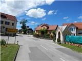 2
2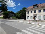 3
3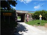 4
4 5
5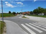 6
6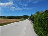 7
7 8
8 9
9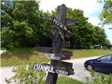 10
10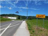 11
11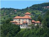 12
12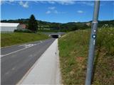 13
13 14
14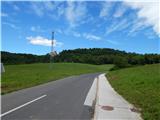 15
15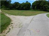 16
16 17
17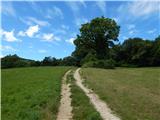 18
18 19
19 20
20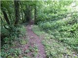 21
21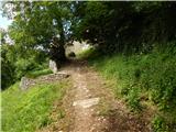 22
22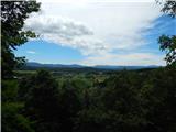 23
23 24
24 25
25 26
26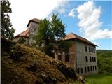 27
27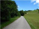 28
28 29
29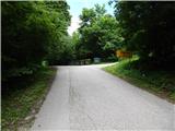 30
30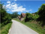 31
31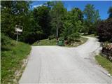 32
32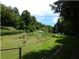 33
33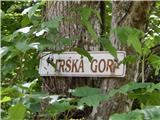 34
34 35
35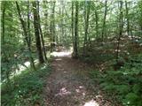 36
36 37
37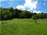 38
38 39
39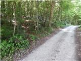 40
40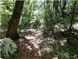 41
41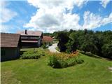 42
42 43
43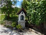 44
44 45
45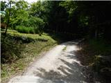 46
46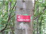 47
47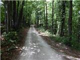 48
48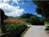 49
49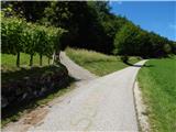 50
50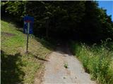 51
51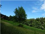 52
52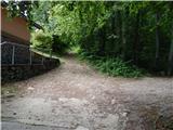 53
53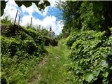 54
54 55
55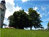 56
56 57
57 58
58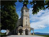 59
59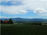 60
60
Discussion about the trip Otočec - Sveta Marija (Trška Gora) (via Stari grad)
To post a comment you must log in:
If you do not yet have a username, you must first
register.