Ozeljan - Veliki Rob (via sekulak)
Starting point: Ozeljan (95 m)
| Latitude/Longitude: | 45,94100°N 13,73290°E |
| |
Route name: via sekulak
Walking time: 4 h 20 min
Difficulty: easy unmarked way
Elevation gain: 1142 m
Elevation difference along the route: 1300 m
Map: Goriška - izletniška karta 1:50.000
Recommended equipment (summer): helmet
Recommended equipment (winter): helmet, ice axe, crampons
Views: 1.350
 | 1 person like this post |
Access to starting point:
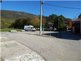
A) From the Vipava expressway, we take the Vogrsko exit, then continue driving towards Tolmin and Ozeljan. When we reach the old Ajdovščina - Nova Gorica road, at the traffic-light intersection we continue right towards Ajdovščina. When we arrive in Ozeljan, in the hamlet Otava we continue left onto a somewhat narrower road that leads us among the houses. After a few hundred meters, we arrive at a smaller intersection by Zavarovalnica Triglav, Pošta Slovenije and Ozlinka, we continue straight and park in the parking area by the recycling island. We can also park in the parking area approximately 100 meters away by the cemetery, which is located to the left of the mentioned intersection.
B) From Nova Gorica, we drive along the old road towards Ajdovščina, then at the hamlet Tri Hiše (the hamlet is located at the traffic-light intersection where the road to the settlement Vogrsko branches off to the right) we continue straight. When we arrive in Ozeljan, in the hamlet Otava we continue left onto a somewhat narrower road that leads us among the houses. After a few hundred meters, we arrive at a smaller intersection by Zavarovalnica Triglav, Pošta Slovenije and Ozlinka, we continue straight and park in the parking area by the recycling island. We can also park in the parking area approximately 100 meters away by the cemetery, which is located to the left of the mentioned intersection.
Route description:
From the starting point, we continue towards the east (in the direction described to the starting point from the intersection where we parked to the right), where the path leads past the company Konem Color, then we arrive at an intersection where we continue left (right Lepenje) on an ascending asphalt road. The road further leads past a few more houses, then in the next few intersections we continue along the "main" road. When higher, near the hamlet Opade, we arrive at an intersection, we continue straight uphill onto a macadam road, beside which there is a traffic sign that "tells" us that we will continue the path along the firebreak trails. We continue along the macadam road, which ascends gently to moderately, and from it we occasionally get some views of the surrounding hills. Higher, at the next sign for the firebreak trail, we continue straight or slightly right. A few dozen steps ahead the road starts to descend, but here we continue left onto a cart track that ascends to a marked junction.
From the junction we go right (left Vodice), then quickly reach the next poorer macadam road, where we join the path from Vitovlje (path from Križišče).
We reach the mentioned road at the 7th station of the Way of the Cross, and we ascend along the road through the forest. At a left bend a few minutes away, a nice view of Vitovski hrib opens up briefly, and we follow the road to the next junction, which is located just before the 12th station of the Way of the Cross.
From the mentioned junction we continue left in the direction of Kopitnik, Čavna and Veliki Rob (straight Vitovski hrib - 5 minutes) and continue along the narrower cart track. A few minutes further we arrive at the next junction, where we continue in the direction of Čavna and Krnic (left Skozno, sharply right sv. Lucija).
Further on, the gentle Napoleon path soon brings us to the steep cliffs of Visoki zid. A wide path then leads us across the artificially carved panoramic ledge (danger of falling rocks), after which the path returns to the forest and brings us to the place where the path to Kopitnik branches off to the left.
We continue slightly right in the direction of Čavna and Sekulak along a somewhat narrower path, which first takes us through a few smaller clearings to a steeper section. The path ahead ascends more steeply and brings us only a little higher to the next junction, where we continue right in the direction of the vantage point (left Kopitnik). We continue the ascent along a gentle path, which brings us in 5 minutes of further walking to the vantage point Sekulak, from which a view opens up over a larger part of the Vipava Valley.
From Sekulak we continue left along the marked path, which continues along the initially very panoramic ridge. Higher, the path enters the forest and shortly after brings us to a small clearing, where the junction is noticeably more poorly marked.
The path left continues towards Kopitnik, but we continue right, where after a few meters we notice the signs for Veliki Rob. We continue the ascent towards Veliki Rob along an initially somewhat less visible trail. Higher, the path becomes clearer and after a while brings us to a vantage point, from which a view opens up on the Vipava Valley, Trstelj, Gulf of Trieste and the Dolomites.
We continue along the marked path, which starts to ascend more steeply, bringing us to the steeper section below the summit of Čavna (1185 m). The path then levels out and continues with a few shorter descents and ascents towards the east. After a few minutes of further walking, we already see the summit of Veliki Rob ahead. The path ahead turns slightly left from the ridge and avoids the steep cliffs. A short ascent through a band of forest follows, and the path brings us to the upper slopes of the mountain, from where we have only a few dozen steps to the summit.
Ozeljan - Sekulak 2:50, Sekulak - Veliki Rob 1:30.

Photos:
 1
1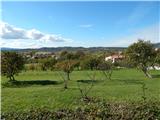 2
2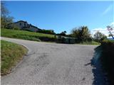 3
3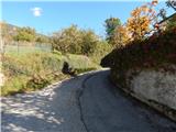 4
4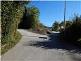 5
5 6
6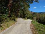 7
7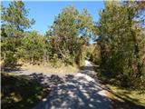 8
8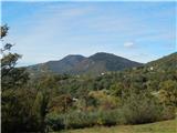 9
9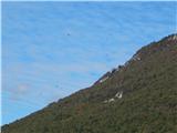 10
10 11
11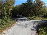 12
12 13
13 14
14 15
15 16
16 17
17 18
18 19
19 20
20 21
21 22
22 23
23 24
24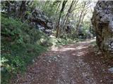 25
25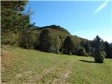 26
26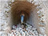 27
27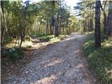 28
28 29
29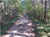 30
30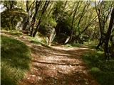 31
31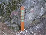 32
32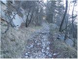 33
33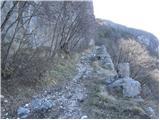 34
34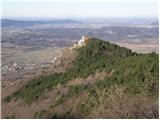 35
35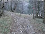 36
36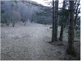 37
37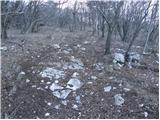 38
38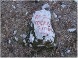 39
39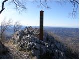 40
40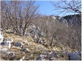 41
41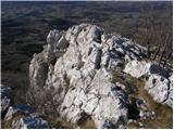 42
42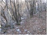 43
43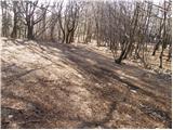 44
44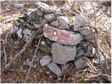 45
45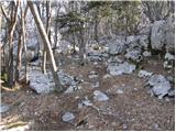 46
46 47
47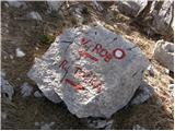 48
48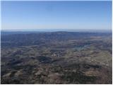 49
49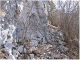 50
50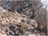 51
51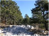 52
52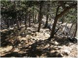 53
53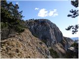 54
54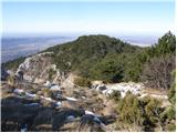 55
55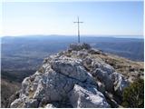 56
56 57
57
Discussion about the trip Ozeljan - Veliki Rob (via sekulak)
To post a comment you must log in:
If you do not yet have a username, you must first
register.