Palafavera - Rifugio Sonino al Coldai
Starting point: Palafavera (1507 m)
| Latitude/Longitude: | 46,40196°N 12,10119°E |
| |
Walking time: 2 h 10 min
Difficulty: easy marked way
Elevation gain: 625 m
Elevation difference along the route: 625 m
Map: Tabacco 15 1:25.000
Recommended equipment (summer):
Recommended equipment (winter): ice axe, crampons
Views: 3.865
 | 2 people like this post |
Access to starting point:
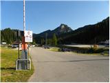
Through the Rateče border crossing we drive to Trbiž / Tarvisio, where we turn onto the highway in the direction of Udine. We leave the highway at the Tolmezzo exit and follow the road to the mentioned settlement. From Tolmezzo we continue in the direction of the settlement Ampezzo and mountain pass Passo della Mauria. The road then starts descending and brings us to the Cadore valley, where we continue left towards Cortina d'Ampezzo. Further, we follow the signs for Cortina d'Ampezzo to the settlement Venas di Cadore. A little before the end of the mentioned settlement we turn left towards the settlement Forno di Zoldo. The road then through the Cibiana pass brings us to the Val di Zoldo valley, where we continue right towards the Staulanza pass. We follow the ascending road to the settlement Palafavera, where we park on a large parking lot next to the Rifugio Palafavera mountain hut. The parking lot is situated on the left side of the road by the ski slope.
Route description:
From the parking lot at the mountain hut Rifugio Palafavera we continue towards the south and then turn right onto the macadam road following the signs »Rifugio Coldai, Forcella D'Alleghe«. After a few meters the road brings us to a junction where we continue right on the macadam road, which is closed to traffic. The road further ascends along and beside the ski slope, and during the ascent beautiful views open up mainly towards the summit Monte Pelmo and Civetta. Later the road brings us to the western side of the peak Col Marino della Travesera. Here a quite gently sloping road runs along the ski slope and then brings us to the mountain pasture Malga Pioda at the saddle Forcella D'Alleghe.
On the mountain pasture where there is a junction we continue left on the footpath following the signs »Rif. A. Sonnino al Coldai«. Initially still very wide, the path starts to ascend slowly in long zigzags towards the slopes of the peak Cima di Coldai. The path then turns left and during the ascent crosses the slopes towards the south, bringing us below the cargo cableway. Here the path turns right and then ascends more steeply along the slope below the cableway. When we reach the upper station of the cargo cableway, the path becomes level and quickly brings us to the mountain hut.

Along the route: Malga Pioda (1816m)
Photos:
 1
1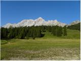 2
2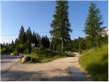 3
3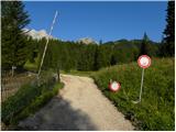 4
4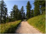 5
5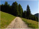 6
6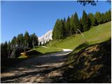 7
7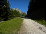 8
8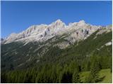 9
9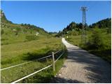 10
10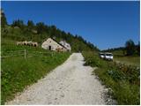 11
11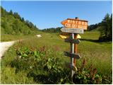 12
12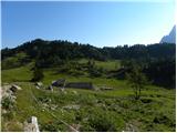 13
13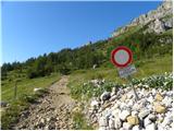 14
14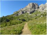 15
15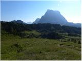 16
16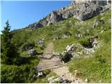 17
17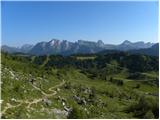 18
18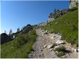 19
19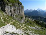 20
20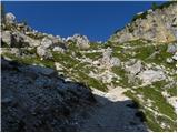 21
21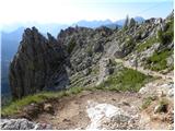 22
22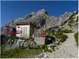 23
23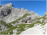 24
24 25
25 26
26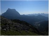 27
27
Discussion about the trip Palafavera - Rifugio Sonino al Coldai
To post a comment you must log in:
If you do not yet have a username, you must first
register.