Paradohuta - Kékestető (pot rumeni križ)
Starting point: Paradohuta (355 m)
Route name: pot rumeni križ
Walking time: 2 h
Difficulty: easy marked way
Elevation gain: 659 m
Elevation difference along the route: 659 m
Map:
Recommended equipment (summer):
Recommended equipment (winter):
Views: 390
 | 1 person like this post |
Access to starting point:
From Budapest, we drive east on the motorway towards the town of Nyiregyhaza. After approximately 90 kilometers, we leave the motorway at the Gyoengyoes, Matrafured exit. We continue to the town of Gyoengyoes, then at the marked intersection continue north towards the place Matrafuered, from there further to the pass Matrahaza and to the northern side until we reach the town of Parad. Here we will notice signs for the village Paradohuta. In Paradohuta, we follow the signs to the spring of Klarissza Csevice. At the starting point there are approximately 5 parking spaces.
Route description:
From the spring of Klarissza Csevice we go uphill along the roots. The path is initially steep, but soon levels out. Further on we arrive at a junction, where we go left (right red cross path). The path initially turns illogically northwards, but after a few bends turns south. The path continues through a belt of dense forest, higher up we arrive at a clearing.
At the end of the clearing, without a footbridge we cross the stream, then we arrive at a fence, which we go around on the left side.
Soon we arrive at a junction, where we go right along the path running beside a belt of spruce forest. Higher up the path brings us back to the stream, then to the hunting lodge, where we cross the stream again. On the other side of the stream we reach an asphalt road, which we follow to the right.
We walk along the road for two minutes, then the markers direct us left onto a narrow path that climbs through the forest. The narrow path becomes a cart track, along which we ascend more steeply for a while. Further on a somewhat poorly marked path leads us to the Gabi Hallala junction (yellow cross path continues to the Matrahaza pass).
From here we continue ahead, the path is level for a while, then becomes very steep. Higher up we arrive at the Sötet Lapi Nyereg pass, where some more paths from surrounding areas join.
We continue right on the steeper path, after 10 minutes we reach the first buildings before the summit. A few more minutes of walking follow and we arrive at the monument on the summit.

Photos:
 1
1 2
2 3
3 4
4 5
5 6
6 7
7 8
8 9
9 10
10 11
11 12
12 13
13 14
14 15
15 16
16 17
17 18
18 19
19 20
20 21
21 22
22 23
23 24
24 25
25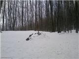 26
26 27
27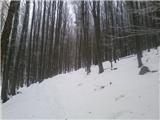 28
28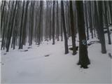 29
29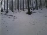 30
30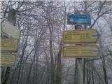 31
31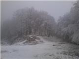 32
32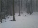 33
33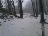 34
34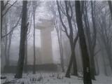 35
35 36
36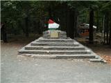 37
37
Discussion about the trip Paradohuta - Kékestető (pot rumeni križ)
To post a comment you must log in:
If you do not yet have a username, you must first
register.