Parkirišče pri botaničnem vrtu - Mali Rajinac (by road)
Starting point: Parkirišče pri botaničnem vrtu (1500 m)
Route name: by road
Walking time: 3 h
Difficulty: easy marked way
Elevation gain: 199 m
Elevation difference along the route: 400 m
Map: Sjeverni Velebit 16a
Recommended equipment (summer):
Recommended equipment (winter): ice axe, crampons
Views: 4.664
 | 2 people like this post |
Access to starting point:
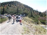
From the Zagreb - Split motorway, take the Otočac exit. Continue along the road towards the village of Krasno and Northern Velebit. The very winding road takes us through the village of Švica to Krasno, where the road from Senj joins (access possible also from this direction). In Krasno, continue towards the signs for Northern Velebit National Park and Zavižan hut. The road then becomes gravel and takes us to the park entrance, where entrance fee is collected. Continue along the road to the intersection at the chapel. Continue straight for another 100m to the parking lot before the road barrier near the botanical garden (botanički vrt).
Route description:
From the parking lot, continue along the road closed to traffic, initially almost flat. After a few minutes of walking, we reach a junction where the path to Gromovača (Premužićeva staza) branches off to the right. Continue along the road, from which the path to Zavižanski Pivčevac soon branches off. The road then begins to descend gradually and after about 45 minutes of walking makes a double bend. Follow the road, which descends almost 200m, to the signs for Mali Rajinac 1:40.
Here we leave the road and turn left into the forest on the hiking path. The path initially climbs through quite overgrown forest to Vrat, where it starts to descend slightly. After a short descent, it brings us to a large clearing, where we reach a junction. Continue right towards Mali Rajinac, which is another 50 minutes away. On the other side of the clearing, the marking R.J. on a rock tells us we are on the right path. The path then climbs again through the forest, aided by frequent markers. The path then almost circles the summit and brings us to the top via increasingly less vegetated slope.
Parking lot - hiking path 1:20, hiking path - summit 1:40.

Photos:
 1
1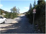 2
2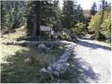 3
3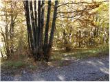 4
4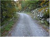 5
5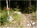 6
6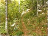 7
7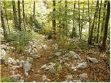 8
8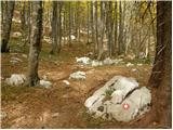 9
9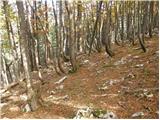 10
10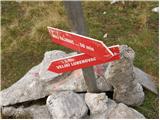 11
11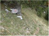 12
12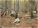 13
13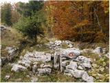 14
14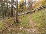 15
15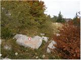 16
16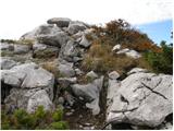 17
17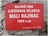 18
18 19
19
Discussion about the trip Parkirišče pri botaničnem vrtu - Mali Rajinac (by road)
To post a comment you must log in:
If you do not yet have a username, you must first
register.