Parkirišče pri botaničnem vrtu - Pasarićev Kuk (Premužičeva steza)
Starting point: Parkirišče pri botaničnem vrtu (1500 m)
Route name: Premužičeva steza
Walking time: 2 h 45 min
Difficulty: easy marked way, difficult pathless terrain
Elevation gain: 130 m
Elevation difference along the route: 250 m
Map: Sjeverni Velebit 16a
Recommended equipment (summer):
Recommended equipment (winter): ice axe, crampons
Views: 6.115
 | 3 people like this post |
Access to starting point:
We leave the motorway from Slovenia towards Split at the Otočac exit. Follow signs for Krasno and Northern Velebit. The winding road takes us through Švica to Krasno, where the road from Senj joins. (Follow the Adriatic highway past Rijeka to Senj, then turn uphill to Krasno.) In Krasno continue towards Northern Velebit National Park and Zavižan hut. The mostly gravel road first leads to the park entrance where entrance fee is collected, then to the junction by the chapel where we can park in the extensive parking lot.
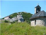
Above the parking lot, a quarter-hour away, is a small mountain hut and the meteorological station Zavižan; below it the botanical garden.
Route description:
From the parking lot continue along the road closed to traffic initially almost flat. After a few minutes of walking, Premužičeva steza branches right at the junction. The masterfully constructed path first gently climbs across the meadow and after a few minutes enters the forest. It proceeds mostly level to the rocky slopes, where it begins to ascend gently along the panoramic slope. The path then re-enters the forest and after two hours from the parking lot reaches a junction where the path to the summit of Gromovača branches right. (15 minutes, marked, slight scrambling).
Continue on Premužičeva steza which after some switchbacks reaches the highest point of the path. A short descent follows to the next junction, continue right. Crossing steep and slightly exposed slopes of Pasarićev Kuk follows, but the path is wide enough to pose no problems. (Caution if snowy or icy). The gradient of the slopes gradually eases and to the right ahead we spot bivouac Rossijeva koliba (shelter). The bivouac is named after Croatian botanist Ljudevit Rossi (1866-1934), a small stone hut where we can rest, perhaps emergency overnight. The shelter has a ladder and wooden platform (no mattresses or blankets), some tools and stove, sometimes firewood.
To the right above the hut notice a path into the scrub and then a gully sufficiently structured to scramble up 50 m higher to the summit. Caution needed when leaping to the upper platform and on descent. The view of Rožanske kukove is even better than from before the hut, also visible Kvarnerski zaliv, Novotnijev Kuk, Gromovača, Crikveno and other rocky pinnacles of Northern Velebit. The summit is named after Josip Pasarić, president of the Croatian mountaineering association, writer, politician, editor and publicist.

Along the route: botanični vrt (1500m), Gromovača (1678m), Rossijeva koliba (1580m)
Photos:
 1
1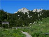 2
2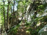 3
3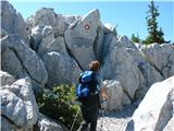 4
4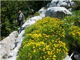 5
5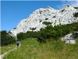 6
6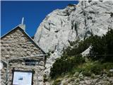 7
7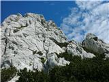 8
8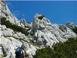 9
9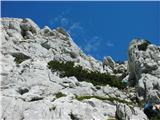 10
10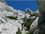 11
11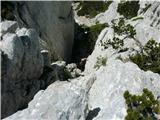 12
12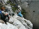 13
13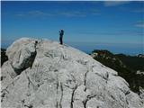 14
14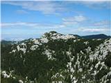 15
15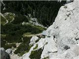 16
16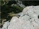 17
17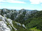 18
18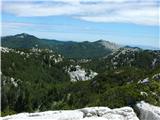 19
19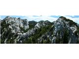 20
20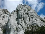 21
21 22
22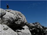 23
23
Discussion about the trip Parkirišče pri botaničnem vrtu - Pasarićev Kuk (Premužičeva steza)
To post a comment you must log in:
If you do not yet have a username, you must first
register.