Parkirišče pri kapelici - Balinovac (via Velika Kosa)
Starting point: Parkirišče pri kapelici (1520 m)
Route name: via Velika Kosa
Walking time: 45 min
Difficulty: easy marked way
Elevation gain: 82 m
Elevation difference along the route: 150 m
Map: Sjeverni Velebit 16a
Recommended equipment (summer):
Recommended equipment (winter): ice axe, crampons
Views: 3.624
 | 1 person like this post |
Access to starting point:
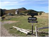
From the Zagreb-Split highway, take the Otočac exit. Follow the road ahead towards the village Krasno and Sjeverni Velebit. The considerably winding road through the village Švica brings us to Krasno, where the road from Senj joins (access from that direction also possible). In Krasno we continue towards the signs for National Park Sjeverni Velebit and Dom Zavižan. The road, which then becomes macadam, brings us to the park entrance, where an entrance fee is charged. We then drive along the road that brings us to the crossroads at the chapel, where we park in the parking lot.
Route description:
From the parking lot, we continue towards Dom Zavižan along the asphalt road to a small saddle between Vučjak and Velika Kosa, where a nice view opens up towards the sea. Here we leave the road and turn left up the grassy slope towards the summit. After a few minutes of walking on the grassy slope, the path brings us to the summit of Velika Kosa.
From the top, we descend along the marked path downwards towards Balinovac (Balinovac). The path, which descends for some time, then leads us to a larger meadow behind which the path takes us into more rocky terrain. A little below the summit, the path stops at a three-meter-high chimney secured with a piton. The passage is not difficult but caution is necessary if we have a child with us. Further on, only a few steps of walking remain to the scenic summit.
Photos:
 1
1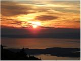 2
2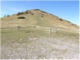 3
3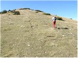 4
4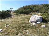 5
5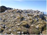 6
6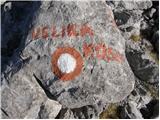 7
7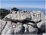 8
8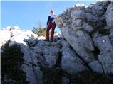 9
9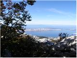 10
10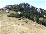 11
11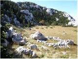 12
12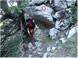 13
13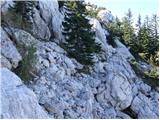 14
14 15
15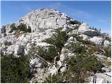 16
16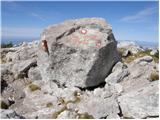 17
17
Discussion about the trip Parkirišče pri kapelici - Balinovac (via Velika Kosa)
To post a comment you must log in:
If you do not yet have a username, you must first
register.