Parkirišče pod kočo Polinikhütte - Ebeneck (Kreuzeck Hohenweg)
Starting point: Parkirišče pod kočo Polinikhütte (1350 m)
Route name: Kreuzeck Hohenweg
Walking time: 3 h
Difficulty: easy marked way
Elevation gain: 781 m
Elevation difference along the route: 781 m
Map: Kompass 49 NP Hohe Tauern Sud 1:50000
Recommended equipment (summer):
Recommended equipment (winter):
Views: 4.191
 | 2 people like this post |
Access to starting point:
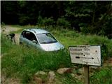
Through the Karawanks Tunnel, we follow the highway past Beljak to the exit towards Lienz, where after Lendorf we turn right towards Obervellach. Here by the gas station, we turn right, after a few meters by the swimming pool to the left into the center and by the end of the shorter main street once again left into the underpass (670 m). We follow numerous signs for Polinikhütte: over a narrow iron bridge, through a tree-lined avenue, past the speed limit 5 km/h and ahead into the forest. Asphalt soon runs out, steep macadam road after a few kilometers ends on a small parking lot by the barrier (around 1350 m). The postal bus from Obervellach also comes here. One bend before is the turn-off towards Wunzenalm, where there used to be a cargo cableway for the mountain hut. The cableway is gone, but the footpath is still there.
Route description:
After the gate, we walk for some time on the road (on the map it has number 328, on the terrain there are no such numbers), then we follow the signs into the forest. The footpath, covered with a carpet of larch and spruce needles, crosses the road a few times and leads to the mountain pasture Stampferalm, where on a panoramic spot at an altitude of 1873 m there is the romantic mountain hut Polinik. To here 90 minutes. From the mountain hut, we follow the signs (on the map path 326) for some time through the forest, then onto wide slopes covered with rhododendron and blueberries. After one hour, just before the ruins of the cattle pen, the footpath branches off to Ebeneck, to which is another half hour (on the map path 329). We continue gently, in a gentle ascent we cross the slopes of higher peaks of the Mornigkopfe ridge, until we reach the lowest of those peaks, our panoramic summit, on which stands a cross with a summit logbook.

Along the route: koča Polinikhutte (1873m)
Photos:
 1
1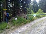 2
2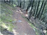 3
3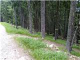 4
4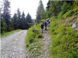 5
5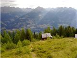 6
6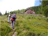 7
7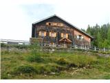 8
8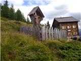 9
9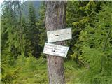 10
10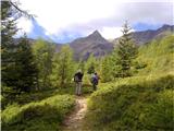 11
11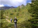 12
12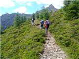 13
13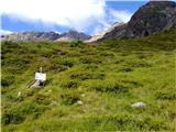 14
14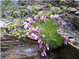 15
15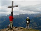 16
16
Discussion about the trip Parkirišče pod kočo Polinikhütte - Ebeneck (Kreuzeck Hohenweg)
To post a comment you must log in:
If you do not yet have a username, you must first
register.