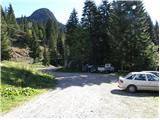
Parking place below Nassfeld - Monte Cavallo / Rosskofel (by east ridge)
Starting point: Parking place below Nassfeld (1460 m)
Starting point Lat/Lon: 46.5524°N 13.2735°E 
Path name: by east ridge
Time of walking: 3 h 30 min
Difficulty: very difficult marked way
Difficulty of skiing: no data
Altitude difference: 780 m
Altitude difference (by path): 810 m
Map: Tabacco 18
Access to starting point:
Over the border crossing in Rateče we drive through Trbiž / Tarvisio, Ukve / Ugovizza to the settlement Tablja / Pontebba, where we turn right following the signs »Passo di Pramollo / Nassfeld« (Slovenian Mokrine). A little before the mountain pass at the right turn macadam road branches off to the left. At the crossroad, there are signposts and a smaller parking lot on which we park.
Path description:
At the parking lot, we go on a macadam road which is closed for traffic and already after few meters, we come to a crossroad, where the path branches off to the right, which runs towards the mountain pass Mokrine / Nassfeld. We continue left on the road which in approximately half an hour in gentle ascents and descents brings us to the mountain pasture at the cottage Baita Winkel (1470 meters).
On the mountain pasture, we go left following the signs Rosskofel Ostgrat. The path crosses the stream and starts ascending in zig-zags through the forest. A little before the ridge we come to a crossroad, where we go to the right, left path runs on Malvueric (1899 meters). The path then through little overgrown dwarf pines brings us on the south side of the ridge. From here ahead the path becomes demanding and quite some easy climbing is needed. The entire path is unsecured and quite exposed, and in wet very dangerous for slipping. The path runs on natural passages and by steep torrent and then through a narrow gully soon brings us to box with an inscription book. Here the path turns right and with easy climbing on the south slopes brings us to a steep grassy slope. Next follows exposed crossing towards the ridge, on which path becomes a little less steep but still quite exposed. We again avoid the ridge on a steep and a slightly crumbly southern slopes of the mountain. When we again step on the ridge path becomes less steep and gradually also less exposed. We soon reach the peak Creta di Pricot (2252 meters), which is even a little higher as our destination Konjski Špik / Monte Cavallo / Rosskofel. From here on an undemanding path in a gentle descent and then ascent in 15 minutes we reach the peak of Konjski Špik.
Pictures:
 1
1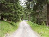 2
2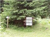 3
3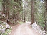 4
4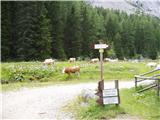 5
5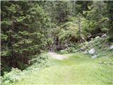 6
6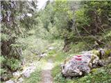 7
7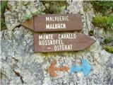 8
8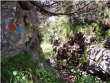 9
9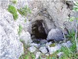 10
10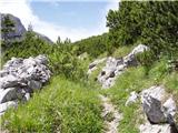 11
11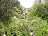 12
12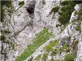 13
13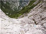 14
14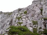 15
15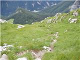 16
16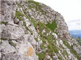 17
17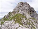 18
18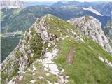 19
19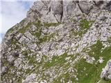 20
20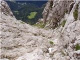 21
21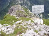 22
22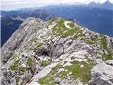 23
23 24
24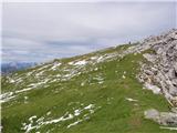 25
25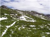 26
26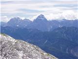 27
27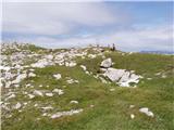 28
28 29
29