Passo Campolongo - Col di Lana
Starting point: Passo Campolongo (1860 m)
| Latitude/Longitude: | 46,51930°N 11,87393°E |
| |
Walking time: 4 h 20 min
Difficulty: difficult marked way
Elevation gain: 592 m
Elevation difference along the route: 870 m
Map: Tabacco 07 1:25.000
Recommended equipment (summer):
Recommended equipment (winter): ice axe, crampons
Views: 598
 | 4 people like this post |
Access to starting point:
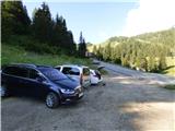
Through the Karawanks Tunnel, we drive into Austria, then continue driving towards Spittal and further towards Lienz (a little after Spittal the motorway ends). Further, we drive on a relatively nice and wide road through the Drau Valley, which brings us to Italy. The road then leads past Dobbiaco / Toblach and Brunico / Bruneck. Just a little after the last-mentioned place, past which a bypass leads, we turn left into the Val Badia valley. Further, we drive through the mentioned valley past the places La Villa and Corvara. Next follows the ascent towards the pass Passo Campolongo. A few hundred meters before the pass, we will notice a gravel parking lot on the left side, on which we park. The parking lot is located behind the hotel Laguscei opposite the bus stop. By the road there is also the lower station of the chairlift. A smaller parking lot is also on the right side of the road before the bus stop.
Route description:
From the parking lot at the hotel Laguscei we ascend on a cart track that runs right under the cableway and after a few dozen meters we come to a marked junction.
We turn left onto a worse cart track, where signs for »Inzija, Pralongia« direct us. To the right, a cart track leads towards the summit Cherz. Our path then crosses the ski slope to the left side of the cableway and the cart track quickly turns into a trail. The path then brings us into the forest and to the left downwards a path branches off towards the Planac parking lot and further towards the place Corvara. We continue straight and the path quickly brings us out of the forest onto the ski slope. Here the path steeply ascends the ski slope for a short time, then turns left from the ski slope and re-enters the forest. Further on, the path runs through the forest from which we occasionally still get views towards the Puez mountain group. Such a path soon brings us to a junction, where another slightly longer path from the Passo Campolongo pass joins us from the right.
At the junction we continue left and then cross the slopes through the forest mostly towards the east. The path then brings us out of the forest onto a clearing or ski slope where there is a bench and another junction.
To the left downwards another path leads towards the place Corvara, to the right a path leads towards the summit Cherz, but we continue straight ahead following the signs »Inzija, Pralongia«. The level path, which occasionally also gently descends, continues through the forest towards the east. Here along the path we will notice quite a few benches and springs. When we come out of the forest, only a short descent follows and the path brings us to the Passo Incisa saddle, where we join the gravel road. Here on the left side there is also the nicely arranged hut La Marmotta.
At the marked junction in front of the hut we continue straight along the road in the direction of Pralongia. The road immediately from the hut begins to ascend relatively steeply towards the east. Here the path runs near the cableway and the Incisa ski slope. We continue further along the ascending road from which increasingly beautiful views open up on the mountain groups Marmolada, Sella and Puez.
To the left somewhat downwards a path then branches off towards the Rifugio Punta Trieste hut, but we continue further uphill along the road. Higher up the road turns slightly left and brings us to another junction. To the left another path leads to the mentioned hut, but we continue somewhat to the right and continue ascending towards the Pralongia summit on which we already see the upper cableway station. Along the panoramic road we then continue all the way to the summit by which there is also the Rifugio Pralongia hut. From here an even more beautiful view opens up also on the mountains above the Val Badia valley and towards the Setsas summit.
From the summit we continue along a wide path towards the east where signs direct us to Setsas and Col di Lana. Initially the path gently descends and runs along a wide indistinct ridge. The path then continues towards the east and begins to gently ascend. When we approach the slopes of the Stores summit, the path turns left and brings us to the northern side of the mentioned summit, where there is also a marked junction.
Here we leave the wider gravel path and turn right uphill onto a trail that ascends the grassy slope towards the Stores summit. After a short ascent we already spot the cross on the summit. The path then turns slightly left and along the summit grassy slope we soon reach the panoramic summit with a cross and a bench.
From the Stores summit we continue along a wide grassy ridge and for quite some time mostly gently descend towards the east. Later the ridge becomes somewhat steeper on the right southern side and the path then for a short time ascends slightly again. A descent follows again further along the left side of the grassy ridge. Such a path then brings us to a small saddle where we cross a cart track.
From the saddle we begin to ascend again and along the path there are again more trees. Here we ascend also along a stream that occasionally flows along the path, which can consequently be somewhat muddy. The trees further on become sparser again and when we get somewhat closer to the slopes of the Setsas summit the path brings us to a marked junction.
To the left a path leads to the Setsas summit, but we continue straight along path no. 23, which leads towards the Passo Sief saddle and the Col di Lana summit. The path from the junction then leads us past a small house and continues to gently ascend the grassy terrain. Traversing a slope strewn with rocks and boulders follows, then the path gently descends and the terrain becomes somewhat more grassy again. Later the path turns left and ascends towards the screes below the sheer walls of the Setsas summit. Here the terrain becomes more rocky again. Further on the path crosses the slopes below the sheer walls towards the southeast and occasionally gently descends. Such a path then brings us below the slopes of the Pico Setsas summit where there is also a somewhat poorly visible unmarked junction. To the left an unmarked path leads to the Pico Setsas summit, but we continue forward towards the Passo Sief saddle. The level path then brings us to the southern side of the Pico Setsas summit where a path from the Passo Valparola pass joins us from the eastern side.
At the junction we continue right along the pasture fence and descend somewhat along the grassy slope to the Passo Sief saddle.
At the saddle where there is a junction we continue straight along the ridge towards the Monte Sief summit. Here along the path we will notice numerous military tunnels and trenches that are nicely renovated. We follow the panoramic path along the military trenches all the way to the Monte Sief summit from which even more beautiful views open up also towards the south.
From the summit we continue along the ridge towards the east and descend into the crater that formed during the First World War when the Austrian side mined the ridge with 45.005 kg of explosives. From the crater we then ascend back onto the ridge with the help of steel cables and a few pegs. Further on the nicely arranged path runs mostly along the southern side of the ridge and several times fixed protections assist us. From the path we otherwise have a nice view all the time on the mountains south of us and along the path we will notice numerous remains from the time of the First World War. Later a somewhat steeper ascent follows along steps, then we will soon see a chapel ahead of us located below the summit. From here to the panoramic summit there is only a short ascent of a few meters.

Along the route: Passo Incisa (1938m), Rifugio La Marmotta (1938m), Pralongia (2109m), Stores (2185m), Passo Sief (2209m), Monte Sief (2424m)
Photos:
 1
1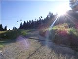 2
2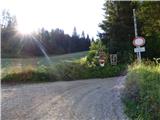 3
3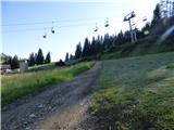 4
4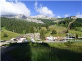 5
5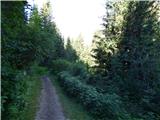 6
6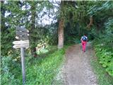 7
7 8
8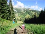 9
9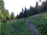 10
10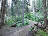 11
11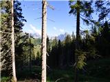 12
12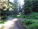 13
13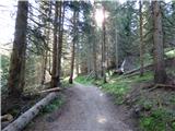 14
14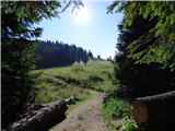 15
15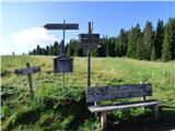 16
16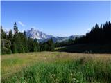 17
17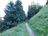 18
18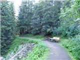 19
19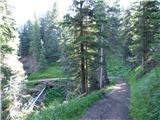 20
20 21
21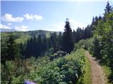 22
22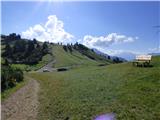 23
23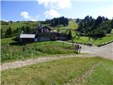 24
24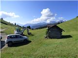 25
25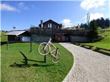 26
26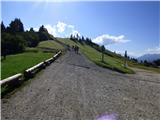 27
27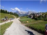 28
28 29
29 30
30 31
31 32
32 33
33 34
34 35
35 36
36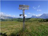 37
37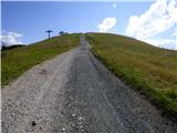 38
38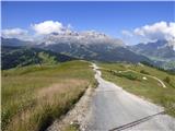 39
39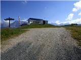 40
40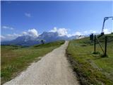 41
41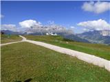 42
42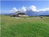 43
43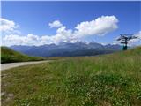 44
44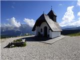 45
45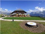 46
46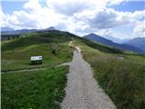 47
47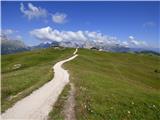 48
48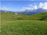 49
49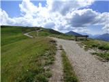 50
50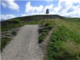 51
51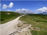 52
52 53
53 54
54 55
55 56
56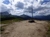 57
57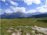 58
58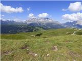 59
59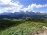 60
60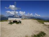 61
61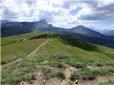 62
62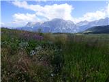 63
63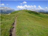 64
64 65
65 66
66 67
67 68
68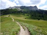 69
69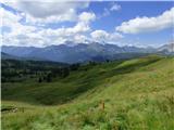 70
70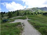 71
71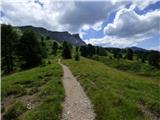 72
72 73
73 74
74 75
75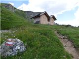 76
76 77
77 78
78 79
79 80
80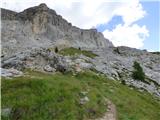 81
81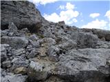 82
82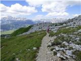 83
83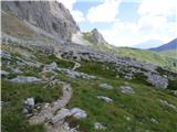 84
84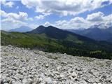 85
85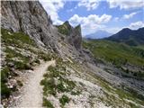 86
86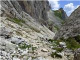 87
87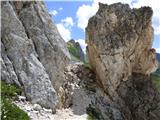 88
88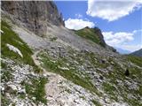 89
89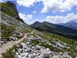 90
90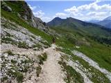 91
91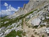 92
92 93
93 94
94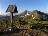 95
95 96
96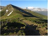 97
97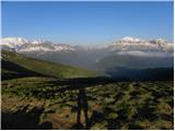 98
98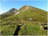 99
99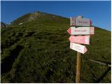 100
100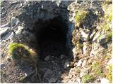 101
101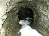 102
102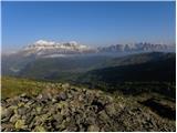 103
103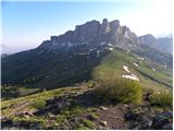 104
104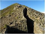 105
105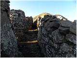 106
106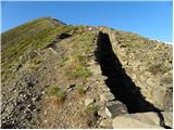 107
107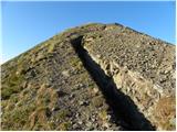 108
108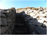 109
109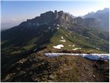 110
110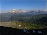 111
111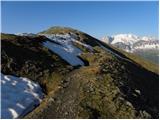 112
112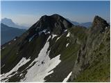 113
113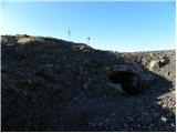 114
114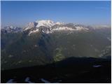 115
115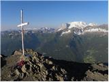 116
116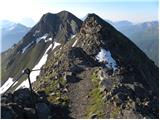 117
117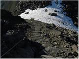 118
118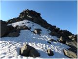 119
119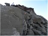 120
120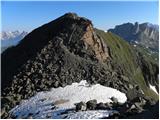 121
121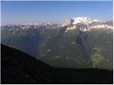 122
122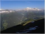 123
123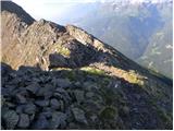 124
124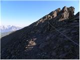 125
125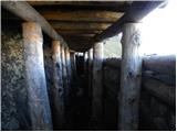 126
126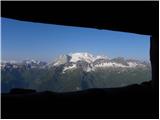 127
127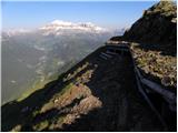 128
128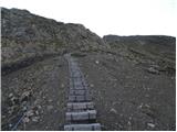 129
129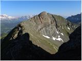 130
130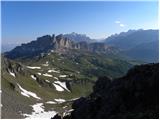 131
131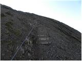 132
132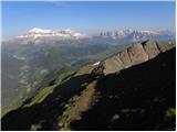 133
133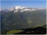 134
134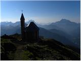 135
135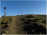 136
136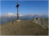 137
137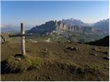 138
138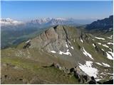 139
139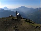 140
140
Discussion about the trip Passo Campolongo - Col di Lana
To post a comment you must log in:
If you do not yet have a username, you must first
register.