Passo Campolongo - Lago Boe
Starting point: Passo Campolongo (1860 m)
| Latitude/Longitude: | 46,51930°N 11,87393°E |
| |
Walking time: 1 h 10 min
Difficulty: easy marked way
Elevation gain: 392 m
Elevation difference along the route: 410 m
Map: Tabacco 03 1:25.000
Recommended equipment (summer):
Recommended equipment (winter):
Views: 2.280
 | 2 people like this post |
Access to starting point:
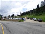
Through the Karawanks Tunnel, we drive into Austria, then continue towards Spittal and further towards Lienz (a little after Spittal the motorway ends). Further, we drive on a relatively nice and wide road through the Drau Valley, which brings us into Italy. The road further leads past Dobbiaco / Toblach and Brunico / Bruneck. Just a little after the last-mentioned town, past which a bypass leads, we turn left into the Val Badia valley. Further, we drive through the mentioned valley past the places La Vila and Corvara. Next follows an ascent towards the pass Passo Campolongo. A few hundred metres before the pass, we will notice on the left side a macadam parking lot on which we park. The parking lot is located behind the hotel Laguscei opposite the bus stop. By the road is also the lower station of the chairlift. A smaller parking lot is also on the right side of the road before the bus stop.
Route description:
From the parking lot, we continue along the main road (towards the south) to the Hotel Boe, which is located on the right western side of the road. At the hotel where there are also signposts, we turn right onto the macadam road following the signs »Rifugio Lago Boe«. Behind the hotel, the road turns right and descends slightly, then starts to ascend and crosses the ski slope. Further on, the road ascends for a short time through the forest and then brings us to the alpine pasture Malga Plan Fisti.
We continue along the road across the alpine pasture and a little after the pasture we come to a marked junction where the footpath to the hut Kaiser Hütte branches off to the left. We continue right and continue ascending along the road. After a short ascent, the path 638A to the summit Crep de Munt also branches off to the right. We continue left along the road from which beautiful views open towards Marmolada and the mountains above the Val Badia valley. Here the road ascends somewhat more steeply and brings us again to the ski slope. Somewhat higher, the road turns right and continues ascending along mostly grassy slopes. The road then becomes gentler and soon brings us to the hut Rifugio Lago Boe. A circular cabin cableway from Corvara in Val Badia also runs to the hut. Near the hut there is also the lower station of the chairlift that goes to the summit Vallon (2530 m). Both cableways operate in the summer months as well.
Near the hut where there is a junction, we continue left across the ski slope where signs direct us to the lake Lech de Boe and the hut Ütia Franz Kostner. The path runs along the right edge of the ski slope and after a short ascent brings us to the mentioned lake, which is located to the right of the ski slope below the rocky ridge.

Photos:
 1
1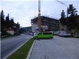 2
2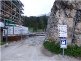 3
3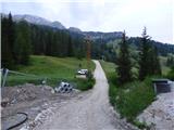 4
4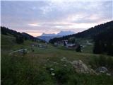 5
5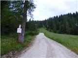 6
6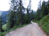 7
7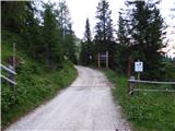 8
8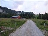 9
9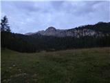 10
10 11
11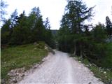 12
12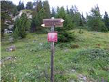 13
13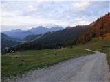 14
14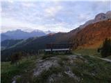 15
15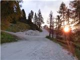 16
16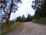 17
17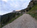 18
18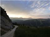 19
19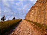 20
20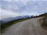 21
21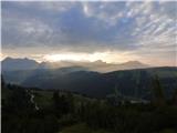 22
22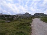 23
23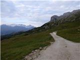 24
24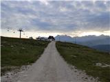 25
25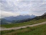 26
26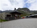 27
27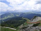 28
28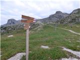 29
29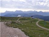 30
30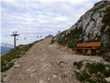 31
31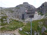 32
32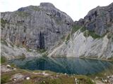 33
33
Discussion about the trip Passo Campolongo - Lago Boe
|
| Savinja1130. 07. 2022 20:27:46 |
On 27.7.2022 we returned from Lake Boe to the starting point - Passo Campolongo (1875m) along the described path. But we started the path along the gravel road opposite Hotel Monte Sherz, which is located by the road near the described starting point. Parking at Passo Campolongo is no problem, no crowds and free. Along the gravel road we chose, we ascend to Rifugio Bec de Roces (2187m) and continue on path 636 through easy, scenic, grassy and rocky terrain towards Lago Boe (2275m). Beautiful views open up from the path to the mountains between Col di Lana and Sassongher. We return along the well-visible and described path or gravel road that leads through the ski slopes. The path is suitable for all ages. For the 8 km easy path we needed three and a half hours.
|
|
|
To post a comment you must log in:
If you do not yet have a username, you must first
register.