Passo di Costalunga / Karerpass - Cima Latemar / Latemarspitze
Starting point: Passo di Costalunga / Karerpass (1745 m)
| Latitude/Longitude: | 46,40401°N 11,60932°E |
| |
Walking time: 3 h 40 min
Difficulty: very difficult marked way
Elevation gain: 1055 m
Elevation difference along the route: 1080 m
Map: Tabacco 06 1:25.000
Recommended equipment (summer): helmet
Recommended equipment (winter): helmet, ice axe, crampons
Views: 1.726
 | 2 people like this post |
Access to starting point:
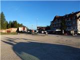
Access from Gorenjska: Through the Karawanks Tunnel, we drive into Austria, then continue towards Spittal and further towards Lienz (just after Spittal the motorway ends). Further on, we drive on a relatively nice and wide road through the Drau Valley, which takes us into Italy. The road then leads past Dobbiaco / Toblach and Brunico / Bruneck. Just a little after the last-mentioned place, past which a bypass runs, we turn left into the Val Badia valley. Further, we drive through the mentioned valley past the places La Vila and Corvara. This is followed by the ascent over the passes Passo Campolongo and Passo Pordoi. From the pass Passo Pordoi, we then descend to the west side into the Val di Fassa valley. A little after the place Pozza di Fassa, we turn right towards the pass Passo di Costalunga / Karerpass. We park on the parking lot at the mentioned pass. The parking lot is located on the left side of the road.
From the Primorska side: From Nova Gorica, we drive into Italy and continue on the motorway towards Venice / Venezia. Near Portogruaro, we leave the motorway towards Venice and continue right on the motorway towards Pordenone. At the next motorway junction near Conegliano, we continue right towards Belluno. We follow the motorway to the exit for Belluno. When we leave the motorway, we come to a larger roundabout, which we leave at the exit for Belluno and the place Feltre. In the smaller roundabout in Belluno, we then continue right towards Agordo. We follow this road all the way to the place Moena in the Val di Fassa valley. In Moena, we then continue right towards Canazei, but only as far as Vigo di Fassa, where we turn left towards the pass Passo di Costalunga / Karerpass. We park on the parking lot at the mentioned pass. The parking lot is located on the left side of the road.
Route description:
From the parking lot on the pass, we head onto the macadam road following the signs »Cima Latemar, Latemarspitze«. The path first leads past the lower cable car station and takes us to the ski slope, where we soon reach a marked junction.
Left leads the path towards the alpine pasture Malga Secine and the southeast path towards the notch Forcella Latemar Piccola. At the junction, we continue right on the macadam road (path no. 17) following the signs »Cima Latemar, Latemarspitze«. From the junction, the road begins to ascend gently and continues along the ski slope. The road then leads along the forest for a while and, in a left bend when crossing the fence, brings us to a junction.
At the junction, we leave the road and turn right onto the footpath that runs across meadows. On the grassy terrain, the path is somewhat less visible, but orientation is not overly demanding. Across the pastures, the path takes us to a bench and a cross, next to which there is also a marked junction.
Right downhill branches the path towards the Karer See hut; we continue slightly left on path 18A. From the junction, the path first descends slightly, then crosses the slope towards the west. Here the path runs through larch forest and soon brings us to another junction, where a path from the Karer See hut and the path named Labirinto join from the right.
At the junction, we continue left towards the notch Forcella Latemar. At the junction there is also a warning that the mentioned path is demanding. From the junction, the path briefly continues to cross the slope towards the west, then turns left and begins to ascend somewhat more steeply beside a deep gully. Trees and bushes become sparser, and increasingly beautiful views open up, especially to the north and towards the Catinaccio mountain group. The path then mostly ascends in switchbacks on a fairly steep slope. Since the path is not secured and not well-trodden, more caution is needed in a few places. Higher up, as the deep gully along which we ascend most of the time ends, the path turns right and takes us to somewhat less steep slopes. Further on, grassy slopes are soon replaced by scree, and the ascent towards the gully leading to the notch Forcella Latemar Piccola follows. In the lower part, the path avoids the gully to the left onto an indistinct ridge along which we ascend for some time. Higher up, the path takes us into the gully, up which we then ascend all the way to the notch Forcella Latemar Piccola. The path runs along the right side of the gully and is quite steep in a few places, so some caution is needed.
At the notch, where there is a marked junction, we continue right; from the left, an easier path joins, which runs below the southeast slopes of the peak Cima Pope.
From the junction, we ascend quite steeply for some time towards the slopes of the peak Col Cornon. The path then becomes less steep and crosses the slopes on the left side of the mentioned mountain. When we reach the south side of the peak Col Cornon, the path turns slightly right and crosses fairly steep slopes towards the west. Further on, the path becomes more demanding and crosses a few short gullies, over which considerable caution is needed since the path is not secured. A few short steep ascents and crossings follow, then the path takes us to the west side of the peak Col Cornon, where the path becomes easier and the slope less steep. The ascent to the false summit follows, where there is also a junction.
Left leads the path towards the Rigatti bivouac and the notch Forcella Grande (Große Latemarscharte); we continue right and along the panoramic ridge soon reach the summit, which we can already see ahead.
We descend to the notch Forcella Latemar Piccola along the ascent path. From there, we can return to the starting point along the easier path (path 517), which runs below the southeast slopes of the peak Cima Pope.

Along the route: Forcella Latemar Piccola (2526m)
Photos:
 1
1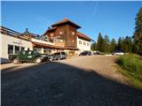 2
2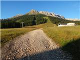 3
3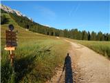 4
4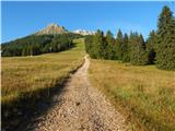 5
5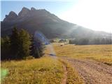 6
6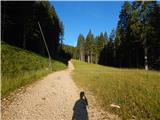 7
7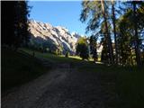 8
8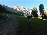 9
9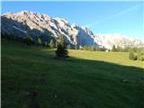 10
10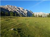 11
11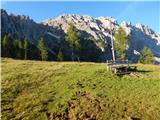 12
12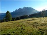 13
13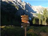 14
14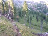 15
15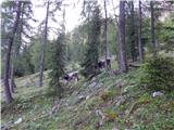 16
16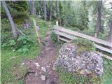 17
17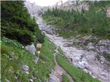 18
18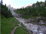 19
19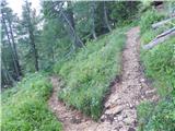 20
20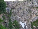 21
21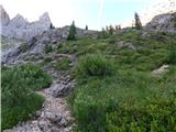 22
22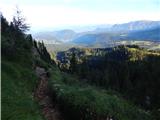 23
23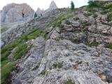 24
24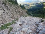 25
25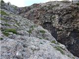 26
26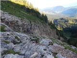 27
27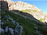 28
28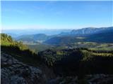 29
29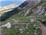 30
30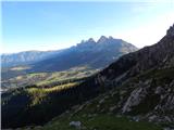 31
31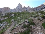 32
32 33
33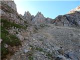 34
34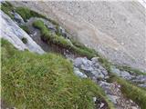 35
35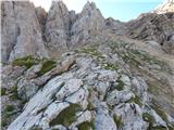 36
36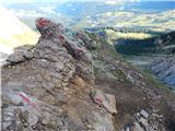 37
37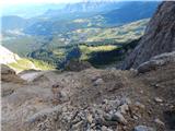 38
38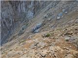 39
39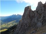 40
40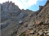 41
41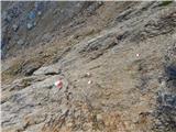 42
42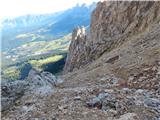 43
43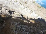 44
44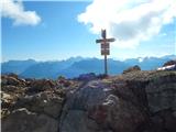 45
45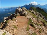 46
46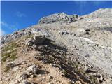 47
47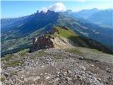 48
48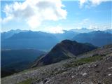 49
49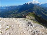 50
50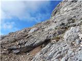 51
51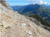 52
52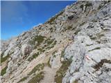 53
53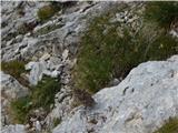 54
54 55
55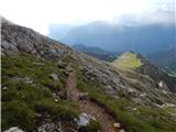 56
56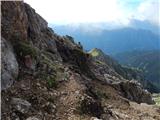 57
57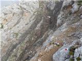 58
58 59
59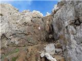 60
60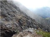 61
61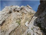 62
62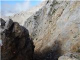 63
63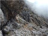 64
64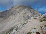 65
65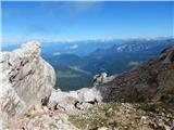 66
66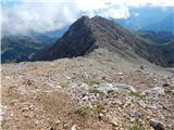 67
67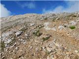 68
68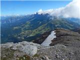 69
69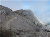 70
70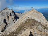 71
71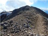 72
72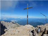 73
73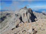 74
74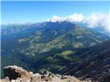 75
75
Discussion about the trip Passo di Costalunga / Karerpass - Cima Latemar / Latemarspitze
To post a comment you must log in:
If you do not yet have a username, you must first
register.