Passo di Fedaia - Bech da Mesdi (Ferrata delle Trincee)
Starting point: Passo di Fedaia (2057 m)
| Latitude/Longitude: | 46,45340°N 11,88890°E |
| |
Route name: Ferrata delle Trincee
Walking time: 2 h 30 min
Difficulty: very difficult marked way
Via ferrata: C
Elevation gain: 670 m
Elevation difference along the route: 720 m
Map: Tabacco 07 1:25.000
Recommended equipment (summer): helmet, self belay set, lamp
Recommended equipment (winter): helmet, self belay set, ice axe, crampons, lamp
Views: 5.681
 | 2 people like this post |
Access to starting point:
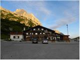
First, we drive to Cortina d'Ampezzo (you can get here via the border crossing at Rateče or Predel to Trbiž / Tarvisio and then on the highway in the direction of Vidma / Udine to the Tolmezzo exit. From Tolmezzo, we follow the road in the direction of the settlement Ampezzo and the mountain pass Passo della Mauria. The road then descends and brings us to an intersection, where we continue left (also right is possible) in the direction of Cortina d'Ampezzo. At all following intersections, we follow the signs for Cortina d'Ampezzo and then follow the signs for the alpine pass Passo di Falzarego. Already in the first part of the ascent towards the pass Falzarego, we will come to an intersection, where the signs for the pass Passo di Giau (2233 m) and Marmolada direct us left. The road after the pass Giau starts to descend, and we follow it through the settlements in the lower part in the direction of Marmolada or the pass Passo di Fedaia. The road, which then starts ascending again, brings us higher to the pass Fedaia, where we park on the parking lot at the hut Rifugio Fedaia.
Access from Primorska: We drive on the highway in the direction of Padova, but only to the highway junction, where we continue in the direction of Veneto and Belluno. Near Belluno, the highway ends, and we follow the road ahead in the direction of Belluno, where at a larger intersection we continue right in the direction of the town Agordo. From the mentioned town onwards, we follow the frequent signs for Marmolada or the pass Passo di Fedaia. When we arrive at the mentioned pass, we park on the parking lot at the hut Rifugio Fedaia.
Route description:
From the parking lot at the hut Rifugio Passo Fedaia, we head on the macadam road towards the hut Rifugio Padon. The macadam road first crosses the main road over a bridge and then ascends along and on the ski slope. The road then turns slightly to the right and brings us to the slopes below the cable car that leads towards the hut Padon. From the path, we have all the time a wonderful view of the nearby Marmolada. The macadam road continues ascending near the cable car all the way to the saddle Passo Padon.
On the saddle, where there is a junction, we continue left on the road to the hut, which we have already seen from the path for some time.
From the hut, we continue on the footpath following the signs »Porta Vescovo«. The path then crosses quite steep grassy slopes towards the west and initially also descends slightly. Further on, the path starts to ascend and crosses the slopes towards the west for some time. Later from the left, an unmarked path from Lake Fedaia joins us, and we continue crossing the grassy slopes from which we have a nice view of Marmolada all the time. A little before the saddle Porta Vescovo below the slopes of the peak Bech da Mesdi, the path brings us to a junction where we continue right upwards. At the junction, there is a red inscription »Ferr.« on the rock, which marks the path towards the secured climbing path Ferrata delle Trincee.
From the junction, the path ascends somewhat more steeply and brings us below the southwest wall of the peak Bech da Mesdi, where the climbing path begins.
The climbing is quite demanding at the beginning and some arm strength is also needed. From the path, a nice view opens towards the mountain group Sella. The path continues steeply ascending along the steel cable all the way to the ridge where the steepness eases somewhat. On the ridge, we then cross a hanging bridge and a steep ascent towards the summit Bech da Mesdi follows again. The secured path runs a few meters below the summit. However, we can reach the summit without major difficulties if from the secured path we continue right upwards at the place where the path starts to descend. The summit is also the highest point on the entire path.
From the summit, we then descend steeply with the help of the steel cable to gentler slopes on the eastern side of the peak. Here, right downwards, there is also an easy path by which we can leave the secured path.
We continue on the path along the ridge, which starts ascending again and brings us to a military tunnel below the sheer walls of the nearby peak. A little before the military tunnel, the path turns left and brings us past some ruins to a more demanding descent. Here, the path descends very steeply along the steel cable, and some pegs also help us. Such a path then brings us to the eastern side of the ridge where, with views towards the mountain group Tofana, it crosses slopes towards the southeast. The path then brings us back to the ridge where there is a junction. At the junction, there are also some military ruins. At the junction, we again have the option to descend to the south side and leave the secured path. If we are walking the Ferrata delle Trincee path in the opposite direction, we must be careful at the mentioned junction not to continue along the ridge but to take the path that crosses the slopes on the eastern side of the ridge.
At the junction, we continue left (southeast) along the ridge and begin to descend slightly. Occasionally, steel cables help us, but the path is not as demanding as in the first part. Later, the path descends to the south side of the ridge where there is another junction where we can leave the secured path early. At the junction, there is also a signpost indicating that the path will continue through military tunnels, in which we will need a headlamp.
From the junction, the path ascends somewhat more steeply along the steel cable and then brings us to the northern side of the ridge. Here, the path descends slightly and brings us to the first military tunnel. When we exit the tunnel, a short crossing on the south side of the ridge follows, then the path brings us back into a tunnel. After exiting the tunnel, a crossing follows again, then the path becomes somewhat more demanding and ascends several times along the steel cable. Such a path brings us to the last military tunnel, which is somewhat longer. On the path through the tunnel, we also ascend stairs. We exit the tunnel at bivouac Bontadini, where the end of the path named Ferrata delle Trincee is.
From the bivouac, we then descend towards the hut Padon and from there towards the starting point at the pass Passo Fedaia.
From the starting point to the summit Bech da Mesdi, we will need approximately 2h 30min, for the entire circular path 4h 45min.

Photos:
 1
1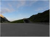 2
2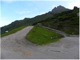 3
3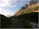 4
4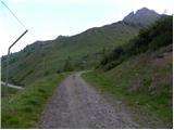 5
5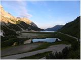 6
6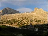 7
7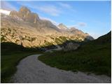 8
8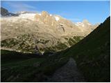 9
9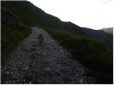 10
10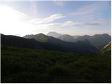 11
11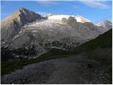 12
12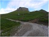 13
13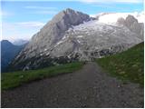 14
14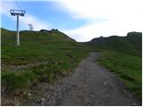 15
15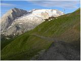 16
16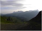 17
17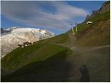 18
18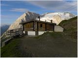 19
19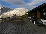 20
20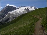 21
21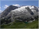 22
22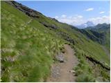 23
23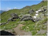 24
24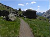 25
25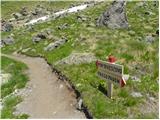 26
26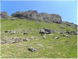 27
27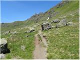 28
28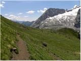 29
29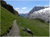 30
30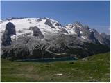 31
31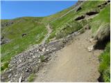 32
32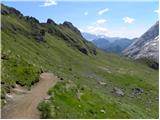 33
33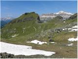 34
34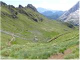 35
35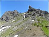 36
36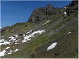 37
37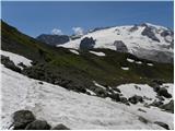 38
38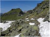 39
39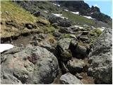 40
40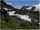 41
41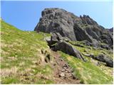 42
42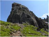 43
43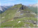 44
44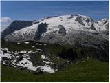 45
45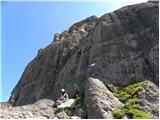 46
46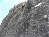 47
47 48
48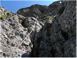 49
49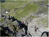 50
50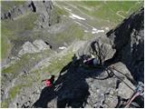 51
51 52
52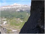 53
53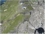 54
54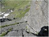 55
55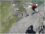 56
56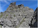 57
57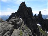 58
58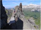 59
59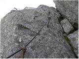 60
60 61
61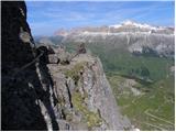 62
62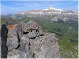 63
63 64
64 65
65 66
66 67
67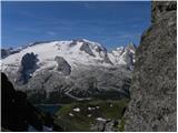 68
68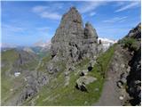 69
69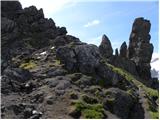 70
70 71
71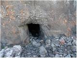 72
72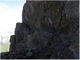 73
73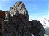 74
74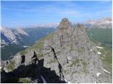 75
75 76
76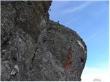 77
77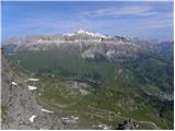 78
78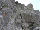 79
79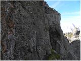 80
80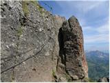 81
81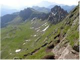 82
82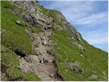 83
83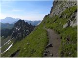 84
84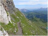 85
85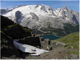 86
86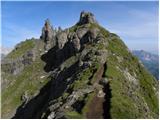 87
87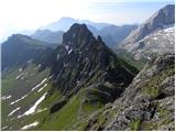 88
88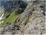 89
89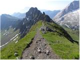 90
90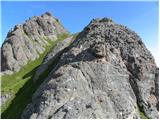 91
91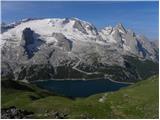 92
92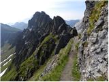 93
93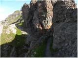 94
94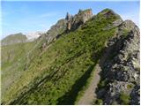 95
95 96
96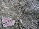 97
97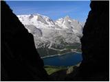 98
98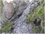 99
99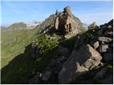 100
100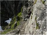 101
101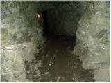 102
102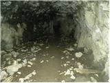 103
103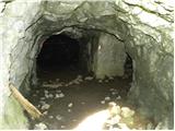 104
104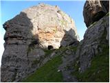 105
105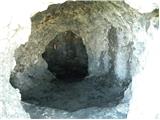 106
106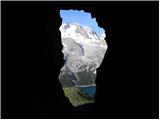 107
107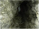 108
108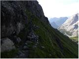 109
109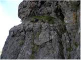 110
110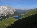 111
111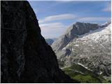 112
112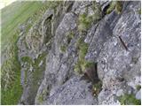 113
113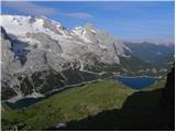 114
114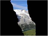 115
115 116
116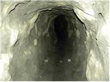 117
117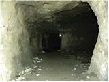 118
118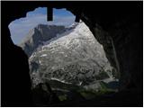 119
119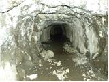 120
120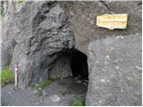 121
121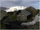 122
122 123
123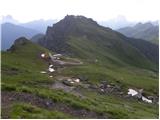 124
124 125
125 126
126
Discussion about the trip Passo di Fedaia - Bech da Mesdi (Ferrata delle Trincee)
To post a comment you must log in:
If you do not yet have a username, you must first
register.