Passo di Fedaia - Rifugio Serauta (via ski slope)
Starting point: Passo di Fedaia (2057 m)
| Latitude/Longitude: | 46,45340°N 11,88890°E |
| |
Route name: via ski slope
Walking time: 3 h
Difficulty: partly demanding unmarked way
Elevation gain: 893 m
Elevation difference along the route: 893 m
Map: Tabacco 07 1:25.000
Recommended equipment (summer): helmet, ice axe, crampons
Recommended equipment (winter): helmet, ice axe, crampons
Views: 2.700
 | 2 people like this post |
Access to starting point:
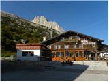
First, we drive to Cortina d'Ampezzo (you can get here via the border crossings Rateče or Predel to Trbiž / Tarvisio and then on the highway in the direction of Udine to the Tolmezzo exit. From Tolmezzo we follow the road in the direction of the settlement Ampezzo and mountain pass Passo della Mauria. The road then descends and brings us to an intersection, where we continue left (possible also right) in the direction of Cortina d'Ampezzo. At all following intersections, we follow the signs for Cortina d'Ampezzo and then the signs for the alpine pass Passo di Falzarego. Already in the first part of the ascent towards the pass Falzarego we will come to an intersection, where the signs for pass Passo di Giau (2233 m) and Marmolada direct us left. The road after the pass Giau starts descending, and we follow it through the settlements in the lower part in the direction of Marmolada or pass Passo di Fedaia. The road, which then again starts ascending, brings us higher to the pass Fedaia where we park on the parking lot at the mountain hut Rifugio Fedaia.
Access from Primorska: We drive on the highway in the direction of Padova, but only to the highway junction, where we continue in the direction of Veneto and Belluno. Near Belluno the highway ends, and we follow the road ahead in the direction of Belluno, where at the larger intersection we continue right in the direction of the town Agordo. From the mentioned town onwards we follow frequent signs for Marmolada or pass Passo di Fedaia. When we arrive at the mentioned pass, we park on the parking lot at the mountain hut Rifugio Fedaia.
Route description:
From the parking lot at the mountain hut we turn left onto the macadam road (transport-rescue road), which leads alongside the cableway. The road ascends on the ski slope below the slopes of the peak Sass del Mul and soon a nice view opens towards the lake Fedaia. We continue walking on the road, which ascends up the valley between the peaks Punta Serauta and Sas da les Unesc. The road on the ski slope then turns slightly left below the slopes of the peak Punta Serauta. Further on, we walk for some time on the road which ascends near the cableway, then the road soon ends.
At the end of the road we continue left towards the precipitous walls of the peak Punta Serauta. On this part the path is poorly visible, but the ascent is not difficult, since the slope is still relatively gentle. A somewhat steeper ascent follows on the left side of the valley, which brings us to the beginning of the glacier.
Here we equip ourselves with ice axe and crampons and continue the ascent on the ski slope. Further on we ascend for quite some time on the ski slope on the left side of the valley towards the saddle Serauta where there is the intermediate station of the gondola cableway. When we come near the saddle we will notice on the left a tunnel which leads from the ski slope towards the mountain hut Rifugio Serauta. We head through the mentioned tunnel and there follows only some easy walking to the hut where there is the intermediate station of the gondola cableway.
In case we are ascending to the hut when the gondola cableway does not operate (after 15 September), the door at the end of the tunnel may be locked. In this case from the ski slope to the hut some climbing is needed.

Photos:
 1
1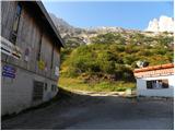 2
2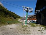 3
3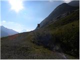 4
4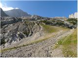 5
5 6
6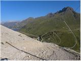 7
7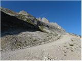 8
8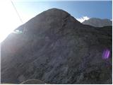 9
9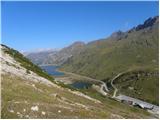 10
10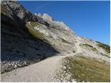 11
11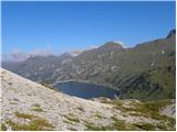 12
12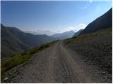 13
13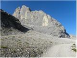 14
14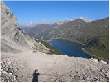 15
15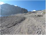 16
16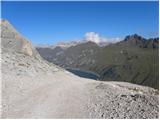 17
17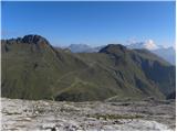 18
18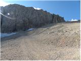 19
19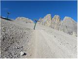 20
20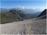 21
21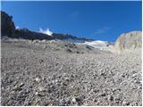 22
22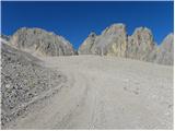 23
23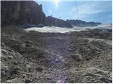 24
24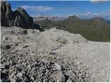 25
25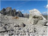 26
26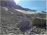 27
27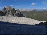 28
28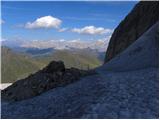 29
29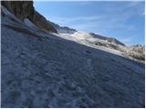 30
30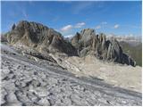 31
31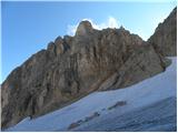 32
32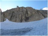 33
33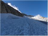 34
34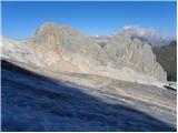 35
35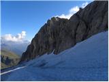 36
36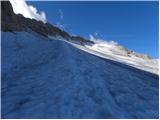 37
37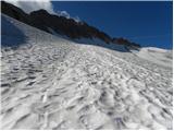 38
38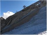 39
39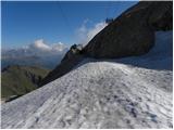 40
40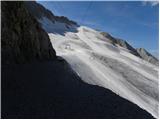 41
41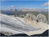 42
42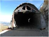 43
43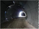 44
44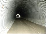 45
45 46
46 47
47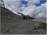 48
48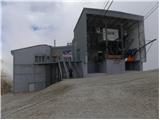 49
49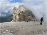 50
50
Discussion about the trip Passo di Fedaia - Rifugio Serauta (via ski slope)
To post a comment you must log in:
If you do not yet have a username, you must first
register.