Passo di Fedaia - Sass del Mul
Starting point: Passo di Fedaia (2057 m)
| Latitude/Longitude: | 46,45340°N 11,88890°E |
| |
Walking time: 1 h
Difficulty: partly demanding marked way
Elevation gain: 244 m
Elevation difference along the route: 260 m
Map:
Recommended equipment (summer):
Recommended equipment (winter): ice axe, crampons
Views: 3.045
 | 2 people like this post |
Access to starting point:
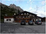
First, we drive to Cortina d'Ampezzo (you can get here via the border crossing Rateče or Predel to Trbiž / Tarvisio and then on the highway in the direction of Udine to the Tolmezzo exit. From Tolmezzo, we follow the road in the direction of the village Ampezzo and mountain pass Passo della Mauria. The road then descends and brings us to a crossroads, where we continue left (also right possible) in the direction of Cortina d'Ampezzo. At all following crossroads, we follow the signs for Cortina d'Ampezzo and then the signs for the alpine pass Passo di Falzarego. Already in the first part of the ascent towards the pass Falzarego, we will come to a crossroads, where the signs for pass Passo di Giau (2233 m) and Marmolada direct us left. The road after the pass Giau starts to descend, and we follow it through the settlements in the lower part in the direction of Marmolada or pass Passo di Fedaia. The road, which then starts ascending again, brings us higher to the pass Fedaia, where we park at the parking lot by the mountain hut Rifugio Fedaia.
Access from Primorska: We drive on the highway in the direction of Padova, but only to the highway junction, where we continue in the direction of Veneto and Belluno. Near Belluno, the highway ends, and we continue following the road in the direction of the city Belluno, where at a larger crossroads we turn right in the direction of the town Agordo. From the mentioned town onwards, we follow the frequent signs for Marmolada or pass Passo di Fedaia. When we arrive at the mentioned pass, we park at the parking lot by the mountain hut Rifugio Fedaia.
Route description:
From the parking lot on the pass, we continue left and first descend a little on the grassy slope. Soon we will notice on the right below the wall a footpath that leads through the dwarf pines. We head onto this footpath and begin to ascend diagonally towards the southeast. The path then turns right and follows the ascent on the grassy slope towards the wall, where the start of the via ferrata Eterna is. A little before the wall, the path brings us to a junction where we continue right following the signs for Sass del Mul (left is the climbing path Via ferrata Eterna).
From the junction, the path ascends gently along a wide path, which however is quite poorly trodden. The blazes lead us along the mostly grassy slope towards the summit of Sass del Mul, on which we can see numerous trenches from the First World War. The path then begins to ascend on a somewhat steeper slope to the left of the rocky forepeak. Since the path is relatively poorly trodden in this section, especially when wet, some caution is needed. The path later becomes less steep again and brings us via grassy terrain to a small saddle below the summit. On the saddle, from which a view opens towards Lake Fedaia, we continue right and only a short ascent remains to the panoramic summit.

Photos:
 1
1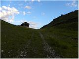 2
2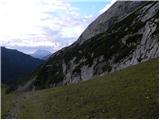 3
3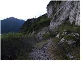 4
4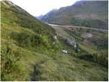 5
5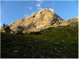 6
6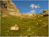 7
7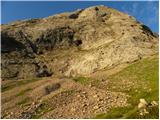 8
8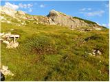 9
9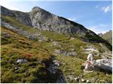 10
10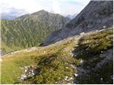 11
11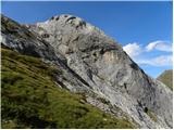 12
12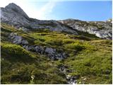 13
13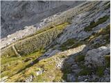 14
14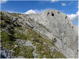 15
15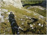 16
16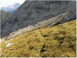 17
17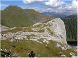 18
18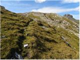 19
19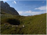 20
20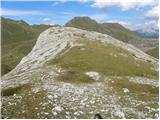 21
21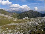 22
22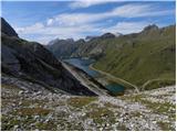 23
23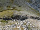 24
24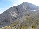 25
25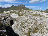 26
26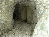 27
27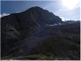 28
28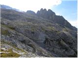 29
29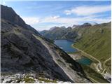 30
30
Discussion about the trip Passo di Fedaia - Sass del Mul
To post a comment you must log in:
If you do not yet have a username, you must first
register.