Passo di Giau - Monte Gusella
Starting point: Passo di Giau (2233 m)
| Latitude/Longitude: | 46,48250°N 12,05380°E |
| |
Walking time: 1 h 30 min
Difficulty: partly demanding unmarked way, very difficult marked way
Via ferrata: A
Elevation gain: 362 m
Elevation difference along the route: 450 m
Map: Tabacco 03 1:25.000
Recommended equipment (summer): helmet, self belay set
Recommended equipment (winter): helmet, self belay set, ice axe, crampons
Views: 1.680
 | 2 people like this post |
Access to starting point:
First, we drive to Cortina d'Ampezzo (you can get here via the border crossing Rateče or Predel to Trbiž / Tarvisio and then on the highway in the direction of Udine to the exit Tolmezzo. From Tolmezzo we follow the road in the direction of the village Ampezzo and mountain pass Passo della Mauria. The road then descends and brings us to a crossroad, where we continue left (possible also right) in the direction of Cortina d'Ampezzo. At all next crossroads, we follow the signs for Cortina d'Ampezzo. Or from the Primorska side, where we drive on the highway in the direction of Trst / Trieste. Further, we drive on the Italian highway in the direction of Padova, but only to the highway junction, where we continue in the direction of Veneto and Belluno. Near Belluno the highway ends, and at the next crossroads we continue in the direction of Cortina d'Ampezzo and then we follow the signs for the Alpine pass Passo di Falzarego. We then follow this ascending road to a crossroad at an altitude of approximately 1400 m. At the crossroad, we continue left in the direction of the Alpine pass Passo di Giau and Marmolada. We park on a large parking lot on the mentioned Alpine pass.
Route description:
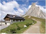
From the pass we continue on a wide path past the hut Rifugio Passo Giau. After a short ascent on a wide path we come to a junction, where we turn right on path 443 following the signs »Rif. Nuvolau Ferrata«. The path then starts to descend slightly and crosses the slopes below the summit Ra Gusela (2595 m). To the left a unmarked path will soon branch off, which leads towards the wall of the peak Ra Gusela. We continue slightly descending towards the east and then come to a marked junction.
Straight ahead the path leads towards the hut Cinque Torri, right downwards leads a marked but poorly trodden path towards the pasture Malga Giau, and we turn left on path 438 towards the via ferrata Ferrata Gusela. The path here starts ascending on scree on the eastern side of the mountain Ra Gusela and brings us to a small notch. From the notch we then descend a few meters and then the path becomes more demanding. For the less experienced, use of a self-belaying kit is recommended. First we ascend along the steel cable through a wide gully, then follows an ascent over a short ladder. The demanding part of the path is very short and soon we are on gentle slopes on the north side of the peak Ra Gusela from where a view also opens towards the summit Nuvolau. The path then turns slightly left and continues for some time on relatively gentle slopes. Further on we must be a bit more attentive as we will soon reach an unmarked junction.
Here we leave the marked path towards the hut Rifugio Nuvolau and turn left onto an unmarked trail towards the summit Ra Gusela. The unmarked path then runs towards the south and ascends towards a well-visible distinct notch. Meanwhile a transverse path joins from the right from the ridge of the peak Nuvolau. The path shortly before the notch turns slightly left and then ascends diagonally on the eastern side of the mountain. Higher the slope becomes somewhat steeper and the path leads us also past a chasm so some caution is needed on the ascent. In the last part the path turns right and only a short ascent follows to the very panoramic summit.

Along the route: Forame (2172m)
Photos:
 1
1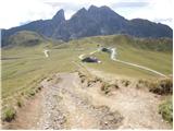 2
2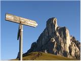 3
3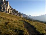 4
4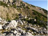 5
5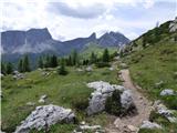 6
6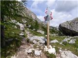 7
7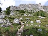 8
8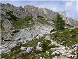 9
9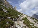 10
10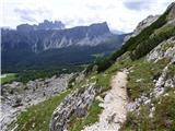 11
11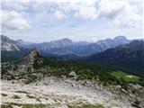 12
12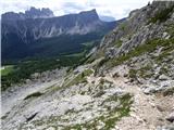 13
13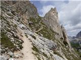 14
14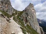 15
15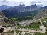 16
16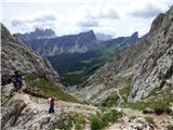 17
17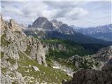 18
18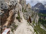 19
19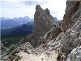 20
20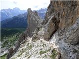 21
21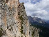 22
22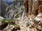 23
23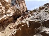 24
24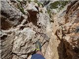 25
25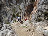 26
26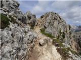 27
27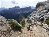 28
28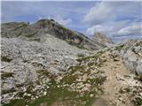 29
29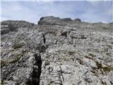 30
30 31
31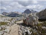 32
32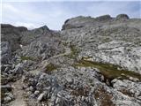 33
33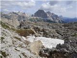 34
34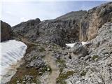 35
35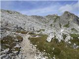 36
36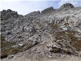 37
37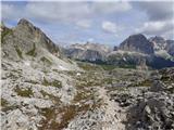 38
38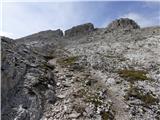 39
39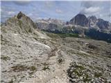 40
40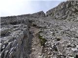 41
41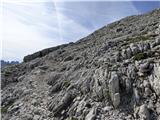 42
42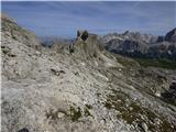 43
43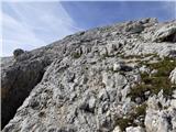 44
44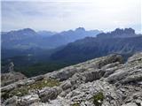 45
45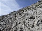 46
46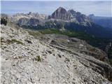 47
47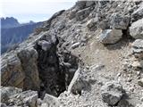 48
48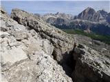 49
49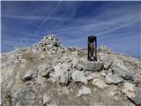 50
50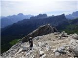 51
51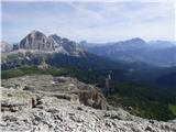 52
52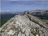 53
53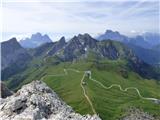 54
54 55
55
Discussion about the trip Passo di Giau - Monte Gusella
To post a comment you must log in:
If you do not yet have a username, you must first
register.