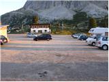
Starting point: Passo Falzarego (2105 m)
| Latitude/Longitude: | 46,51860°N 12,00960°E |
| |
Walking time: 2 h 30 min
Difficulty: very difficult marked way
Elevation gain: 544 m
Elevation difference along the route: 600 m
Map:
Recommended equipment (summer): helmet, self belay set
Recommended equipment (winter): helmet, self belay set, ice axe, crampons
Views: 6.065
 | 3 people like this post |
Access to starting point:
First, we drive to Cortina d'Ampezzo (you can get here via the border crossing at Rateče or Predel to Trbiž / Tarvisio and then on the highway in the direction of Udine to the exit Tolmezzo. From Tolmezzo we follow the road in the direction of the settlement Ampezzo and the mountain pass Passo della Mauria. The road then descends and brings us to an intersection, where we continue left (right also possible) in the direction of Cortina d'Ampezzo. In all following intersections, we follow the signs for Cortina d'Ampezzo.
Or from the Primorska side, where we drive on the highway in the direction of Trst / Trieste. Further, we drive on the Italian highway in the direction of Padova, but only to the highway junction, where we continue in the direction of the Veneto region and Belluno. Near Belluno the highway ends, and at the next intersections we continue in the direction of Cortina d'Ampezzo and then we follow the signs for the alpine pass Passo di Falzarego. We then follow this ascending road to the large parking lot on the mentioned pass.
To Cortina d'Ampezzo we can also come from the direction of Austria (direction Karawanks Tunnel, Spittal, Lienz, Sillian, Dobbiaco / Toblach, Cortina d'Ampezzo, Passo Falzarego).
Route description:
From the Falzarego pass we head south on path 441 (direction Rifugio Averau and Rifugio Nuvolau), which begins ascending gentle grassy slopes. After a short ascent, we come to an unmarked junction, where a less noticeable path branches off to the right towards the summit or ridge Col Galina; we continue slightly left on the wide and still marked path. The path from which beautiful views open up on Sas de Stria, Lagazoi Piccolo, Tofano di Rozes, Averau and Croda Negro takes us higher to a marked junction, where the path to Croda Negro branches off to the right.
We continue in the direction of the Averau hut on a path which gradually transitions to the eastern slopes of Croda Negro. Here the path temporarily flattens out completely and then crosses a deep torrent gully over a large bridge. After the bridge the path starts to ascend steeply, then suddenly flattens and transitions to more plateau-like terrain. The path ahead ascends a smaller torrent gully and brings us to the next junction just a few dozen meters further.
We continue left (right Croda Negro) and continue the ascent through a steep gully; higher the path temporarily goes over steep slopes, then turns left and flattens completely. After a short descent we come to a marked junction, where the path from the Col Gallina hut joins from the left; we continue right, where after a few dozen steps of further walking we arrive at the Forcella Averau saddle (2435 m). Here the path descends to the steep walls of the nearby Averau summit, where we cross scenic and dangerous-for-falling-rocks slopes. The path from which a beautiful view opens up on Marmolada and its glacier temporarily ascends steeply, then transitions to scree over which we walk to the nearby hut (hut Averau is currently being renovated, data August 2010).
From the hut we continue left and follow the path along the mountain road. Already after a few meters the sign »Ferrata Averau« directs us left upward. The path first crosses scree on the eastern side of the mountain and soon turns left where we enter the climbing section of the path. At the start of the climbing path we ascend steeply along the cable over a steep wall, then come to a path junction. The left slightly easier path ascends vertically on pegs through a chimney. The right path also ascends almost vertically, only without pegs on the path. Note that the left path is often damp and snow persists somewhat longer. After a short steep section both paths reunite and a traverse to the right with the aid of the cable follows. The climbing section of the path ends quickly and we soon reach the less steep summit slopes of the mountain. In the last part the path is no longer demanding and we soon reach the very scenic summit.

Photos:
 1
1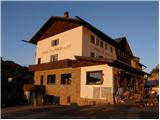 2
2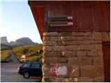 3
3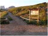 4
4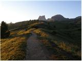 5
5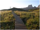 6
6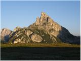 7
7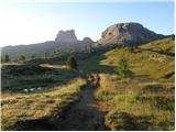 8
8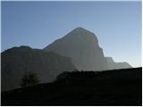 9
9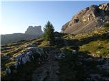 10
10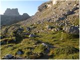 11
11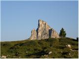 12
12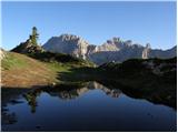 13
13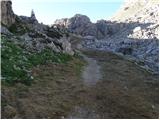 14
14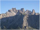 15
15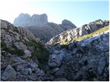 16
16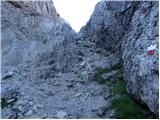 17
17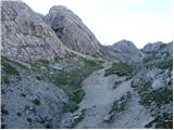 18
18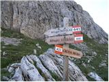 19
19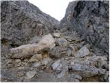 20
20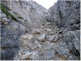 21
21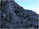 22
22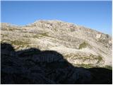 23
23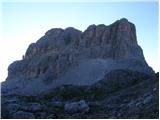 24
24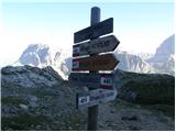 25
25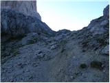 26
26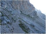 27
27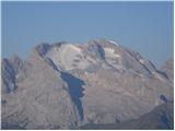 28
28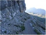 29
29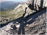 30
30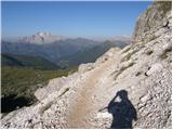 31
31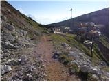 32
32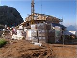 33
33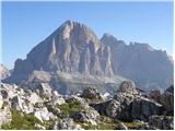 34
34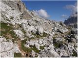 35
35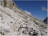 36
36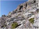 37
37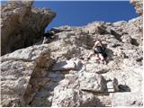 38
38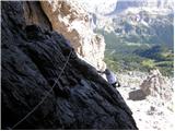 39
39 40
40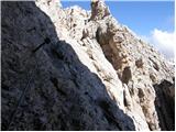 41
41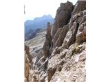 42
42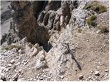 43
43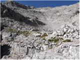 44
44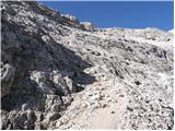 45
45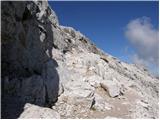 46
46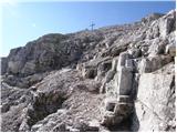 47
47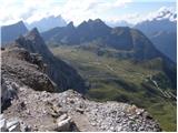 48
48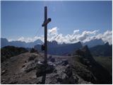 49
49
Discussion about the trip Passo Falzarego - Averau
To post a comment you must log in:
If you do not yet have a username, you must first
register.