Passo Gardena - Col de Mesores / Sass dla Luesa
Starting point: Passo Gardena (1956 m)
| Latitude/Longitude: | 46,54742°N 11,82125°E |
| |
Walking time: 2 h 50 min
Difficulty: easy pathless terrain, difficult marked way
Elevation gain: 659 m
Elevation difference along the route: 690 m
Map: Tabacco 07 1:25.000
Recommended equipment (summer): helmet, self belay set
Recommended equipment (winter): helmet, self belay set, ice axe, crampons
Views: 2.238
 | 2 people like this post |
Access to starting point:
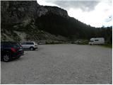
A) From Kranjska Gora over Korensko sedlo to Austria, where at the first larger crossroad, we continue left towards Podklošter / Arnoldstein and Trbiž / Tarvisio. At the end of the settlement Podklošter signs for Šmohor / Hermagor point us to the right on a regional road, on which past the mentioned settlement we drive to the end of the valley Gailtal, or more precisely to the settlement Kötschach-Mauthen, where we turn right towards the settlement Oberdrauburg. The path ahead leads us over an Alpine mountain pass Gailbergsattel (982 meters), after which we descend into the mentioned settlement. After we cross the bridge over the river Drau, we continue left towards the settlement Lienz. In the main roundabout in Lienz we continue "left" in the direction of the settlement Sillian and Italy. Further, we cross the border between Austria and Italy, and we follow the main road past settlements Dobbiaco / Toblach, Villabassa / Niederdorf, Monguelfo - Tesido / Welsberg - Taisten, Brunico / Bruneck. Only a little after the last-mentioned settlement, past which leads a bypass road, we turn left into a valley Alta Badia. Further, we drive through the mentioned valley and in the settlement La Villa we turn right towards the mountain pass Passo Gardena. Further, we follow an ascending road to a large parking lot some turns before the mountain pass Passo Gardena. At the parking lot is also a big sign with a caption »Via Ferrata – Klettersteig«.
B) From Nova Gorica, we drive to Italy and drive forward on the highway to the settlement Portogruaro, where at the highway junction we turn in the direction of the settlement Belluno. We follow the highway to its end (we don't turn in the direction towards Belluno), and then we continue driving towards Cortina d'Ampezzo. When we get into Cortina d'Ampezzo, we follow the signs for Alpine mountain pass Passo Falzarego. On the mountain pass Passo Falzarego (2105 meters) we turn right in the direction of Alta Badia and at first ascend on the neighbouring mountain pass Passo Valparola (2192 meters), from there we descend into the mentioned valley. In the settlement La Villa we turn left towards the mountain pass Passo Gardena. Further, we follow an ascending road to a large parking lot some turns before the mountain pass Passo Gardena. At the parking lot is also a big sign with a caption »Via Ferrata – Klettersteig«.
Route description:
From the parking lot, we go towards the south following the signs »Utia de Pisciadu«. The path quite steeply ascends and brings us to a junction where a transverse path towards the secured path Via Ferrata Tridentina branches off to the left. We continue straight and continue to ascend towards precipitous walls of peaks in the Sella group.
The path towards the mountain pass Passo Gardena then branches off to the right, we still continue straight upwards and start ascending in a narrow valley named Val Setus, which is surrounded by precipitous walls. The path here ascends on scree upwards and runs below the cargo cableway. Higher up, the slope becomes increasingly steep and in the last part the path is also secured with a steel cable and pegs. The path here ascends steeply a few times and some caution is needed. If we are not used to this kind of paths, self-belaying is highly recommended. The secured path then soon ends and brings us to gentler slopes where there is a junction.
To the left it is only a few minutes' walk to the hut Rifugio Pisciadu, we continue right on path 677. The path then ascends transversely on scree above the upper station of the cargo cableway. From the path to the right we can also see the peak Col de Mesores, which from the south side is completely flat. The path then ascends somewhat more steeply and brings us to an indistinct saddle.
Here we leave the marked path and head right into pathless terrain. On this section there is no trail and we walk on a slope strewn with numerous rocks and boulders. From the mentioned saddle we walk northwards, aided by some cairns. A somewhat steeper descent follows to level terrain that is partly covered with grass. During the descent considerable caution is needed, as there is quite a lot of slippery sand on the slope.
On the left side a view then opens towards the waterfall, located on the slopes of the peak Torre de Murfreit. Continuing, we walk along a flat wide ridge past a small weather station. The slope then remains flat all the way to the summit of Col de Mesores, on which a larger cairn is placed.

Photos:
 1
1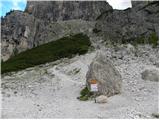 2
2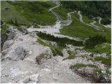 3
3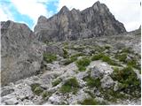 4
4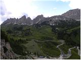 5
5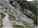 6
6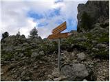 7
7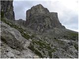 8
8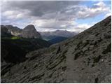 9
9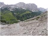 10
10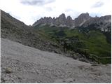 11
11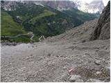 12
12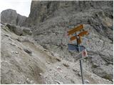 13
13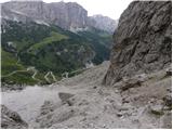 14
14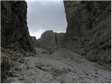 15
15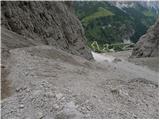 16
16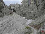 17
17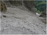 18
18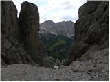 19
19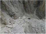 20
20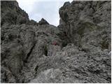 21
21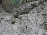 22
22 23
23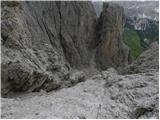 24
24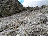 25
25 26
26 27
27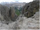 28
28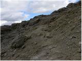 29
29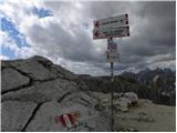 30
30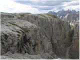 31
31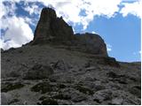 32
32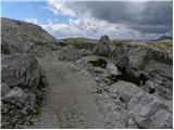 33
33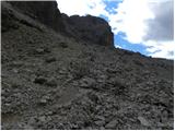 34
34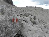 35
35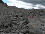 36
36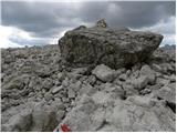 37
37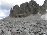 38
38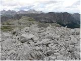 39
39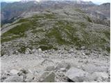 40
40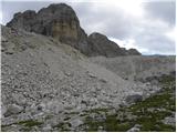 41
41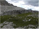 42
42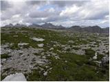 43
43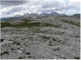 44
44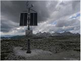 45
45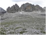 46
46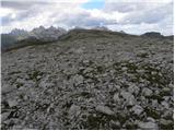 47
47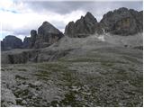 48
48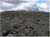 49
49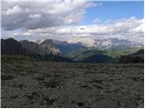 50
50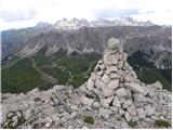 51
51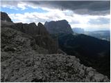 52
52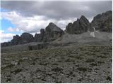 53
53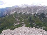 54
54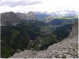 55
55
Discussion about the trip Passo Gardena - Col de Mesores / Sass dla Luesa
To post a comment you must log in:
If you do not yet have a username, you must first
register.