Passo Gardena - Muntejela de Puez
Starting point: Passo Gardena (2121 m)
| Latitude/Longitude: | 46,54984°N 11,80847°E |
| |
Walking time: 3 h 30 min
Difficulty: easy pathless terrain
Elevation gain: 545 m
Elevation difference along the route: 800 m
Map: Tabacco 07 1:25.000
Recommended equipment (summer):
Recommended equipment (winter): ice axe, crampons
Views: 1.040
 | 3 people like this post |
Access to starting point:
A) From Kranjska Gora over Korensko sedlo to Austria, where at the first larger intersection we continue left towards Podklošter / Arnoldstein and Trbiž / Tarvisio. At the end of the settlement Podklošter signs for Šmohor / Hermagor point us to the right on a regional road, on which past the mentioned settlement we drive to the end of the valley Gailtal, or more precisely to the settlement Kötschach-Mauthen, where we turn right towards the settlement Oberdrauburg. The path ahead leads us over the Alpine pass Gailbergsattel (982 m), after which we descend into the mentioned settlement. After we cross the bridge over the river Drau, we continue left towards the settlement Lienz. In the main roundabout in Lienz we continue "left" in the direction of the settlement Sillian and Italy. Further, we cross the border between Austria and Italy, and we follow the main road past settlements Dobbiaco / Toblach, Villabassa / Niederdorf, Monguelfo - Tesido / Welsberg - Taisten, Brunico / Bruneck. Only a little after the last-mentioned settlement, past which leads a bypass road, we turn left into the valley Alta Badia. Further, we drive through the mentioned valley and in the settlement La Villa we turn right towards the pass Passo Gardena. Further, we follow an ascending road all the way to pass Passo Gardena where we park on a payable parking lot (4€ – June 2012).
B) From Nova Gorica, we drive to Italy and continue on the highway to the settlement Portogruaro, where at the highway junction we turn in the direction of the settlement Belluno. We follow the highway to its end (we don't turn in the direction towards Belluno), and then we continue driving towards Cortina d'Ampezzo. When we arrive in Cortina d'Ampezzo, we follow the signs for the Alpine pass Passo Falzarego. On the pass Passo Falzarego (2105 m) we turn right in the direction of Alta Badia and first ascend to the neighbouring pass Passo Valparola (2192 m), from there we descend into the mentioned valley. In the settlement La Villa we turn left towards the pass Passo Gardena. Further, we follow an ascending road all the way to pass Passo Gardena where we park on a payable parking lot (4€ – June 2012).
Route description:
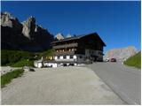
From the pass Passo Gardena we head towards the north on the footpath following the signs »Baita Jimmy Hütte«. The path leads us along grassy slopes from which there is a wonderful view of the mountain group Sella to the south and towards Sassolungo to the west. The path along grassy slopes soon brings us to the road. We continue right on the gravel road, which we follow all the way to the hut Jimmy Hütte.
From the hut we continue on the footpath towards the northeast and begin to ascend through the dwarf pines. The path soon brings us out of the dwarf pines and continues relatively steeply ascending. Higher up the path turns to the left and follows the ascent to the notch Forcella Cier where a view opens towards the north.
On the saddle we cross the fence, then in a slight descent we cross the scree slopes. Such a path then brings us to a marked junction where the path through the valley Val de Chedul joins from the left.
From the junction the path begins to ascend slightly again and continues crossing the slopes towards the northeast. Later the path turns slightly to the left and follows a somewhat steeper ascent to the notch Forcella de Crespeina.
On the notch where a view opens on a larger part of the mountain group Puez we continue straight ahead, to the right the path leads over the summit Sas Ciampac. The path then begins to descend and brings us to somewhat flatter grassy terrain. From the path we have a nice view of the lake Lech de Crespeina and Sas Ciampac. Our path then for a short time ascends somewhat more steeply again, then a relatively flat path brings us to a junction, where the path over the summit Sas Ciampac joins from the right.
The path then descends slightly further and brings us to yet another junction. To the right downwards the path leads towards the settlement Calfosch, to the left the path leads into the valley Langental, we continue straight following the signs »Puezhütte«.
A little after the junction the path turns to the left and begins to ascend slightly towards the north. The relatively flat path later brings us to yet another junction, where the path to Sassongher branches off to the right.
Here the path turns somewhat to the left again and ahead of us we can already see the flag located near the hut. The panoramic path remains flat and soon brings us to the hut, which is located on grassy slopes below the summit Puezkofel.
From the hut we return a few dozen meters back to the marked junction and head onto path number 1-11 following the signs »Badia Abtei, Ütia Gherdenacia«. At the junction the path ascends and brings us to flatter terrain partly covered with grass. Here we will already see the summit Muntejela ahead of us. The easiest approach to the summit is to continue along the marked path to the eastern side of the mountain. There we leave the marked path and head sharply left onto the eastern ridge of the mountain. Along the undemanding ridge we then ascend all the way to the summit on which a cairn is also erected.

Photos:
 1
1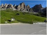 2
2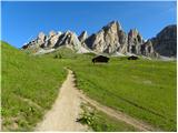 3
3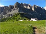 4
4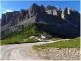 5
5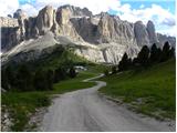 6
6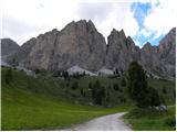 7
7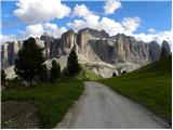 8
8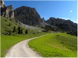 9
9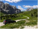 10
10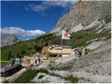 11
11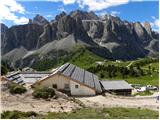 12
12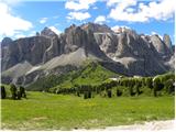 13
13 14
14 15
15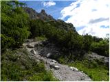 16
16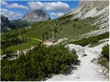 17
17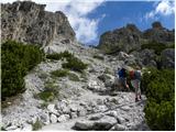 18
18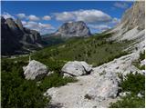 19
19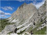 20
20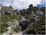 21
21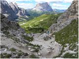 22
22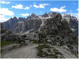 23
23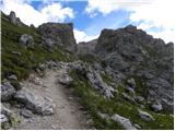 24
24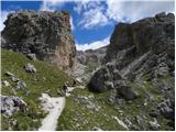 25
25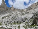 26
26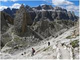 27
27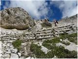 28
28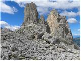 29
29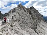 30
30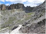 31
31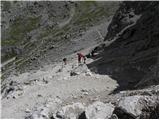 32
32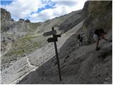 33
33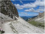 34
34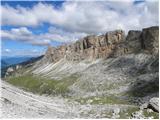 35
35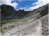 36
36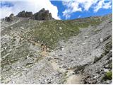 37
37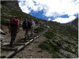 38
38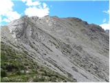 39
39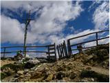 40
40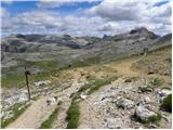 41
41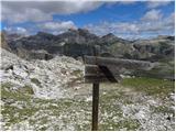 42
42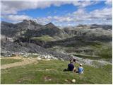 43
43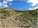 44
44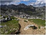 45
45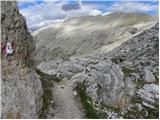 46
46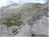 47
47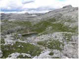 48
48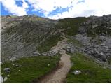 49
49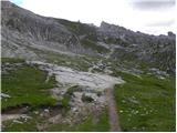 50
50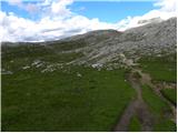 51
51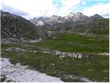 52
52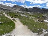 53
53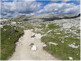 54
54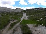 55
55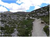 56
56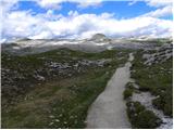 57
57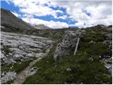 58
58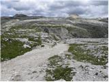 59
59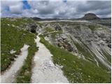 60
60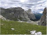 61
61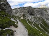 62
62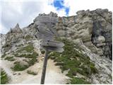 63
63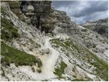 64
64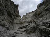 65
65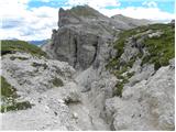 66
66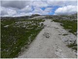 67
67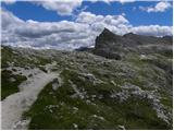 68
68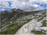 69
69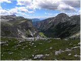 70
70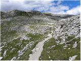 71
71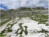 72
72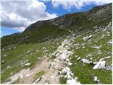 73
73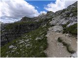 74
74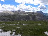 75
75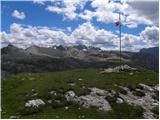 76
76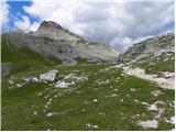 77
77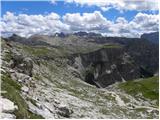 78
78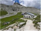 79
79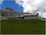 80
80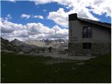 81
81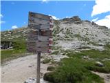 82
82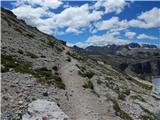 83
83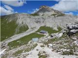 84
84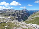 85
85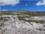 86
86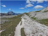 87
87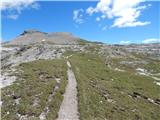 88
88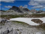 89
89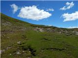 90
90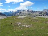 91
91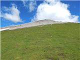 92
92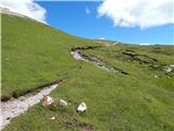 93
93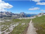 94
94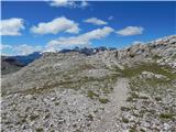 95
95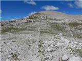 96
96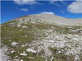 97
97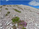 98
98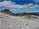 99
99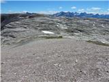 100
100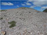 101
101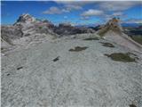 102
102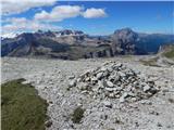 103
103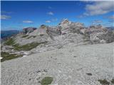 104
104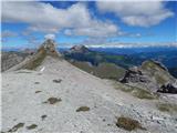 105
105
Discussion about the trip Passo Gardena - Muntejela de Puez
To post a comment you must log in:
If you do not yet have a username, you must first
register.