Passo Gardena - Piz Boe (Via Ferrata Brigata Tridentina)
Starting point: Passo Gardena (1956 m)
| Latitude/Longitude: | 46,54742°N 11,82125°E |
| |
Route name: Via Ferrata Brigata Tridentina
Walking time: 6 h 10 min
Difficulty: extremely difficult marked way
Via ferrata: C
Elevation gain: 1196 m
Elevation difference along the route: 1350 m
Map: Tabacco 07 1:25.000
Recommended equipment (summer): helmet, self belay set
Recommended equipment (winter): helmet, self belay set, ice axe, crampons
Views: 14.207
 | 2 people like this post |
Access to starting point:
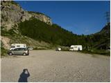
A) From Kranjska Gora over Korensko sedlo into Austria, where at the first larger crossroad we continue left towards Podklošter / Arnoldstein and Trbiž / Tarvisio. At the end of the settlement Podklošter signs for Šmohor / Hermagor point us to the right on a regional road, on which past the mentioned settlement we drive to the end of the Gailtal valley, or more precisely to the settlement Kötschach-Mauthen, where we turn right towards the settlement Oberdrauburg. The path ahead leads us over the Alpine pass Gailbergsattel (982 m), after which we descend into the mentioned settlement. After we cross the bridge over the river Drau, we continue left towards the settlement Lienz. In the main roundabout in Lienz we continue "left" in the direction of the settlement Sillian and Italy. Further, we cross the border between Austria and Italy, and we follow the main road past settlements Dobbiaco / Toblach, Villabassa / Niederdorf, Monguelfo - Tesido / Welsberg - Taisten, Brunico / Bruneck. Only a little after the last-mentioned settlement, past which leads a bypass road, we turn left into the Alta Badia valley. Further, we drive through the mentioned valley and in the settlement La Villa we turn right towards the pass Passo Gardena. Further, we follow the ascending road to a large parking lot a few turns before the pass Passo Gardena. At the parking lot there is also a large sign with the inscription »Via Ferrata – Klettersteig«.
B) From Nova Gorica we drive into Italy and further on the highway to the settlement Portogruaro, where at the highway junction we turn in the direction of the settlement Belluno. We follow the highway to its end (we do not turn in the direction towards Belluno), then we continue driving towards Cortina d'Ampezzo. When we arrive in Cortina d'Ampezzo, we follow the signs for the Alpine pass Passo Falzarego. At the pass Passo Falzarego (2105 m) we turn right in the direction of Alta Badia and first ascend to the neighboring pass Passo Valparola (2192 m), from there we descend into the mentioned valley. In the settlement La Villa we turn left towards the pass Passo Gardena. Further, we follow the ascending road to a large parking lot a few turns before the pass Passo Gardena. At the parking lot there is also a large sign with the inscription »Via Ferrata – Klettersteig«.
Route description:
From the parking lot, we head left following the signs »Via Ferrata Tridentina«. The path first crosses the slope towards the east and runs mostly along thickets of dwarf pines and rare larches. The path, which also slightly descends, soon brings us to the start of the secured path.
The secured path initially climbs steeply with the aid of pegs, then ascends for a while along the steel cable on usually damp terrain upwards. A shorter climb on pegs follows, then we reach gentler slopes. The path then leads past large boulders and brings us to a junction.
At the junction, we continue slightly left following the signs »Pisciadu Via Ferrata«. The path then crosses slopes towards the south and soon we will notice a waterfall ahead. Soon we reach another junction and continue right towards the waterfall following the signs »Pisciadu Via Ferrata«.
To the right of the waterfall we re-enter the wall and begin steeply ascending the secured path Via Ferrata Brigata Tridentina. The path further on is very well secured and ascends all the time to the right of the wide gully down which a stream with numerous waterfalls flows. From the path we have wonderful views all the time of the sheer walls of surrounding peaks and down towards the settlement Colfosco and Alta Badia.
The secured path later turns slightly left and brings us to a junction. Left we can leave the secured path and ascend on easier terrain towards the Pisciadu hut. Right we continue on the secured path, which climbs the walls of the tower Torre Exner. The path in this section becomes a bit more demanding and during the ascent some arm strength is also needed. The path climbs vertically several times, aided by pegs and a short ladder. Higher up the path crosses the wall to the left and brings us to a suspension bridge. From the bridge only a short climb along the steel cable follows, then the secured path ends.
The scenic path then turns slightly left and a short undemanding ascent follows to the Rifugio Pisciadu hut.
From the hut we continue south following the signs »Cima Pisciadu, Rif. Boe« and descend towards the lake. The path then turns right and during the ascent crosses scree on the left side of the lake. Here the path runs below the steep walls of Pisciadu peak and brings us to somewhat steeper slopes. Further on the path turns left and begins to climb somewhat more steeply with the aid of fixed protections. During the ascent some caution is needed, self-belaying is not strictly necessary.
The path then becomes less steep again and brings us via the valley called Val de Tita to a junction on the south side of Pisciadu peak.
Left upwards the path leads to Cima Pisciadu, we continue somewhat right following the signs »Rif. Boe«. The path ascends up the valley for a while longer, then turns right again and climbs somewhat more steeply towards the broad ridge near the summit Sas de Mesdi. When we reach the ridge we continue south and begin descending. To the right the path to the saddle Sela de Pisciadu branches off, we continue straight ahead and descend further. The path then levels out somewhat and brings us to a junction at the notch Forcella d'Antersass.
Here to the right downwards the path to Canazei branches off, we continue slightly left towards the Rifugio Boe hut. The relatively level path then quickly brings us to yet another junction. Both paths lead to the Rifugio Boe hut, but the right one is more demanding as it crosses exposed slopes below the summit L'Antersass. The path is well secured and not overly demanding, nevertheless there is a sign at the start of the path warning that self-belaying is required. The left easier path is slightly longer and climbs the rocky slope to the summit of L'Antersass. From the summit the path then descends south and rejoins the more difficult path. After a short crossing of somewhat steeper slopes we reach level terrain and only a short walk to the Rifugio Boe hut remains.
From the hut we continue left following the signs »Piz Boe«. The path begins to ascend on scree towards the southeast. Higher up the path brings us to a junction before a short rocky step. Since the path is usually crowded, the right path is for ascent and the left for descent. At the junction we therefore continue right and cross the somewhat exposed slope along the steel cable to the right. A short climb along the steel cable follows and the path becomes less demanding again. Further on the path climbs quite steeply up the summit slope of the mountain. When we reach the ridge the path from Passo Campolongo joins from the left and only an ascent along the scenic ridge to the summit remains.

Photos:
 1
1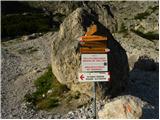 2
2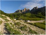 3
3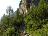 4
4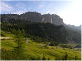 5
5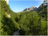 6
6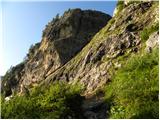 7
7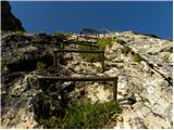 8
8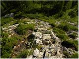 9
9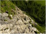 10
10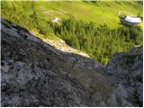 11
11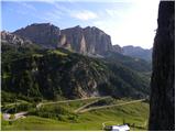 12
12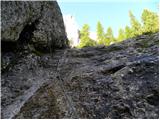 13
13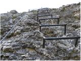 14
14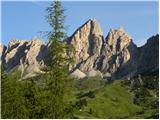 15
15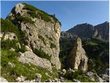 16
16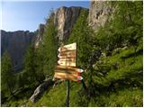 17
17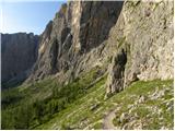 18
18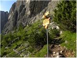 19
19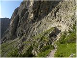 20
20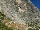 21
21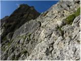 22
22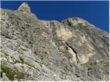 23
23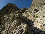 24
24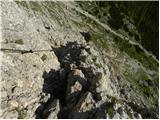 25
25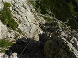 26
26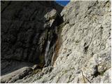 27
27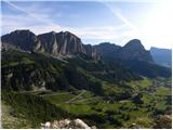 28
28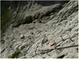 29
29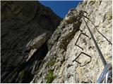 30
30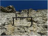 31
31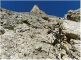 32
32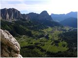 33
33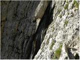 34
34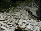 35
35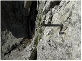 36
36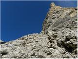 37
37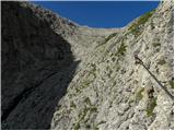 38
38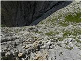 39
39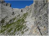 40
40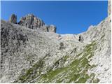 41
41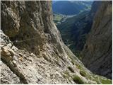 42
42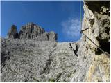 43
43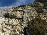 44
44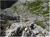 45
45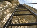 46
46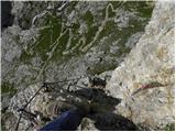 47
47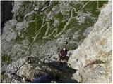 48
48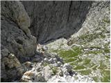 49
49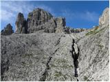 50
50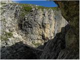 51
51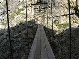 52
52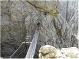 53
53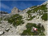 54
54 55
55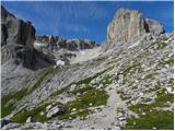 56
56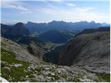 57
57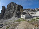 58
58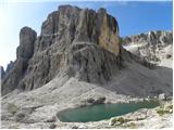 59
59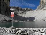 60
60 61
61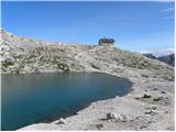 62
62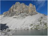 63
63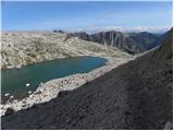 64
64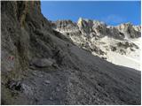 65
65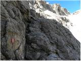 66
66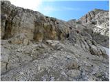 67
67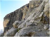 68
68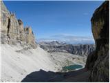 69
69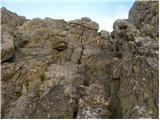 70
70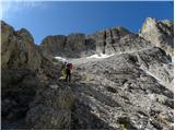 71
71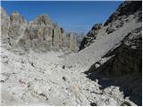 72
72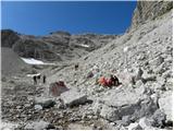 73
73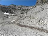 74
74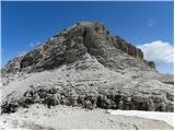 75
75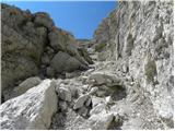 76
76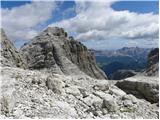 77
77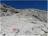 78
78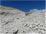 79
79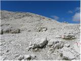 80
80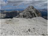 81
81 82
82 83
83 84
84 85
85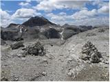 86
86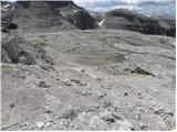 87
87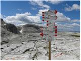 88
88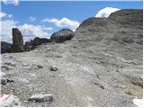 89
89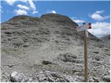 90
90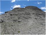 91
91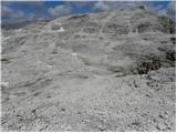 92
92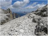 93
93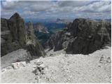 94
94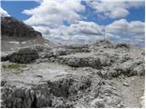 95
95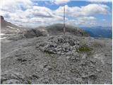 96
96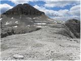 97
97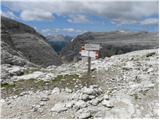 98
98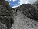 99
99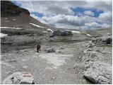 100
100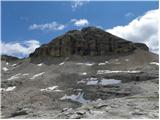 101
101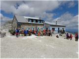 102
102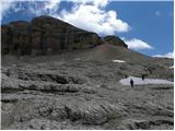 103
103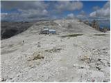 104
104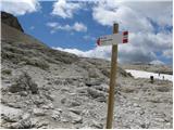 105
105 106
106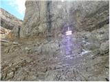 107
107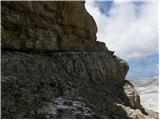 108
108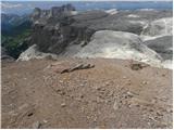 109
109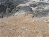 110
110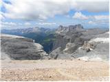 111
111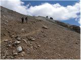 112
112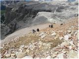 113
113 114
114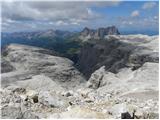 115
115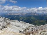 116
116 117
117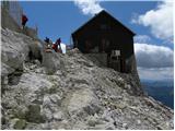 118
118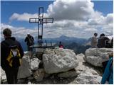 119
119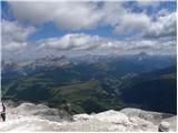 120
120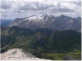 121
121
Discussion about the trip Passo Gardena - Piz Boe (Via Ferrata Brigata Tridentina)
|
| andrejp1. 09. 2015 |
Thursday reserved for the "royal" tour. From Passo Gardena via ferrata to Pisceadu hut, then past Boe hut to Pordoi hut, descent via scree to the path towards Piazzeta ferrata (stop in the shade of a boulder, which we christened the Slovenian rest boulder , just before the entrance to the ferrata). Then via it to the summit of Piz Boe. Descent via the approach path to Pisceadu hut and then the easier path to Passo Gardena. , just before the entrance to the ferrata). Then via it to the summit of Piz Boe. Descent via the approach path to Pisceadu hut and then the easier path to Passo Gardena.
Lots of people at the summit, but we were almost alone in the ferratas.
excellent
|
|
|
To post a comment you must log in:
If you do not yet have a username, you must first
register.