Passo Giau - Monte Cernera
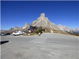
Starting point: Passo Giau (2236 m)
| Latitude/Longitude: | 46,48250°N 12,05380°E |
| |
Walking time: 2 h
Difficulty: difficult marked way
Elevation gain: 429 m
Elevation difference along the route: 510 m
Map: Tabacco 03 1:25.000
Recommended equipment (summer): helmet
Recommended equipment (winter): helmet, ice axe, crampons
Views: 3.180
 | 4 people like this post |
Access to starting point:
A) Access from Gorenjska: Through the border crossing at Rateče or Predel to Trbiž / Tarvisio and then on the highway in the direction of Vidma / Udine to the Tolmezzo exit. From Tolmezzo we follow the road in the direction of the village Ampezzo and mountain pass Passo della Mauria. The road then descends and brings us to a crossroad, where we continue left (possible also right) in the direction of Cortina d'Ampezzo. At all next crossroads, we follow the signs for Cortina d'Ampezzo.
In Cortina d'Ampezzo we then follow the signs for the alpine pass Passo di Falzarego. We then follow this ascending road to a crossroad at an altitude of approximately 1400m. At the crossroad, we continue left in the direction of the alpine pass Passo di Giau and Marmolada. We park on a large parking lot on the pass Passo di Giau.
B) From Primorska: We drive on the highway towards Venice / Venezia. At Portogruaro we leave the highway towards Venice and continue right on the highway towards Pordenone. At the next highway junction near Conegliano, we continue right towards Belluno. Near Belluno the highway ends, and at the next crossroads we continue in the direction of Cortina d'Ampezzo. Further, we follow the description above.
Route description:
From the pass we continue left (towards the south) on the path that bypasses the chapel on the left side. The path marked 436 first leads us across gentle meadows with beautiful views of the surrounding peaks, then brings us to a smaller notch named Forcella Zonia. From the notch we descend slightly, then cross steep slopes above the valley Valle di Zonia. After the crossing, the path brings us to the notch Forcella Col Piombin where there is another junction.
Left leads path 436 towards the notch Forcella Giau, while we head right on a somewhat less used path following the signs »Sentiero Alpinistico del Cernera«.
Further we continue on the path that first crosses gentle then increasingly steep slopes of Mount Monte Cernera. The path, from which views mainly open up to the west side, quickly brings us to the first exposed traverse. We overcome a short rocky slope with the help of a steel cable, which due to the wet terrain is quite welcome. The steepness eases for a short time and the path brings us to a steep rocky step up which we ascend steeply with the help of fixed protections. The protections soon end and the path brings us to relatively steep grassy slopes. Further on, the steepness eases slightly and the path brings us to a poorly visible junction where an unmarked path branches off to the right. We continue straight and continue ascending the grassy slopes. When we approach the rocky slopes, we first cross a short torrent gully then the path brings us to a marked junction.
Right leads the path towards the summit Monte Verdal and further into the valley Valle di Zonia, while we continue left towards the summit Monte Cernera. From the junction the path becomes more demanding again and with the help of steel cables ascends steeply on the rocky slope. The secured section of the path is again relatively short and quickly brings us to the grassy slope on the western side of the summit Monte Cernera. Here a view briefly opens towards the summit Monte Civetta, then the path turns left and continues ascending the slope on the southwestern side of the summit. The path here is not particularly demanding and runs along a rocky slope on which there is also some scree. Further the path mostly ascends diagonally towards the east and soon a view also opens towards the cross on the mountain summit. When we reach the northern side of the mountain, the path turns right and follows the final ascent along the summit slope to the top.
We descend along the ascent path.

Along the route: Forcella Zonia (2229m), Forcella Col Piombin (2239m)
Photos:
 1
1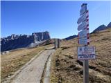 2
2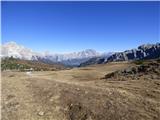 3
3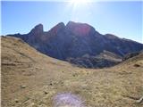 4
4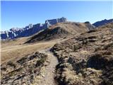 5
5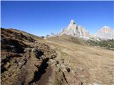 6
6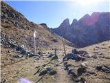 7
7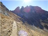 8
8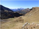 9
9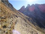 10
10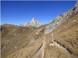 11
11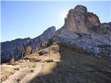 12
12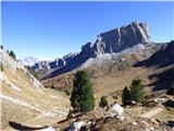 13
13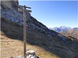 14
14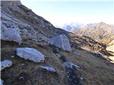 15
15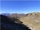 16
16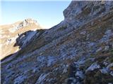 17
17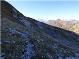 18
18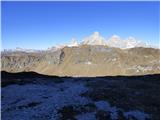 19
19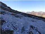 20
20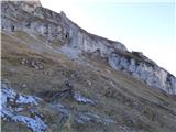 21
21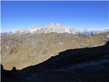 22
22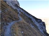 23
23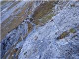 24
24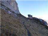 25
25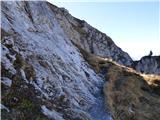 26
26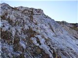 27
27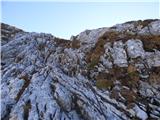 28
28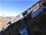 29
29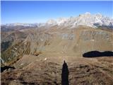 30
30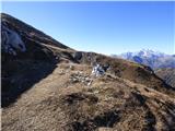 31
31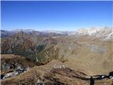 32
32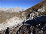 33
33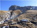 34
34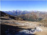 35
35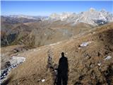 36
36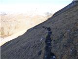 37
37 38
38 39
39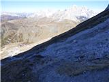 40
40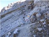 41
41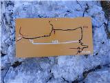 42
42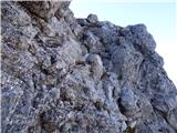 43
43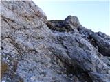 44
44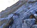 45
45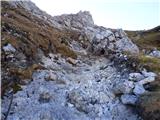 46
46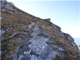 47
47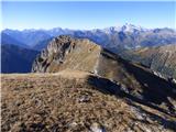 48
48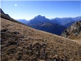 49
49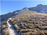 50
50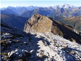 51
51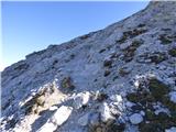 52
52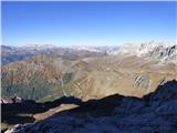 53
53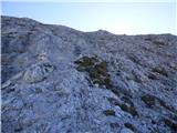 54
54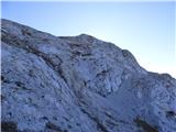 55
55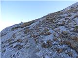 56
56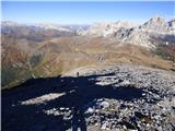 57
57 58
58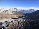 59
59 60
60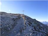 61
61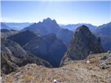 62
62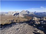 63
63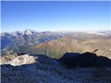 64
64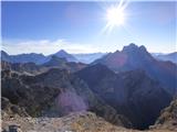 65
65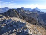 66
66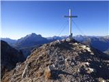 67
67
Discussion about the trip Passo Giau - Monte Cernera
|
| Borut14. 09. 2018 |
Nice path with wonderful views.
|
|
|
To post a comment you must log in:
If you do not yet have a username, you must first
register.