Passo Giau - Monte Formin
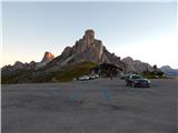
Starting point: Passo Giau (2236 m)
| Latitude/Longitude: | 46,48250°N 12,05380°E |
| |
Walking time: 4 h
Difficulty: easy pathless terrain
Elevation gain: 421 m
Elevation difference along the route: 720 m
Map: Tabacco 03 1:25.000
Recommended equipment (summer):
Recommended equipment (winter): ice axe, crampons
Views: 1.860
 | 2 people like this post |
Access to starting point:
A) Access from Gorenjska: Via the border crossings at Rateče or Predel to Trbiž / Tarvisio and then on the highway in the direction of Vidma / Udine to the Tolmezzo exit. From Tolmezzo we follow the road in the direction of the village Ampezzo and the mountain pass Passo della Mauria. The road then descends and brings us to a crossroad, where we continue left (also right is possible) in the direction of Cortina d'Ampezzo. At all subsequent crossroads, we follow the signs for Cortina d'Ampezzo.
In Cortina d'Ampezzo, we then follow the signs for the alpine pass Passo di Falzarego. We follow this ascending road to a crossroad at an altitude of approximately 1400 m. At the crossroad, we continue left in the direction of the alpine pass Passo di Giau and Marmolada. We park on the large parking lot at the pass Passo di Giau.
B) From the Primorska side: We drive on the highway towards Venice / Venezia. At Portogruaro we leave the highway towards Venice and continue right on the highway towards Pordenone. At the next highway junction near Conegliano, we continue right towards Belluno. Near Belluno the highway ends, and at the next crossroads we continue in the direction of Cortina d'Ampezzo. Further, we follow the above description.
Route description:
From the pass we continue left (towards the south) on the path that bypasses the chapel on the left side. The path marked 436 first leads us across easy meadows with beautiful views of the surrounding peaks, then brings us to a smaller notch named Forcella Zonia. From the notch we descend slightly, then cross steep slopes above the valley Valle di Zonia. After the crossing, the path brings us to the notch Forcella Col Piombin where there is another junction.
To the right branches off a somewhat less beaten path Sentiero Alpinistico del Cernera, which leads towards the peaks Monte Cernera and Monte Verdal. From the notch we continue left on the well-beaten path 436. The path from the notch begins to descend and first crosses somewhat steeper slopes. The slopes then become gentler, the path turns left towards the east and continues slightly descending. The path then starts ascending again and brings us to a junction below the precipitous walls of the peak Monte Formin.
At the junction where a path from a somewhat lower starting point joins us from the left, we continue right towards the notch Forcella Giau. Here the path begins to ascend somewhat more steeply, and from the path increasingly beautiful views open up on the mountain groups Tofana and Sella. Such a path then brings us to the already mentioned notch where a view opens up towards the south where Monte Pelmo stands out.
At the notch where there is a junction, the less beaten path 465 branches off to the right, and we continue left on the well-beaten path 436 towards the notch Forcella Ambrizola. Our path then begins to descend across grassy slopes towards the east. From the path we have here a very nice view of the nearby precipitous walls of the peak Monte Formin and other nearby peaks. The path continues slightly descending and somewhat lower it runs along a smaller stream which we then also cross. Such a path then brings us to a junction where to the right branches off the archaeological path towards the pasture Malga Mondeval di sopra and mesolithic archaeological finds.
We continue on the left better beaten path, which soon begins to ascend again. The path then ascends across panoramic grassy slopes all the way to the junction where we join the path from the notch Forcella Ambrizola.
At the junction we continue left towards the notch Forcella Rossa and the path soon begins to ascend more steeply. Here the path runs through the valley below the precipitous walls of the peak Cima Ambrizola. The increasingly panoramic path then continues quite steeply ascending all the way to the notch Forcella Rossa, where a view opens up towards the mountain group Tofana.
At the notch we then leave the marked path and head left onto relatively gentle slopes towards the summit Monte Formin. Here we walk pathless terrain, but the ascent is not demanding and cairns along the path assist us. When we reach the indistinct forepeak where numerous cairns and obelisks are placed, a view opens up towards the summit Monte Formin.
From the forepeak we then descend slightly, then continue the ascent across increasingly panoramic slopes. In the last part of the ascent we turn slightly to the right, so that we reach the summit from the north side. On the left (south) side in the last part there are some cracks or narrow gullies, which if covered with snow can also be dangerous.

Along the route: Forcella Zonia (2229m), Forcella Col Piombin (2239m), Forcella Giau (2360m), Forcella Rossa (2462m)
Photos:
 1
1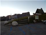 2
2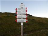 3
3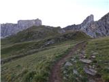 4
4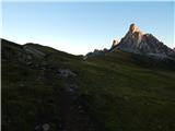 5
5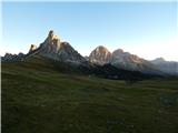 6
6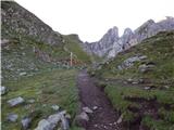 7
7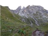 8
8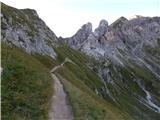 9
9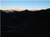 10
10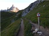 11
11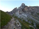 12
12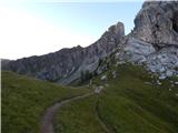 13
13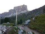 14
14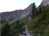 15
15 16
16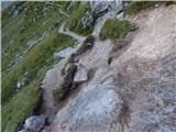 17
17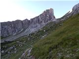 18
18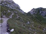 19
19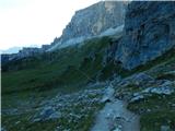 20
20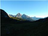 21
21 22
22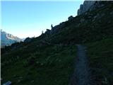 23
23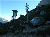 24
24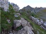 25
25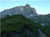 26
26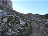 27
27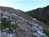 28
28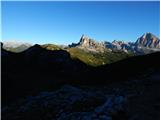 29
29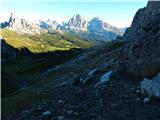 30
30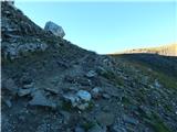 31
31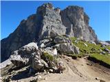 32
32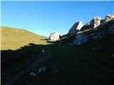 33
33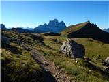 34
34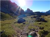 35
35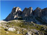 36
36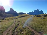 37
37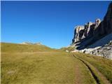 38
38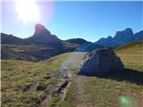 39
39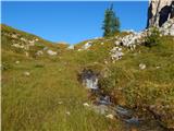 40
40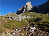 41
41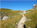 42
42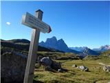 43
43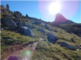 44
44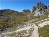 45
45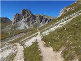 46
46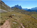 47
47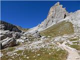 48
48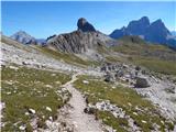 49
49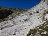 50
50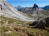 51
51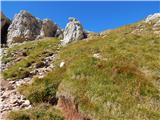 52
52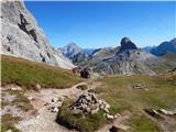 53
53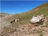 54
54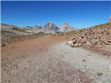 55
55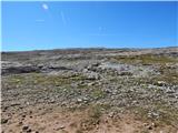 56
56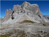 57
57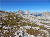 58
58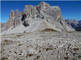 59
59 60
60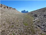 61
61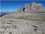 62
62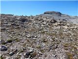 63
63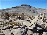 64
64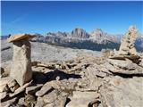 65
65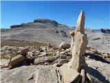 66
66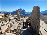 67
67 68
68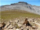 69
69 70
70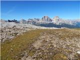 71
71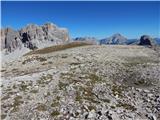 72
72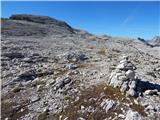 73
73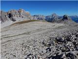 74
74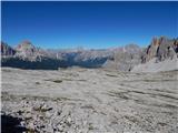 75
75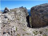 76
76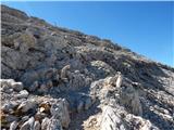 77
77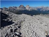 78
78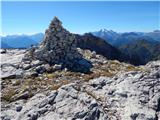 79
79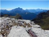 80
80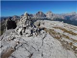 81
81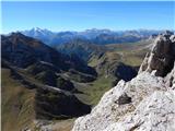 82
82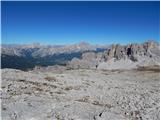 83
83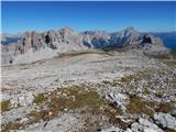 84
84
Discussion about the trip Passo Giau - Monte Formin
|
| KARAMELICA7. 01. 2017 |
One of the most beautiful passes in the Dolomites, along with Passo di Sella. We go to this pass every year when we finish our vacation in the Dolomites. Magnificent view of the mountain (rock ) behind the hut. ) behind the hut.
|
|
|
To post a comment you must log in:
If you do not yet have a username, you must first
register.