Passo Pordoi - Belvedere (ridge way)
Starting point: Passo Pordoi (2239 m)
| Latitude/Longitude: | 46,48800°N 11,81130°E |
| |
Route name: ridge way
Walking time: 3 h
Difficulty: difficult marked way
Elevation gain: 411 m
Elevation difference along the route: 800 m
Map: Tabacco 07 1:25.000
Recommended equipment (summer):
Recommended equipment (winter): ice axe, crampons
Views: 3.092
 | 2 people like this post |
Access to starting point:
Access from Gorenjska: Through the border crossing at Rateče or Predel to Trbiž / Tarvisio and then on the highway in the direction of Udine to the Tolmezzo exit. From Tolmezzo we follow the road in the direction of the village Ampezzo and mountain pass Passo della Mauria. The road then descends and brings us to a crossroad, where we continue left (also right possible) in the direction of Cortina d'Ampezzo. At all subsequent crossroads, we follow the signs for Cortina d'Ampezzo.
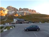
In Cortina d'Ampezzo we then follow the signs for the alpine pass Passo di Falzarego. We follow this ascending road to the mentioned pass. At the pass we come to a crossroad, where we continue on the left road in the direction of Marmolada and settlement Arabba (right Alta Badia). The road continues descending for quite some time ahead, then brings us to a crossroad, where we continue right in the direction of pass Passo Pordoi (left Marmolada). We follow the relatively wide and ascending road all the way to the mentioned pass, where we park on a large parking lot.
From Primorska: We drive on the highway towards Venice / Venezia. At Portogruaro we leave the highway towards Venice and continue right on the highway towards Pordenone. At the next highway junction near Conegliano we continue right towards Belluno. Near Belluno the highway ends, and at the next crossroads we continue in the direction of Cortina d'Ampezzo. Further we follow the above description.
Route description:
From the parking lot on the pass we continue towards the southeast past the hut Savoia, behind which we will notice signposts. The signposts direct us to the footpath towards hut Rifugio Fredarola. The wide path initially runs towards the southeast and brings us to the chapel. Here the path turns right and then slightly ascends below the eastern slopes of peak Sas Bece. From the path we otherwise have a very nice view mainly on the nearby peaks in the mountain group Sella. The path then soon brings us to a saddle on the north side of peak Sas Bece, from where a view towards Marmolada also opens.
At the saddle where there is a junction we continue straight ahead; left along the ski slope the path leads towards hut Rifugio Sass Bece. The path from the saddle first crosses grassy slopes towards the south and then brings us to a macadam road.
At the junction we continue slightly left and then head to the footpath that crosses a short grassy slope. Left ahead along the road the path leads towards hut Sass Bece, right downhill towards hut Belvedere and further towards summit Col di Rosc. After a short crossing the path brings us to a wider macadam path where we continue left.
The wide path then runs towards the east and slightly ascends along somewhat steeper grassy slopes with beautiful views towards Marmolada. Along such a path we then soon reach hut Rifugio Fredarola.
At the hut where there is a junction we continue along the macadam road towards the east following the signs "Viel del Pan". The road then quickly brings us to another marked junction.
At the junction we continue slightly left onto the ridge path (Sentiero Attrezzato delle Creste); right leads the easier path named Bindelweg towards hut Rifugio Viel del Pan and further towards saddle Porta Vescovo. The path from the junction runs along the north side of the ridge and quickly brings us to somewhat steeper slopes from which we have a very nice view towards the mountain group Sella and towards Alta Badia. The path from the northern slopes soon turns right and ascends towards the ridge. Further on we ascend along the ridge for some time, then the path brings us to the 2563 m high peak Col da Cuch from which a view opens onto the entire Padon ridge and towards lake Lago di Fedaia.
From the summit we continue further along the ridge and begin to descend mostly over grassy terrain. The path, which continues descending, further runs along the south side of the ridge and brings us to a smaller saddle. Right here an unmarked trail branches off that crosses grassy slopes towards hut Viel del Pan; we continue along the ridge and begin to ascend more steeply again.
The path then leads us over an unnamed summit on which a larger cairn is placed and then descends to a saddle below the western slopes of peak Sas Ciapel. Also at this saddle there is a junction where right across the grassy slope a trail branches off towards path Bindelweg and hut Viel del Pan.
We continue further along the ridge towards the east and the path brings us below steeper slopes of peak Sas Ciapel. The marked path here begins to cross the slopes on the south side of the peak; on the left side we will notice some trails leading towards the summit. We head onto one of the trails, which ascends for a short time over a fairly steep slope, so some caution is needed during the ascent. The path then quickly brings us to the ridge followed by a short easy ascent to the panoramic summit.
From the summit we return to the path that crosses the south slopes below the summit. After crossing steep grassy slopes the path brings us to the ridge on the east side of peak Sas Ciapel. Here the path begins to descend and runs along a slightly exposed ridge. The slope soon becomes less steep and is followed by a descent along a grassy slope beside the ridge to the next smaller saddle. We continue further along the ridge path and ascend to the less prominent summit named Col de Pausa. After descending from the summit we arrive below the western slopes of peak Le Forfesc. Here right a trail branches off towards the easier path Bindelweg; we continue along the ridge for a short time, then we must be somewhat more attentive as the marked path turns left onto the northern slopes. Right an unmarked path leads, which bypasses the steep slopes along the south side and then ascends back towards the ridge. We therefore continue left and cross the slopes on the north side of peak Le Forfesc. Further on for some time we cross the slopes in a gentle ascent towards the east, then the path turns slightly right and ascends towards the ridge. We reach the ridge on the east side of peak Le Forfesc, to which there is only a short ascent along the ridge.
On the ridge we continue left towards the east and then cross grassy slopes on the south side of the ridge for quite some time. Later on the left side we will spot summit Belvedere on which a cross stands. The trail here becomes somewhat less visible and soon joins the path from saddle Porta Vescovo. At the poorly visible junction we continue left followed by an ascent along a panoramic grassy slope to the summit.
We descend towards saddle Porta Vescovo and then along the relatively gentle path Bindelweg, which runs along the south slopes back towards pass Passo Pordoi.

Photos:
 1
1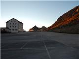 2
2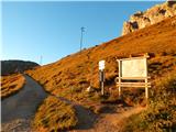 3
3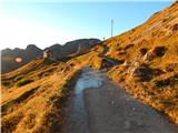 4
4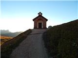 5
5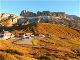 6
6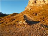 7
7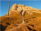 8
8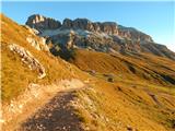 9
9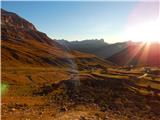 10
10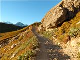 11
11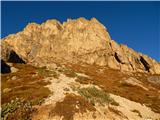 12
12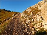 13
13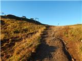 14
14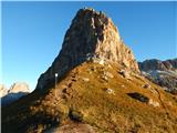 15
15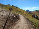 16
16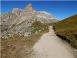 17
17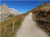 18
18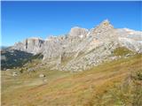 19
19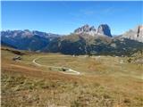 20
20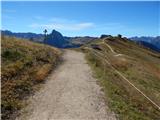 21
21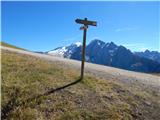 22
22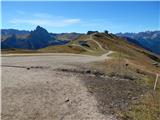 23
23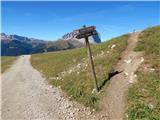 24
24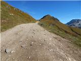 25
25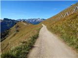 26
26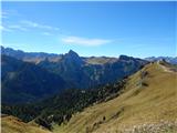 27
27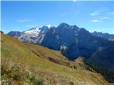 28
28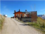 29
29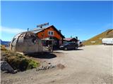 30
30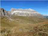 31
31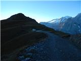 32
32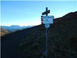 33
33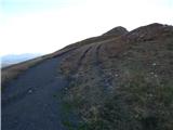 34
34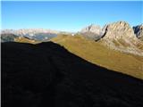 35
35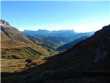 36
36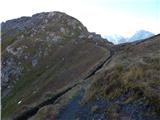 37
37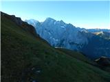 38
38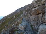 39
39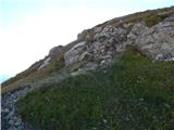 40
40 41
41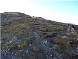 42
42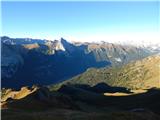 43
43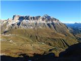 44
44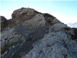 45
45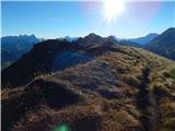 46
46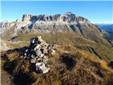 47
47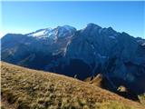 48
48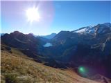 49
49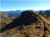 50
50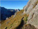 51
51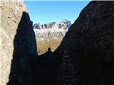 52
52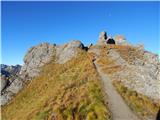 53
53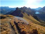 54
54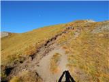 55
55 56
56 57
57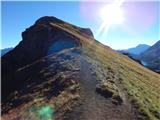 58
58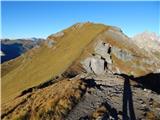 59
59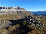 60
60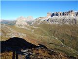 61
61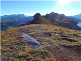 62
62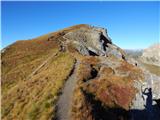 63
63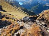 64
64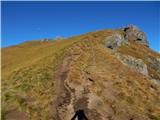 65
65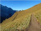 66
66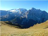 67
67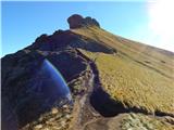 68
68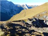 69
69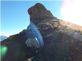 70
70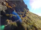 71
71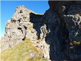 72
72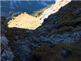 73
73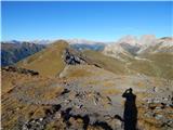 74
74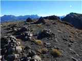 75
75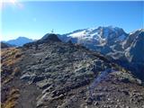 76
76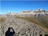 77
77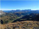 78
78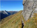 79
79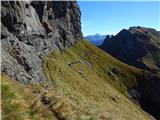 80
80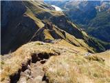 81
81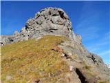 82
82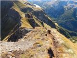 83
83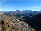 84
84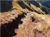 85
85 86
86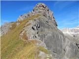 87
87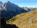 88
88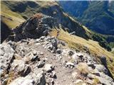 89
89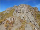 90
90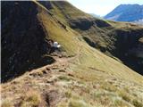 91
91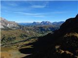 92
92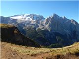 93
93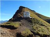 94
94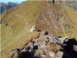 95
95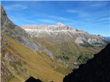 96
96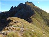 97
97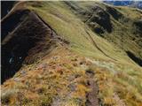 98
98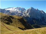 99
99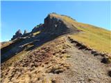 100
100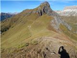 101
101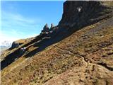 102
102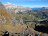 103
103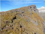 104
104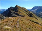 105
105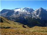 106
106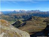 107
107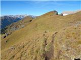 108
108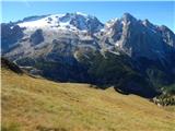 109
109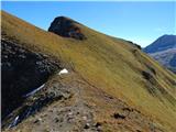 110
110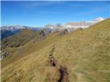 111
111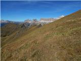 112
112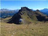 113
113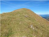 114
114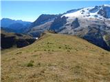 115
115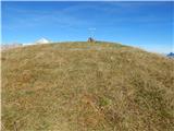 116
116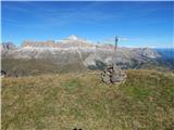 117
117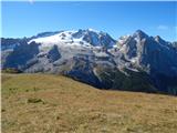 118
118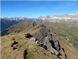 119
119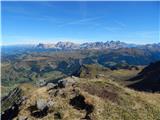 120
120
Discussion about the trip Passo Pordoi - Belvedere (ridge way)
To post a comment you must log in:
If you do not yet have a username, you must first
register.