Passo Pordoi - Rifugio Boe
Starting point: Passo Pordoi (2239 m)
| Latitude/Longitude: | 46,48800°N 11,81130°E |
| |
Walking time: 2 h 30 min
Difficulty: partly demanding marked way
Elevation gain: 634 m
Elevation difference along the route: 670 m
Map: Tabacco 07 1:25.000
Recommended equipment (summer): helmet
Recommended equipment (winter): helmet, ice axe, crampons
Views: 3.415
 | 2 people like this post |
Access to starting point:
Access from Gorenjska: Through the border crossing at Rateče or Predel to Trbiž / Tarvisio and then on the highway in the direction of Videm / Udine to the Tolmezzo exit. From Tolmezzo we follow the road in the direction of the village Ampezzo and mountain pass Passo della Mauria. The road then descends and brings us to an intersection, where we continue left (also right possible) in the direction of Cortina d'Ampezzo. At all following intersections we follow the signs for Cortina d'Ampezzo.
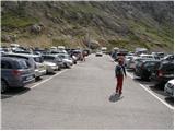
In Cortina d'Ampezzo we then follow the signs for the alpine pass Passo di Falzarego. At the mentioned pass we come to an intersection, where we continue on the left road in the direction of Marmolada and settlement Arabba (right Alta Badia). The road further descends for quite some time, then brings us to an intersection, where we continue right in the direction of the pass Passo Pordoi (left Marmolada). We follow the relatively wide and ascending road all the way to the mentioned pass, where we park on a large parking lot.
From the Primorska side: We drive on the highway towards Venice / Venezia. At Portogruaro we leave the highway towards Venice and continue right on the highway towards Pordenone. At the next highway intersection near Conegliano we continue right towards Belluno. Near Belluno the highway ends, and we continue at the following intersections in the direction of Cortina d'Ampezzo. Further follow the above description.
Route description:
From the parking lot first we carefully cross the road, then we head to path no. 627 (direction Piz Boe). The path first ascends somewhat steeper across a panoramic grassy slope, then it flattens and brings us into a more rocky world. The path ahead turns slightly to the left and starts ascending steeper again. After a few minutes of further walking we finally leave the grassy slopes, and the path transitions into gravel terrain, across which we ascend on a quite wide path. The path higher up flattens once more and brings us to a marked junction.
We continue straight on path no. 627 in the direction of hut Rifugio Forcella Pordoi and Rifugio Boe (right Ferrata C. Piazzetta). The path ahead transitions to increasingly steep scree, which takes quite some energy from us. We follow this path, which in the upper part is also exposed to falling rocks, all the way to the mountain hut Rifugio Forcella Pordoi, which we reach when we ascend to the top of the already mentioned scree.
From the hut we continue right in the direction of the summit and hut Rifugio Boe. Further a very wide and gentle path, then for some time it crosses slopes to the east, after which it brings us into a more plateau-like world, where we arrive at a marked junction.
We continue left towards hut Rifugio Boe, straight ahead the path leads towards summit Piz Boe. From the junction our path crosses slopes to the north and slightly ascends alongside a steel cable. The path here is wide enough and well secured, so the ascent causes no major difficulties. Further the path crosses slopes on the western side of summit Piz Boe for quite some time and occasionally ascends a bit. The path is fairly level all the way and soon a view opens towards hut Rifugio Boe. From here only a short descent to the hut follows.

The trip can be extended to the following destinations: Piz Boe
Photos:
 1
1 2
2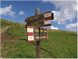 3
3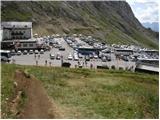 4
4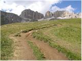 5
5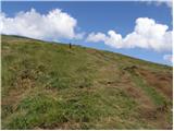 6
6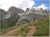 7
7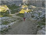 8
8 9
9 10
10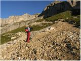 11
11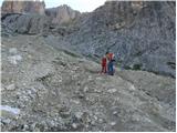 12
12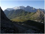 13
13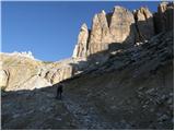 14
14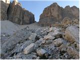 15
15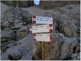 16
16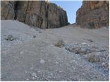 17
17 18
18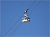 19
19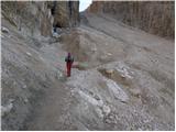 20
20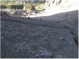 21
21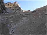 22
22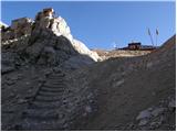 23
23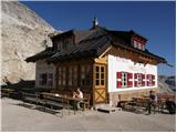 24
24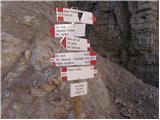 25
25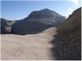 26
26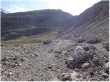 27
27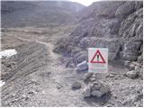 28
28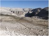 29
29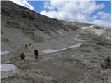 30
30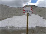 31
31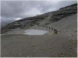 32
32 33
33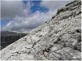 34
34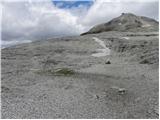 35
35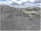 36
36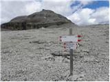 37
37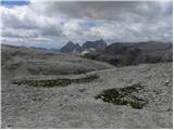 38
38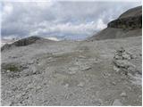 39
39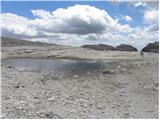 40
40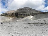 41
41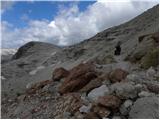 42
42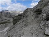 43
43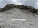 44
44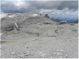 45
45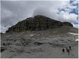 46
46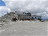 47
47
Discussion about the trip Passo Pordoi - Rifugio Boe
|
| mirank15. 09. 2023 22:46:16 |
It looked like in the picture a few years ago, now it's at least doubled, as they added a very large modern building on the west side to it.
|
|
|
To post a comment you must log in:
If you do not yet have a username, you must first
register.