Passo Sella - Sassopiatto / Plattkofel
Starting point: Passo Sella (2183 m)
| Latitude/Longitude: | 46,50822°N 11,75825°E |
| |
Walking time: 5 h 10 min
Difficulty: easy marked way
Elevation gain: 786 m
Elevation difference along the route: 970 m
Map: Tabacco 05 1:25.000
Recommended equipment (summer):
Recommended equipment (winter): ice axe, crampons
Views: 6.295
 | 2 people like this post |
Access to starting point:
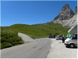
From Kranjska Gora via Korensko sedlo to Austria, where at the first major intersection we continue left towards Podklošter / Arnoldstein and Trbiž / Tarvisio. At the end of the settlement Podklošter signs for Šmohor / Hermagor direct us right onto a regional road, on which past the mentioned settlement we drive to the end of the Gailtal valley, or more precisely to the settlement Kötschach-Mauthen, where we turn right towards the settlement Oberdrauburg. The route ahead leads us over the Alpine pass Gailbergsattel (982 m), after which we descend into the mentioned settlement. After we cross the bridge over the Drava River, we continue left towards the settlement Lienz. In the main roundabout in Lienz we continue "left" in the direction of the settlement Sillian and Italy. Further, we cross the border between Austria and Italy, and we follow the main road past settlements Dobbiaco / Toblach, Villabassa / Niederdorf, Monguelfo - Tesido / Welsberg - Taisten, Brunico / Bruneck. Only a little after the last-mentioned settlement, past which a bypass road leads, we turn left into the Alta Badia valley. Further, we drive through the mentioned valley and in the settlement La Villa we turn right towards the pass Passo Gardena. Further, we follow the ascending road for the signs Passo Gardena. From the pass Passo Gardena we descend on the other side and then we continue left towards the pass Passo Sella. On the pass Sella we park at the mountain hut Rifugio Passo Sella or on one of the smaller parking lots by the road. The parking lot at the mountain hut is paid (July 2012 – 4€).
Route description:
From the mountain hut Rifugio Passo Sella we continue on the main road to a crossroad where a narrower road towards the mountain hut Rifugio Carlo Valentini branches off to the right upward. At the crossroad, there is also a smaller parking lot. We head onto the mentioned road and start ascending on the initially still asphalted road. The road leads us past the already mentioned mountain hut Carlo Valentini, and then the asphalt ends and we continue slightly right on a macadam road following the signs »Sasso Piatto Plattkofel«.
From the road which runs by grassy slopes we have a nice view mainly towards the Sella group and Marmolada, and occasionally a view towards the summit Sassolungo also opens up. The road further ascends towards the south and leads us past the mountain hut Rifugio Salei and then also past the mountain hut Chalet Margherita to the notch Forcela Rodela, which is situated below the slopes of the peak Col Rodela. On the notch where there is a crossroad we continue right and on a gentle road we come to the hut Rifugio Friedrich August.
From the hut we continue a few dozen meters on the road, and then the road ends and we continue on a footpath following the signs »Rif. Sasso Piato«. The path at first slightly descends and then crosses grassy slopes towards the west. Further, the path crosses a stream and brings us below the slopes of the peak Sasso Levante. Here increasingly beautiful views towards the mountain group Catinaccio start to open up. The path then still crosses slopes towards the west and then brings us to the hut Rifugio Sandro Pertini.
From the hut we continue following the signs »Rif. Sasso Piatto« and still cross the slopes towards the west in gentle ascents and descents. The path named Sentiero Friedrich August later brings us to an indistinct saddle from which a view opens up towards the hut Sasso Piatto.
The path further again slightly descends and brings us on somewhat steeper slopes. Here a steel cable helps us, but the path is still relatively easy and does not cause problems. Soon thereafter we come to a junction where the path towards the mountain pasture Malga del Sasso Piatto branches off to the left downward, to the right upward an unmarked shortcut towards the summit Sasso Piatto branches off, and we continue straight on a wide path towards the hut Rifugio Sasso Piatto.
From the junction the path still in a gentle descent crosses slopes towards the west and soon brings us to the hut.
At the hut we continue right upward following the signs »Plattkofel, Sasso Piatto«. A nicely maintained path leads us across grassy slopes and then ascends somewhat more steeply. Later grassy slopes are replaced by scree and a prolonged ascent follows on the western slopes of the mountain. The path all the time runs slightly to the right and all the time ascends quite steeply. Such a path leads us all the way to the main ridge, which we reach somewhat to the right (southeast) of the summit.
On the ridge the path turns to the left and soon the climbing path Via Ferrata Oskar Schuster also joins from the right. From here only a short ascent along the ridge to the summit follows.

Photos:
 1
1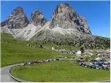 2
2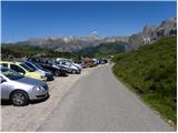 3
3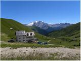 4
4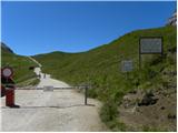 5
5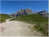 6
6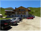 7
7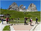 8
8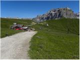 9
9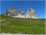 10
10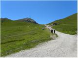 11
11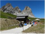 12
12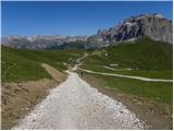 13
13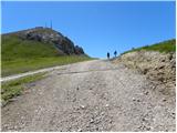 14
14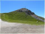 15
15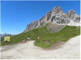 16
16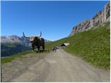 17
17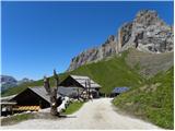 18
18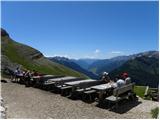 19
19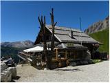 20
20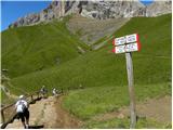 21
21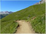 22
22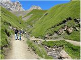 23
23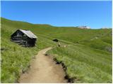 24
24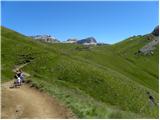 25
25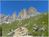 26
26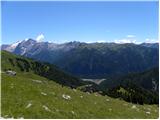 27
27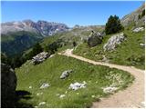 28
28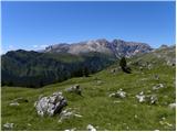 29
29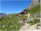 30
30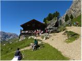 31
31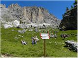 32
32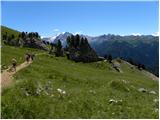 33
33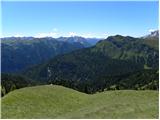 34
34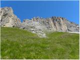 35
35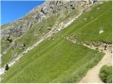 36
36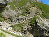 37
37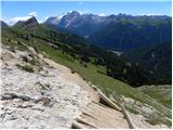 38
38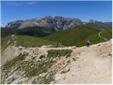 39
39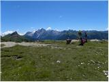 40
40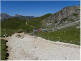 41
41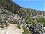 42
42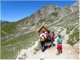 43
43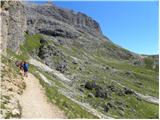 44
44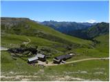 45
45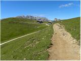 46
46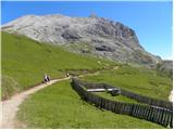 47
47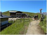 48
48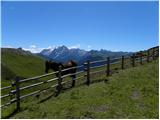 49
49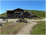 50
50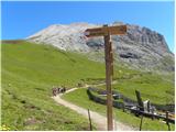 51
51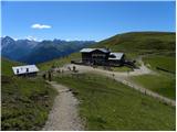 52
52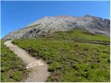 53
53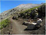 54
54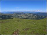 55
55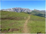 56
56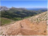 57
57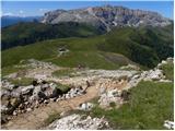 58
58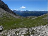 59
59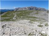 60
60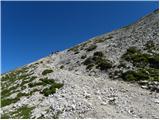 61
61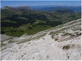 62
62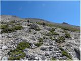 63
63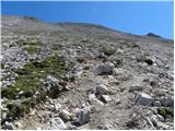 64
64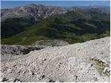 65
65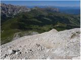 66
66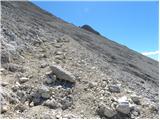 67
67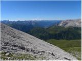 68
68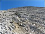 69
69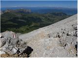 70
70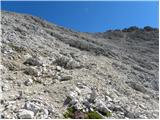 71
71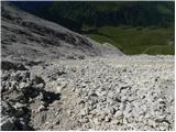 72
72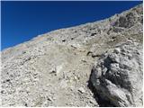 73
73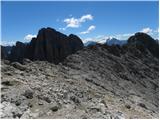 74
74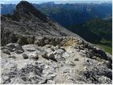 75
75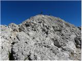 76
76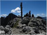 77
77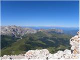 78
78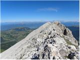 79
79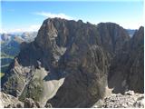 80
80
Discussion about the trip Passo Sella - Sassopiatto / Plattkofel
To post a comment you must log in:
If you do not yet have a username, you must first
register.