Passo Valparola - Sasso di Stria
Starting point: Passo Valparola (2180 m)
| Latitude/Longitude: | 46,52745°N 11,99250°E |
| |
Walking time: 50 min
Difficulty: difficult marked way
Elevation gain: 297 m
Elevation difference along the route: 297 m
Map: Tabacco 03 1:25.000
Recommended equipment (summer):
Recommended equipment (winter): ice axe, crampons
Views: 4.275
 | 2 people like this post |
Access to starting point:
Access from Gorenjska: Through the border crossing at Rateče or Predel to Trbiž / Tarvisio and then continue on the highway in the direction of Udine to the Tolmezzo exit. From Tolmezzo we follow the road in the direction of the village Ampezzo and mountain pass Passo della Mauria. The road then descends and brings us to a crossroad, where we continue left (possible also right) in the direction of Cortina d'Ampezzo. At all next crossroads, we follow the signs for Cortina d'Ampezzo.
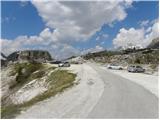
In Cortina d'Ampezzo then we follow the signs for the alpine pass Passo di Falzarego. We follow this ascending road to the mentioned pass, and then we continue right towards the pass Passo Valparola. We park on a large parking lot below the slopes of the peak Sas de Stria. The parking lot is located a little before the fortress Forte Tre Sassi, in which there is a museum.
From the Primorska side: We drive on the highway towards Venice / Venezia. At Portogruaro we leave the highway towards Venice and continue right on the highway towards Pordenone. At the next highway junction near Conegliano, we continue right towards Belluno. Near Belluno the highway ends, and at the next crossroads we continue in the direction of Cortina d'Ampezzo. Further, we follow the above description.
Route description:
From the parking lot, we head onto a narrow asphalt road below the slopes of the peak Sas de Stria. Along the road, we will notice a signpost that directs us to the path towards the summit Sas de Stria. After a short crossing that brings us to the northern side of the mountain, the path turns left and starts to ascend relatively steeply. The path runs all the time along the northern slope of the mountain, from which we have a very nice view all the time towards the nearby peaks above the Valparola pass. Along the path, we will also notice numerous military fortifications from the time of the First World War.
In the second part, the slope becomes somewhat steeper and on a shorter section a steel cable and ladder assist us. The path then becomes less demanding again and along the panoramic ridge soon brings us to the summit.
Photos:
 1
1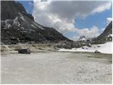 2
2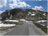 3
3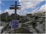 4
4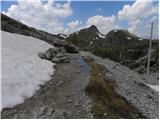 5
5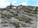 6
6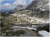 7
7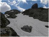 8
8 9
9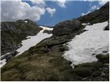 10
10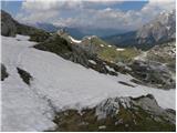 11
11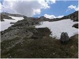 12
12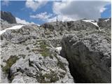 13
13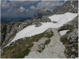 14
14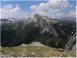 15
15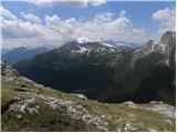 16
16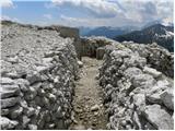 17
17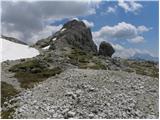 18
18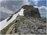 19
19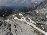 20
20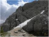 21
21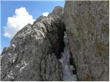 22
22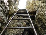 23
23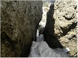 24
24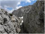 25
25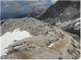 26
26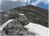 27
27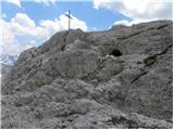 28
28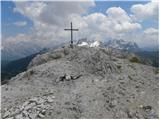 29
29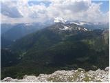 30
30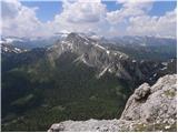 31
31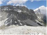 32
32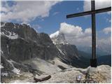 33
33
Discussion about the trip Passo Valparola - Sasso di Stria
|
| haridautovic2. 08. 2020 |
Sass de Stria, pass Falzarego Valparola-Lagazuoi,
museum Forte Tre Sassi, is an open-air Great War museum. This is a wonderful easy hike, relatively simple and not tiring, but extremely useful.
Besides visiting numerous trenches, artifacts and tunnels dug during the First World War (Sass de Stria was an exceptionally strategic observation point for the Austro-Hungarians), the summit is one of the most beautiful panoramic balconies in the Dolomites. At Valparola pass by the road is the Tre Sassi fort, part of the Austro-Hungarian defensive line against the Kingdom of Italy.
Built in 1897–1900 it was already obsolete at the start of the war, as it was built with concrete armor without iron and Italian artillery severely damaged it in the first months of war in 1915.
Today this restored fort is a Great War museum.
|
|
|
To post a comment you must log in:
If you do not yet have a username, you must first
register.