Pečana - Altemaver (Ratitovec)
Starting point: Pečana (1400 m)
| Latitude/Longitude: | 46,24880°N 14,07390°E |
| |
Walking time: 55 min
Difficulty: easy marked way
Elevation gain: 278 m
Elevation difference along the route: 278 m
Map: Škofjeloško in Cerkljansko hribovje 1:50.000
Recommended equipment (summer):
Recommended equipment (winter): ice axe, crampons
Views: 33.123
 | 1 person like this post |
Access to starting point:
A) First, we drive to Bohinjska Bistrica, then we continue driving towards Soriška planina. Higher up, we arrive at a crossroad, where we continue straight towards Železniki (sharply right Soriška planina), and we follow the main road for approximately another 1 km, then we continue right towards Ribčeva planina. Higher up, the asphalt ends, and the macadam road splits into two parts. We continue on the right road, which brings us to Ribčeva planina. At the crossroad above the mountain pasture, we continue right, then in the next two crossroads left. From the second crossroad, where we went left, we drive a few hundred meters to the next crossroad, there we turn right and then drive to the end of the road, where we park. From the crossroad on Bitenjska planina to the starting point is approximately 7.5 km.
B) From Železniki or Podbrdo, we first drive to Soriška planina, then we continue driving towards Bohinjska Bistrica. From the parking lot on Soriška planina, we drive approximately another 1 km, then we turn right onto the forest road. At the first crossroad, to which we arrive after less than 2 km of driving from the place where we left the main road, we continue left, then in the next one, which is located after a few kilometers, slightly right. From the second crossroad onwards, we drive a few hundred meters, then at the next crossroad we turn right and continue to the end of the road, where we park in a suitable place.
Route description:
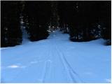
From the parking lot, we continue on a wide cart track, which starts relatively steeply ascending through the forest. After approximately 10 minutes of walking, the cart track flattens, then a little further it brings us to the cottages on the mountain pasture Pečana.
A few steps above the mentioned cottages, we emerge from the forest onto grassy slopes, and we continue along the right side of the mountain pasture for only a few meters, then at the junction we continue right in the direction of Krekova koča (straight Kosmati vrh). The path ahead starts to ascend moderately through increasingly sparse spruce forest. Higher up, we finally step out of the forest onto the expansive pastures of Ratitovec, where we leave the cart track and continue the ascent on a somewhat less visible but marked footpath, which after a few minutes of further walking brings us to the summit slopes of Ratitovec, where we join the path Krekova koča - Altemaver.
Here we continue right (left Krekova koča 5 minutes) and start to ascend more steeply along the pasture fence. After a few minutes of ascent, the path brings us to the eastern forepeak of Altemaver. A short descent follows, then the marked path turns slightly to the right. Right at the place where the marked path leading towards Soriška planina turns slightly to the right, we leave it and continue the ascent on a well-visible path in the direction of the summit Altemaver, which continues along the ridge of Ratitovec. We then follow this scenic path to the highest peak of Ratitovec, which we reach after a few dozen steps of further walking.

Photos:
 1
1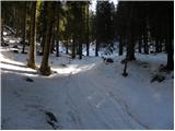 2
2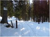 3
3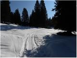 4
4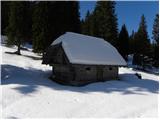 5
5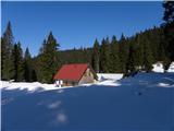 6
6 7
7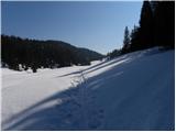 8
8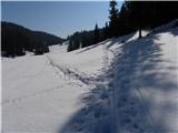 9
9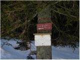 10
10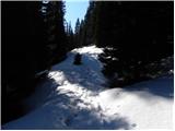 11
11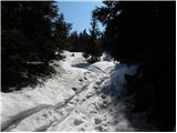 12
12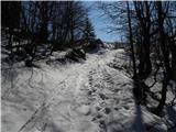 13
13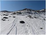 14
14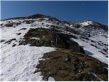 15
15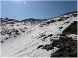 16
16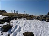 17
17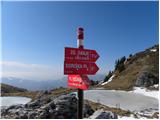 18
18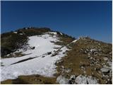 19
19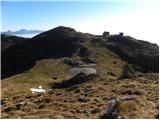 20
20 21
21 22
22
Discussion about the trip Pečana - Altemaver (Ratitovec)
|
| jozicasmuk12. 06. 2018 |
On 08.06.2018 went to Ratitovec...a lot of fallen trees on the road, very difficult to access by car....
|
|
|
To post a comment you must log in:
If you do not yet have a username, you must first
register.