Starting point: Peče (453 m)
| Latitude/Longitude: | 46,14810°N 14,81020°E |
| |
Walking time: 2 h
Difficulty: easy unmarked way, easy marked way
Elevation gain: 237 m
Elevation difference along the route: 405 m
Map:
Recommended equipment (summer):
Recommended equipment (winter):
Views: 708
 | 3 people like this post |
Access to starting point:
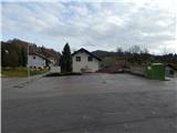
A) We leave the Štajerska motorway at exit Krtina, and then we follow the signs for Moravče and Zagorje ob Savi. On the part when we drive through the valley of Drtiljščica, we leave the main road towards Zagorje ob Savi and continue left in the direction of the settlement Peče. In the settlement Peče we continue right in the direction of the villages Pretrž and Križate, and we drive to the parking lot by the parish church of St. Jernej in Peče.
B) We drive to Izlake (to here from Trojane or Zagorje ob Savi), and then we continue driving in the direction of Moravče. After the settlement Kandrše the road starts descending towards Moravče, and we follow it only to a crossroad, where signs for Peče point us to the right on an ascending asphalt road. In the settlement Peče we continue right in the direction of the villages Pretrž and Križate, and we drive to the parking lot by the parish church of St. Jernej in Peče.
Route description:
From the parking lot, we walk to the fire station, and from there we continue on a side road which branches off towards the north. The road at first leads past a few more houses, and then we get to a smaller crossroad, where we go left (or also straight on parts of a hard-to-follow footpath, which higher joins the described path).
A little further from the crossroad the asphalt ends and we continue walking on the road which ascends diagonally towards the left, from which a nice view opens up on the village Peče for a while. Higher, we reach an asphalt road which leads from the settlement Zgornje Koseze towards Tlačnica, and we follow it right upwards. At the beginning of Tlačnica the already mentioned footpath also joins from the right, and we follow the road to a marked crossroad in the center of Tlačnica, where we join the marked path from Kandrše.
We continue left in the direction of Golčaj, Kal and Limbarska gora (left downwards Peče and Zgornje Koseze) and continue walking on the forest road which first ascends gently to moderately, then flattens and occasionally descends a little. When we leave the forest we arrive at the first houses or holiday cottages in the hamlet Kal. Here the road becomes asphalted, and at the end of the settlement we leave it and at the hayrack continue right where the blazes direct us. Only a few dozen strides ahead the path ends, and we continue left downwards, where through a meadow we descend to the edge of the forest, where the marked path reappears. There follows a steeper descent through the forest, lower by the edge of a meadow we reach a marked crossroad.
From the crossroad we continue sharply right in the direction of Golčaj (slightly left Limbarska gora) and continue on a gentle cart track. The path ahead leads past a cross (here from the right an unmarked shortcut from the hamlet Kal joins), then from the slope we gradually pass onto a forested ridge. There follows some more ascent, then we reach a marked crossroad, where the path from Blagovica also joins.
We continue in the direction of the summit Golčaj and the NOB monument, and we reach the summit of Golčaj after 3 minutes of further walking.
From the summit we continue slightly right and after a short descent we arrive at the nearby church of St. Neža.
Peče - Tlačnica 0:40, Tlačnica - Kal 0:30, Kal - Golčaj 0:50.

Along the route: Tlačnica (702m), Kal (725m)
The trip can be extended to the following destinations: Limbarska gora
Photos:
 1
1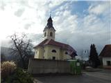 2
2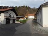 3
3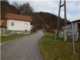 4
4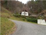 5
5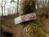 6
6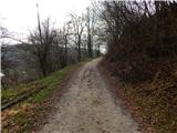 7
7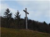 8
8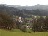 9
9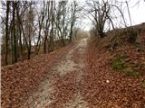 10
10 11
11 12
12 13
13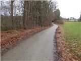 14
14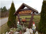 15
15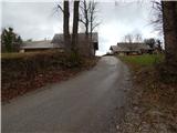 16
16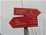 17
17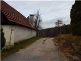 18
18 19
19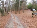 20
20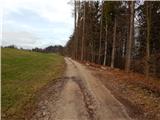 21
21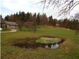 22
22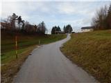 23
23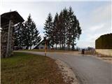 24
24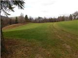 25
25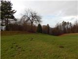 26
26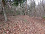 27
27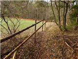 28
28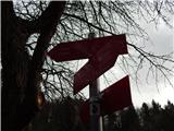 29
29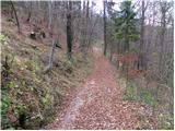 30
30 31
31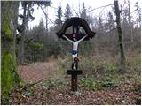 32
32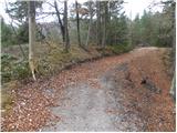 33
33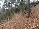 34
34 35
35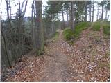 36
36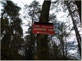 37
37 38
38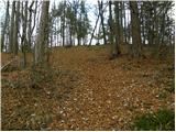 39
39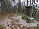 40
40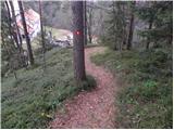 41
41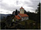 42
42
Discussion about the trip Peče - Golčaj
To post a comment you must log in:
If you do not yet have a username, you must first
register.