Starting point: Pečica (371 m)
| Latitude/Longitude: | 46,27359°N 15,55892°E |
| |
Walking time: 1 h 35 min
Difficulty: easy marked way
Elevation gain: 287 m
Elevation difference along the route: 340 m
Map:
Recommended equipment (summer):
Recommended equipment (winter): ice axe, crampons
Views: 96
 | 1 person like this post |
Access to starting point:
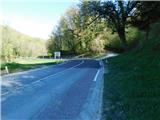
a) From the Celje - Rogaška Slatina road, drive to the Podplat settlement, where from the traffic-light intersection next to the Petrol gas station, turn in the direction of Maribor, Slovenska Bistrica and Poljčane. This is followed by an ascent to the Pečica pass, and as we begin to descend towards Lovnik, on the right side next to a small intersection, notice the red mountaineering direction signs for Boč. The described path begins at the intersection, where there are no arranged parking spaces.
b) Drive to Poljčane, then continue driving in the direction of Rogaška Slatina and Podčetrtek. The path ahead leads towards the Pečica pass, but just before the pass, on the left side of the road next to a small intersection, notice the red mountaineering direction signs for Boč. The described path begins at the intersection, where there are no arranged parking spaces.
Route description:
From the starting point, head to the side road where there are signs for Boč, but continue on the side road leading south. The ascending road leading past individual houses keeps turning left, so behind the last house we are already ascending northwards. Behind the house, the path enters the forest and continues along a cart track, following the markers. There follows fairly easy walking with some short ascents and descents, and the path mostly leads eastwards. There is some more traversing above the upper edge of the village Zgornji Gabernik, then we reach the small road pass Galke located above the mentioned settlement, and the road descends to the other side towards Lovnik, or the valley of the Bela stream.
We merely cross the mentioned road and continue following the signs for Boč. We ascend moderately for some time; after a small quarry which we bypass on the left, the path becomes steep. We ascend steeply for some time, and at the end of the steep ascent a bench awaits us where we can rest; above the bench we quickly reach a marked junction where we join the path starting from the Zgornji Gabernik settlement.
Here the path levels out somewhat, the marked path continues briefly along the ridge, then turns right.
Straight ahead an unmarked path continues to the Galk summit, but we continue right along the marked path, which for some time proceeds without major changes in elevation and leads past a pleasant bench from which a nice view opens up. There follows some more traversing, then we reach a meadow, and immediately after crossing the road we arrive at the fenced pasque-flower bed.
Continue towards Dom na Boču, passing through the arranged passage by the bed, then reach another road where from the right the path joins leading from Zgornje Kostrivnice past Koča Velikonočnice towards Boč. Follow the mentioned road to the left, continue along it for about ten minutes, then after crossing the asphalt road we already arrive at Dom na Boču.
Starting point - Galke junction 1:05, Galke junction - turnoff for Galke 0:05, turnoff for Galke - pasque-flower bed 0:15, pasque-flower bed - Dom na Boču 0:10.
Description and photos refer to the condition in April 2026.

Along the route: Prelaz Galke (388m), Razpotje Galke (600m), Odcep proti Galkam (625m), Rastišče velikonočnice (632m)
Photos:
 1
1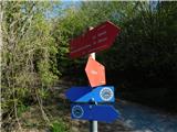 2
2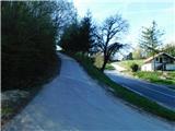 3
3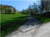 4
4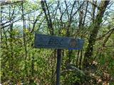 5
5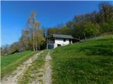 6
6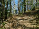 7
7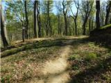 8
8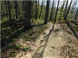 9
9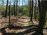 10
10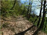 11
11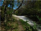 12
12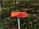 13
13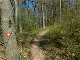 14
14 15
15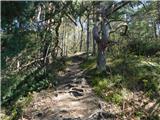 16
16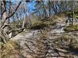 17
17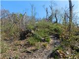 18
18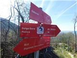 19
19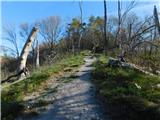 20
20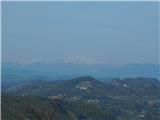 21
21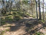 22
22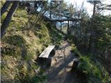 23
23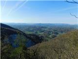 24
24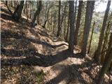 25
25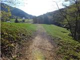 26
26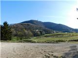 27
27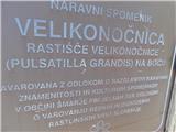 28
28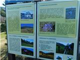 29
29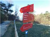 30
30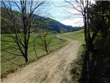 31
31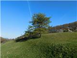 32
32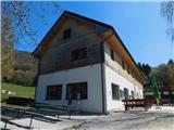 33
33
Discussion about the trip Pečica - Dom na Boču
To post a comment you must log in:
If you do not yet have a username, you must first
register.