Pedrovo - Stjenkova koča on Trstelj
Starting point: Pedrovo (350 m)
| Latitude/Longitude: | 45,85610°N 13,76490°E |
| |
Walking time: 1 h 55 min
Difficulty: easy marked way
Elevation gain: 260 m
Elevation difference along the route: 335 m
Map: Goriška - izletniška karta 1:50.000
Recommended equipment (summer):
Recommended equipment (winter): crampons
Views: 5.144
 | 2 people like this post |
Access to starting point:
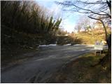
A) From the Ljubljana - Koper highway, take the Senožeče exit, then continue driving towards the village of Štorje. In Štorje, continue right towards Branik (straight to Sežana and Trst) and then drive through the villages of Kazlje, Dobravlje, and Ponikve. At the intersection a few kilometers after Ponikve, continue right towards the village of Kobdilj (left to Kopriva and Dutovlje); from there, follow the signs to Štanjel and Branik. After a few kilometers of descent, arrive in Branik, where continue sharply left towards Komen. Further on, drive past Rihemberk Castle (also known as Branik Castle), then in a sharp left turn leave the road to Komen and continue right towards the village of Pedrovo. From the mentioned intersection, drive about another 2 km, then park at the marked parking lot just below the village.
B) First drive to Ajdovščina, then continue on the old road towards Nova Gorica. Upon reaching the settlement of Potoče, leave the main road and continue left towards Branik. The road quickly leads to the bridge over the Vipava River, after which it gradually becomes more winding. After a short ascent, a shorter descent follows, and you arrive in Branik. Upon reaching the main road, continue left towards Koper and Sežana; on this road, drive to the intersection where the road to Komen branches slightly right. Further on, drive past Rihemberk Castle (also known as Branik Castle), then in a sharp left turn leave the road to Komen and continue right towards the village of Pedrovo. From the mentioned intersection, drive about another 2 km, then park at the marked parking lot just below the village.
C) From Nova Gorica or its surroundings, drive to Dornberk, then continue towards Branik. In Branik, leave the main road to Sežana and continue slightly right towards Komen. Further on, drive past Rihemberk Castle (also known as Branik Castle), then in a sharp left turn leave the road to Komen and continue right towards the village of Pedrovo. From the mentioned intersection, drive about another 2 km, then park at the marked parking lot just below the village.
D) First drive to Komen, then continue towards Branik. Towards Branik, drive to the sharp right turn, where turn left onto the local road towards the village of Pedrovo. From the mentioned intersection, drive about another 2 km, then park at the marked parking lot just below the village.
Route description:
From the parking lot, continue along the road, quickly arriving at the chapel of the Holy Spirit in the village of Pedrovo. Upon reaching the village, continue through it, then at its end continue along a wide, poorly marked cart track that begins to ascend moderately. Further on, the cart track splits several times; continue on the "main" one, i.e., the marked one (the blazes are occasionally quite rare). Higher up, reach a poorer road (firebreak - intervention road no. 14P), along which begin a moderate descent. A bit further, from the slope enter a small valley, where continue right uphill along an initially less distinct cart track. The path ahead briefly continues across a panoramic meadow, then quickly leads to the abandoned Slavčeva bajta. Bypass the mentioned hut on the left and continue along the poorly marked cart track, which rises and falls several times. At the forks, continue along the marked cart track; it eventually brings you to grassy slopes from which a beautiful view opens up all the way to the highest peaks of the Julian Alps. A somewhat steeper descent follows, and the path leads to Železnih vrat, where cross the asphalt road.
Continue along the macadam road towards Trstelj, walking along it to the power line. Immediately after the power line, leave the road and continue the ascent left along the marked path, which begins to ascend more steeply. After a few minutes, the path levels out and passes onto panoramic and relatively gentle shady slopes. The path quickly returns to the forest, and from the right, the path from Renč joins.
Continue left towards the hut along the path, which soon splits into two parts. Continue slightly right along the marked shortcut, then join a poorer forest road, which you follow to the nearby Stjenkova koča on Trstelj.

Photos:
 1
1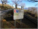 2
2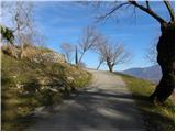 3
3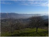 4
4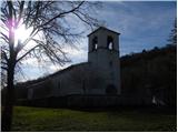 5
5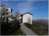 6
6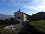 7
7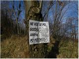 8
8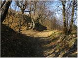 9
9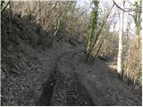 10
10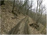 11
11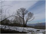 12
12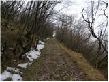 13
13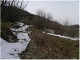 14
14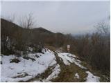 15
15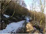 16
16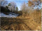 17
17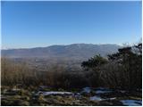 18
18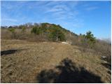 19
19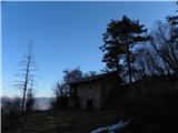 20
20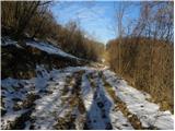 21
21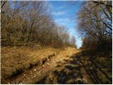 22
22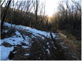 23
23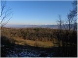 24
24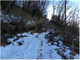 25
25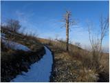 26
26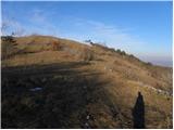 27
27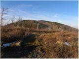 28
28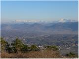 29
29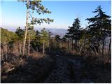 30
30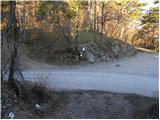 31
31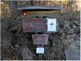 32
32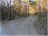 33
33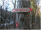 34
34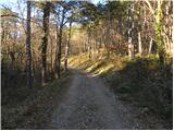 35
35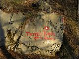 36
36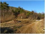 37
37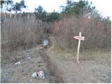 38
38 39
39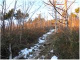 40
40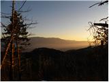 41
41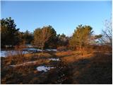 42
42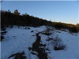 43
43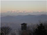 44
44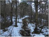 45
45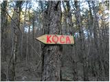 46
46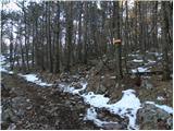 47
47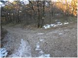 48
48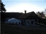 49
49
Discussion about the trip Pedrovo - Stjenkova koča on Trstelj
|
| bosin25. 03. 2013 |
Hm, on Saturday around noon all tables were occupied. For black coffee I paid 1 euro, for good tea with honey also 1 euro. Maybe the food is expensive?
|
|
|
|
| fpetel110. 03. 2014 |
Some junctions are very poorly marked. The first spot is where there is an ambiguous arrow - we head along the cart track where there is a no-entry sign. Later the path turns right. We don't go down into the valley but continue a few meters further and go right across the meadow. After about 300 meters we see the marking among the grass on a stone. To the right we have a nice view towards the Vipava valley.
|
|
|
|
| fpetel110. 03. 2014 |
Some junctions are very poorly marked. The first spot is where there is an ambiguous arrow - we head along the cart track where there is a no-entry sign. Later the path turns right. We don't go down into the valley but continue a few meters further and go right across the meadow. After about 300 meters we see the marking among the grass on a stone. To the right we have a nice view towards the Vipava valley.
|
|
|
To post a comment you must log in:
If you do not yet have a username, you must first
register.