Petačev graben - Sveta Jedert
Starting point: Petačev graben (460 m)
| Latitude/Longitude: | 46,09230°N 14,28870°E |
| |
Walking time: 1 h
Difficulty: easy marked way
Elevation gain: 290 m
Elevation difference along the route: 300 m
Map: Ljubljana - okolica 1:50.000
Recommended equipment (summer):
Recommended equipment (winter):
Views: 9.431
 | 1 person like this post |
Access to starting point:
From Horjul or Dobrova we drive to Polhov Gradec, and then we continue driving towards Črni Vrh. A little above Polhov Gradec, at the crossroad at the confluence of the rivers Mala and Velika Božna, we continue straight in the direction of Selo and Škofja Loka (left Črni Vrh). Further, we drive by the stream Mala Božna, and then by the road we notice mountain signposts for Selo, Tošč and Črni Vrh, by which we also park.
Route description:
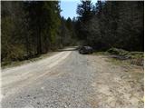
On the opposite side of the parking lot, we notice a macadam road (direction Selo, Tošč, Črni Vrh and Gabrše), which we follow for only some 10 m, then signs for the footpath direct us slightly to the left onto a cart track which ascends along the Selanov potok. Along the mentioned stream we ascend for quite some time, then blazes direct us to the left side (right bank) of the stream. The cart track only a little further turns sharply to the left and after a few minutes of additional walking brings us out of the forest onto wide grassy meadows. The path then turns sharply to the right and further ascends diagonally across more and more panoramic slopes. After approximately 45 minutes of walking from the starting point, we step onto the road, which we follow to the right (left Ogrin, Črni Vrh, Pasja ravan and Sveti Ožbolt). Further, we ascend only for a short time, and after we bypass some houses we gradually start descending. After a short descent, we come to a junction by a quarry and chapel. Here we continue right in the direction of Tošč and on a slightly ascending road, in 10 minutes of additional walking, we arrive at the church of St. Jedert.

The trip can be extended to the following destinations: Tošč
Photos:
 1
1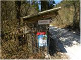 2
2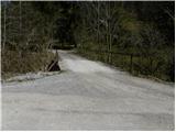 3
3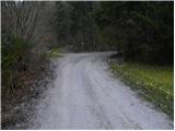 4
4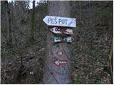 5
5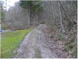 6
6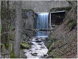 7
7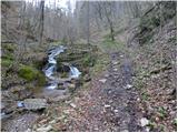 8
8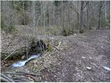 9
9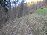 10
10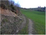 11
11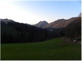 12
12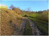 13
13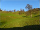 14
14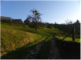 15
15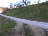 16
16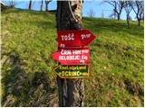 17
17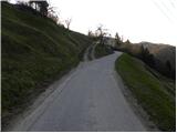 18
18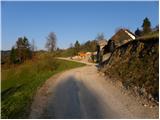 19
19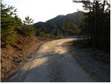 20
20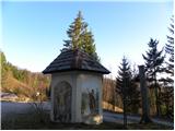 21
21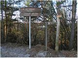 22
22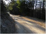 23
23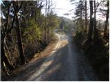 24
24 25
25 26
26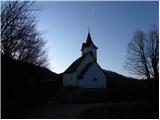 27
27
Discussion about the trip Petačev graben - Sveta Jedert
|
| TomKepi19. 10. 2019 |
Today I chose this path but unfortunately didn't reach the goal. There are no markings and the path ends with a drop created by a landslide. I met a local who said the path has been impassable since 2014.
|
|
|
|
| franca31. 01. 2022 21:36:31 |
On Sunday I went via Petačev graben to Tošč. That it was Petačev graben I only realized after analyzing at home, because nothing matched the description, no markings either by the road or later, the path was a muddy cart track along Selanov potok with small waterfalls, which ended in a landslide. From there I went straight up the slope through steep forest to a clearing and on its upper edge reached a new cart track above the same gully. After a few slightly trodden paths I reached the road that is in picture 16, from there onwards as per description to Sveta Jedrt. Probably an easier variant can be found, but in any case it's no longer a marked path, mine wasn't entirely easy either.
|
|
|
To post a comment you must log in:
If you do not yet have a username, you must first
register.