Starting point: Petrinje (418 m)
| Latitude/Longitude: | 45,57450°N 13,90670°E |
| |
Walking time: 1 h 20 min
Difficulty: easy marked way
Elevation gain: 19 m
Elevation difference along the route: 29 m
Map: Primorje in Kras 1:50.000
Recommended equipment (summer):
Recommended equipment (winter):
Views: 3.720
 | 1 person like this post |
Access to starting point:
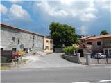
A) From the Ljubljana - Koper highway, we take the Kozina exit, then continue driving on the old road towards Koper. When we arrive in Petrinje (smaller settlement on the right side of the main road, on the left side of the road there is the church of St. Boštjan), we turn off the main road and then look for a suitable space for parking (in the settlement there are no organized parking spaces).
B) From the Koper - Ljubljana highway, we take the Kastelec exit, then continue right in the direction of Ljubljana, Kozina and Podgorje. There follow two more intersections, where we keep the direction towards Kozina; when we reach the old Koper - Ljubljana road, we drive along it to the top of the Črnokalskega klanca hill, then the road flattens and a little further brings us to the smaller settlement Petrinje, which is located on the left side of the main road (on the right side of the road there is the church of St. Boštjan). Here we turn off the main road (either left or right) and then look for a suitable parking space. There are no organized parking spaces at the starting point.
Route description:
When we enter the village we continue left, walk to the power line pole, where the road ends. We continue straight ahead, so we walk for a few minutes along the road towards Koper, then from the path that led us across the hayfield we turn right into the strip of low forest. The forest is quickly replaced by a strip of bushes, in the middle of which runs a well-followable but often somewhat overgrown path. After a few minutes we reach an asphalt road, which we follow to the right, along it to the intersection from which the nearby highway is well visible, which here emerges from the Kastelec tunnel.
At the mentioned intersection we go left, then after some 10 steps right onto the marked footpath. The path ahead leads us again across overgrown meadows and a strip of low forest, then brings us to a narrower macadam road, which we follow to the left. We walk along the road without major changes in elevation, i.e. initially we ascend slightly, soon a path from Črni Kal and Kastelec joins us from the left (also described paths from starting points Varda and Žlebinje).
We continue straight in the direction of Socerb along the subsequently wider macadam road, which leads us through the karst landscape. A few minutes further we reach an asphalt road, which we soon leave as the marks lead us slightly right onto the path that past Sveta jama (entrance to the cave is locked) in a few minutes brings us back to the asphalt road. When we reach the road again, we follow it all the way to Socerb Castle, from which a nice view opens up.
Description and pictures refer to the condition in 2016 (June).

Along the route: Sveta jama (415m)
Photos:
 1
1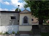 2
2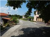 3
3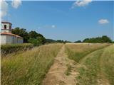 4
4 5
5 6
6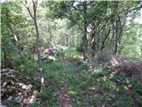 7
7 8
8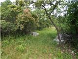 9
9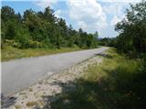 10
10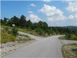 11
11 12
12 13
13 14
14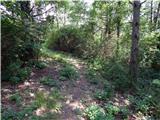 15
15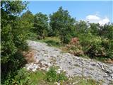 16
16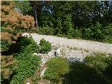 17
17 18
18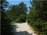 19
19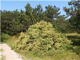 20
20 21
21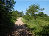 22
22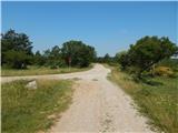 23
23 24
24 25
25 26
26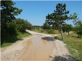 27
27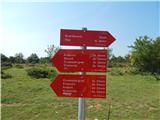 28
28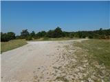 29
29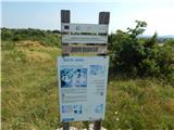 30
30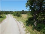 31
31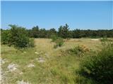 32
32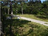 33
33 34
34 35
35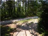 36
36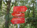 37
37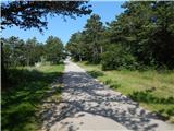 38
38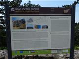 39
39 40
40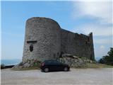 41
41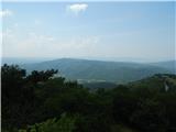 42
42
Discussion about the trip Petrinje - Socerb Castle
To post a comment you must log in:
If you do not yet have a username, you must first
register.