Pfitscher Tal / Val di Vizze - Hochfeiler
Starting point: Pfitscher Tal / Val di Vizze (1718 m)
| Latitude/Longitude: | 46,98003°N 11,65461°E |
| |
Walking time: 5 h 40 min
Difficulty: difficult marked way
Elevation gain: 1792 m
Elevation difference along the route: 1850 m
Map:
Recommended equipment (summer): helmet, ice axe, crampons
Recommended equipment (winter): helmet, ice axe, crampons
Views: 10.190
 | 3 people like this post |
Access to starting point:
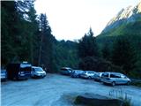
Through the Karawanks Tunnel, we drive into Austria, then we continue driving towards Spittal and further towards Lienz (a little after Spittal the highway ends). Further, we drive on a relatively nice and wide road through the Drau Valley, which brings us into Italy. The road further leads past Dobbiaco / Toblach and Brunico / Bruneck. We continue further on the main road and then join the highway towards Austria (direction Brenner, Innsbruck). Instead of the highway, we can also continue on the parallel road. We leave the highway at the exit for Vipiteno / Sterzing. At two roundabouts, we continue right and follow the signs for the Pfitscher Tal / Val di Vizze valley. Just a little after the second roundabout, we turn left towards the mentioned Pfitscher Tal / Val di Vizze valley. Further, we always follow the signs for the mentioned valley and the Pfitscher Joch / Passo di Vizze pass. The road becomes very narrow, but initially it is still asphalted. Higher up, where the road towards the last houses in the village Stein / Sasso branches off to the left, we continue right on a narrow macadam road towards the Pfitscher Joch / Passo di Vizze pass. We follow this road to one of the two parking lots. The footpath starts at a bend at the second, somewhat smaller parking lot.
Route description:
At the starting point, we head onto a wide path following the signs »Hochfeilerhütte«. Already after a few dozen meters, we come to a junction where we head right downwards on a somewhat narrower trail towards the Hochfeilerhütte hut. After a short descent, we cross a bridge over the Oberbergbach stream and an ascent follows on a well-maintained path. Further, we ascend through the forest, then soon cross a fence and arrive at a marked junction.
Left leads the path towards the Hochferner bivouac, while we continue right following the signs »Hochfeilerhütte«. The path then mostly in a gentle ascent crosses slopes among bushes and somewhat overgrown grassy slopes and brings us near the Bichl alpine pasture where there is another junction.
Right branches off the path towards the Gliederscharte notch, while we continue left and further follow the signs for the Hochfeilerhütte hut. Further, we ascend quite steeply and beautiful views of the surrounding peaks begin to open from the path. We continue ascending on an otherwise well-beaten trail that runs along bushes and somewhat overgrown meadows. The path then turns slightly to the right and for quite some time crosses relatively steep slopes high above the Gliderbach stream. Later we cross a grazing fence and the path brings us to somewhat wider grassy slopes. Here for a short time we ascend somewhat more steeply on grassy slopes, then the path turns slightly to the right again and crosses steep slopes towards the east. On some sections where the path crosses steep slopes, a steel cable assists us. Soon we reach less steep slopes again, from which the view towards the Hochfeilerhütte hut opens for the first time. Further, the path also descends slightly and crosses several streams via a bridge.
The path starts ascending again and from the right a less well-beaten path from the Gliederscharte notch joins us. We continue ascending on an increasingly scenic path, cross another stream and the path brings us to another marked junction.
Right leads the path towards the Hochfeilerhütte hut, while we continue left upwards towards the Hochfeiler summit. From the junction, we ascend diagonally for some time and grassy slopes soon turn rocky. From the right, the path past the Hochfeilerhütte hut then joins us. Here we continue somewhat to the left and ascend along the ridge. When we reach the ridge, which is precipitous on the eastern side, the view towards the Gliderferner glacier and the peaks above the glacier opens up. In the distance, the High Tauern and Dolomites become increasingly visible. Further, we ascend along the ridge, with numerous cairns placed along the path.
When the slope on the eastern side of the ridge becomes gentler, a path running across the Gliderferner glacier joins quite unnoticeably from the right. We continue along the ridge for a while longer, then the slope becomes steeper and the path begins to ascend on the eastern side of the ridge. The slope here is quite steep and some caution is needed at a few spots. When we reach the ridge again, the view also opens to the Weißkarferner glacier, located on the western side of the ridge. Further, we ascend along the ridge towards the summit. In the final part of the ascent, the ridge is often snowy even in summer months, so an ice axe and crampons are often needed for the final push to the summit. In late summer, the slope on the eastern side of the ridge may also be snow-free. In this case, we move away from the ridge to the right onto the eastern side and reach the summit on rocky slabs without major difficulties.

Along the route: Bichl (1838m), Unterbergalm (2200m)
Photos:
 1
1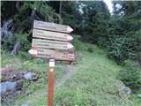 2
2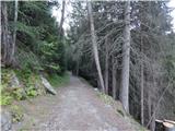 3
3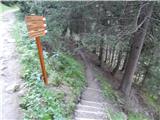 4
4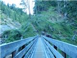 5
5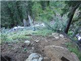 6
6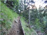 7
7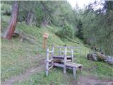 8
8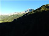 9
9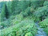 10
10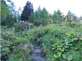 11
11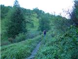 12
12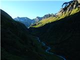 13
13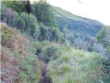 14
14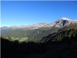 15
15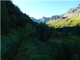 16
16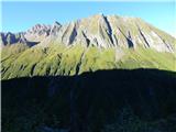 17
17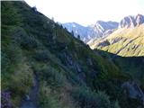 18
18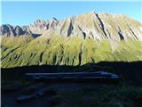 19
19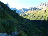 20
20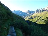 21
21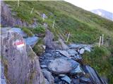 22
22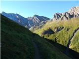 23
23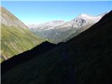 24
24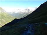 25
25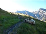 26
26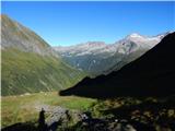 27
27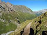 28
28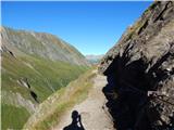 29
29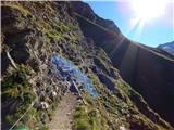 30
30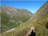 31
31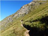 32
32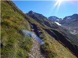 33
33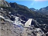 34
34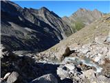 35
35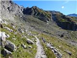 36
36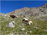 37
37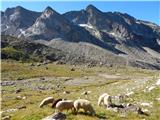 38
38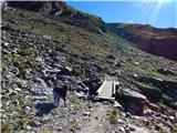 39
39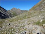 40
40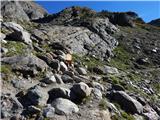 41
41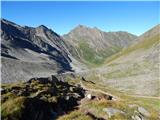 42
42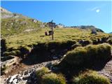 43
43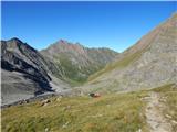 44
44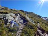 45
45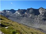 46
46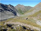 47
47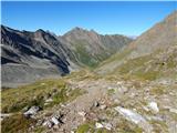 48
48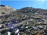 49
49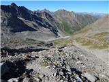 50
50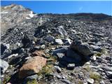 51
51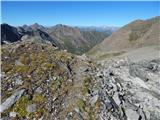 52
52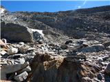 53
53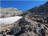 54
54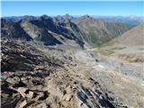 55
55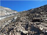 56
56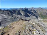 57
57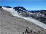 58
58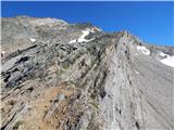 59
59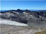 60
60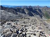 61
61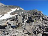 62
62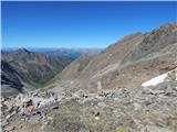 63
63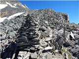 64
64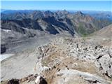 65
65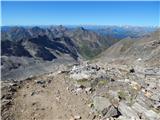 66
66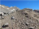 67
67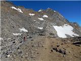 68
68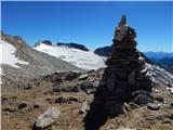 69
69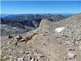 70
70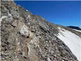 71
71 72
72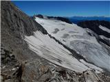 73
73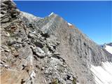 74
74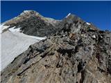 75
75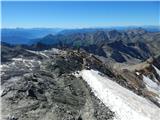 76
76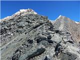 77
77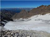 78
78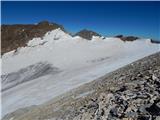 79
79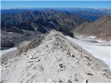 80
80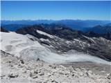 81
81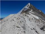 82
82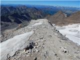 83
83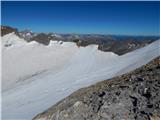 84
84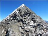 85
85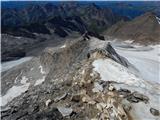 86
86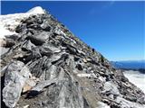 87
87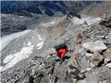 88
88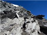 89
89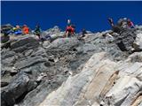 90
90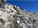 91
91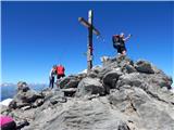 92
92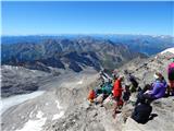 93
93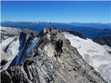 94
94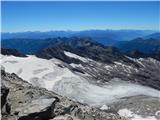 95
95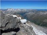 96
96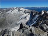 97
97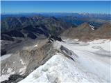 98
98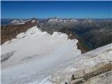 99
99
Discussion about the trip Pfitscher Tal / Val di Vizze - Hochfeiler
|
| NYG25. 08. 2018 |
On Tuesday I did this tour. There was even less snow than in the photos, so I climbed directly up the ridge to the summit without problems. The ascent is not technically demanding, but quite steep in the second half.
Weather was great, view excellent. It was my highest peak so far and probably I won't stand higher. Snow adventures with crampons don't interest me.
|
|
|
|
| mirank25. 08. 2018 |
The condition as you describe has been like that for some years; the western ridge where the access to the summit runs is usually snow-free in August.
|
|
|
To post a comment you must log in:
If you do not yet have a username, you must first
register.