Pian dei Spiriti - Rifugio Fonda Savio
Starting point: Pian dei Spiriti (1840 m)
| Latitude/Longitude: | 46,59096°N 12,26319°E |
| |
Walking time: 1 h 20 min
Difficulty: partly demanding marked way
Elevation gain: 527 m
Elevation difference along the route: 535 m
Map: Tabacco 03 1:25.000
Recommended equipment (summer):
Recommended equipment (winter): ice axe, crampons
Views: 1.600
 | 1 person like this post |
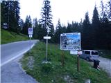
Access to starting point:
A) Access from Gorenjska: Via the border crossing Rateče, we drive to Trbiž / Tarvisio, where we head onto the motorway in the direction of Vidma / Udine. We leave the motorway at the Tolmezzo exit and follow the road to the aforementioned town. From Tolmezzo, we continue in the direction of the settlement Ampezzo and the mountain pass Passo della Mauria. The road then starts descending and brings us into the Cadore valley, where we continue right (left Belluno and Cortina d'Ampezzo) in the direction of the settlement Auronzo. After a few more km of driving, we come to the next bigger junction, where we turn right towards the Misurina pass and Tre Cime (left Tre Crocci pass). From the Misurina pass, the road starts descending and quickly brings us to a junction where the signs for Tre Cime direct us right onto the mountain road towards the hut Auronzo. We follow this road to a junction where a macadam road marked with the sign »Rifugio Fonda Savio« branches off to the right. We can park on the macadam parking lot at the beginning of the mentioned road. There is also another parking lot a little higher if we continue on the macadam road. The mountain road to here is not payable.
B) From the Primorska side: We drive on the motorway towards Venice / Venezia. At Portogruaro, we leave the motorway towards Venice and continue right on the motorway towards Pordenone. At the next motorway junction near Conegliano, we continue right towards Belluno. Near Belluno, the motorway ends, and we continue in the direction of Cortina d'Ampezzo and Auronzo. When the road brings us into the Cadore valley, we will come to a bigger junction, where the road towards Cortina d'Ampezzo goes left, and towards Auronzo right. Here we continue right towards Auronzo. Further, we follow the above description.
Route description:
From the parking lot, we continue on the macadam road, which starts ascending through the forest, and on a smaller clearing, an unmarked path from a slightly higher starting point joins us from the left. The road here turns right and then brings us to the mountain pasture Pian dei Spiriti, where there is another parking lot.
On the mountain pasture, where there are signposts, we head slightly left onto footpath 115 towards the hut Rifugio Fonda Savio. The path brings us back into the forest, through which we then ascend for some time. The forest becomes sparser, and a little higher, the path turns right. The path then crosses the slope in ascent towards the southeast and brings us to more panoramic slopes below the cargo cableway. The path here turns left and then ascends in switchbacks below the cableway for some time. Higher up, the terrain flattens, and a view opens towards the hut Rifugio Fonda Savio and the surrounding precipitous peaks. The path turns left again and leads us across relatively flat and mostly grassy terrain towards the northeast. When we come below the precipitous slopes of the peak Cima Ciadin dei Toce, the path turns slightly right and then ascends along the left side of the valley. Further on, we ascend over increasingly rocky terrain, and a little before the hut, the path brings us to a marked junction.
To the right, the path branches off towards the notch Forcella del Diavolo and the hut Rifugio Col de Varda, while we head left towards the hut Rifugio Fonda Savio. To the hut follows only a shorter, somewhat steeper ascent. During the last ascent, a steel cable assists us, though it is not strictly necessary. At the hut, which is located on the saddle Passo dei Tocci below the slopes of the peak Torre Wundt, a view also opens towards the northeast.
We descend along the ascent path.

Along the route: Pian dei Spiriti (1896m), Passo dei Tocci (2358m)
Photos:
 1
1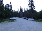 2
2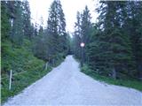 3
3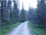 4
4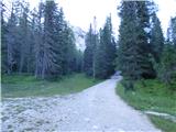 5
5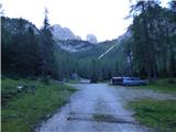 6
6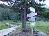 7
7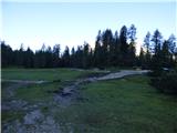 8
8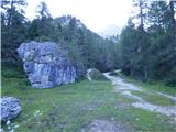 9
9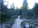 10
10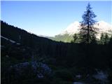 11
11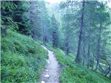 12
12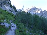 13
13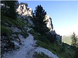 14
14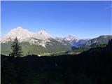 15
15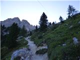 16
16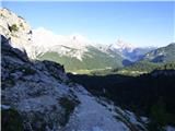 17
17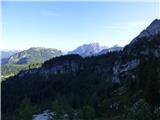 18
18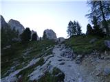 19
19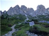 20
20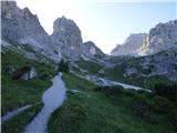 21
21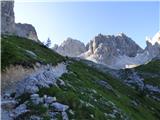 22
22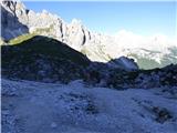 23
23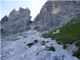 24
24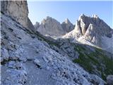 25
25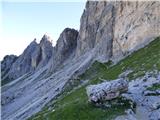 26
26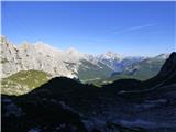 27
27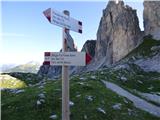 28
28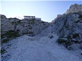 29
29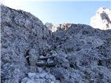 30
30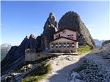 31
31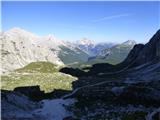 32
32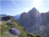 33
33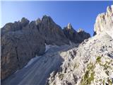 34
34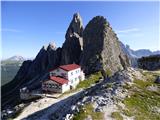 35
35
Discussion about the trip Pian dei Spiriti - Rifugio Fonda Savio
To post a comment you must log in:
If you do not yet have a username, you must first
register.