Piano Fiscalino / Fischleinboden - Rifugio Pian di Cengia
Starting point: Piano Fiscalino / Fischleinboden (1454 m)
| Latitude/Longitude: | 46,66680°N 12,35360°E |
| |
Walking time: 3 h 30 min
Difficulty: easy marked way
Elevation gain: 1074 m
Elevation difference along the route: 1100 m
Map: Tabacco 10 1:25.000
Recommended equipment (summer):
Recommended equipment (winter): ice axe, crampons
Views: 3.054
 | 2 people like this post |
Access to starting point:
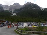
From Ljubljana through the Karawanks Tunnel to Spittal. Next we drive towards Lienz, where at the roundabout we continue in the direction of the village Sillian and Italy. On the Italian side of the border, we quickly come to San Candido, where we continue left in the direction of the tourist town Sesto / Sexten. Only a little after the town Sesto we come to San Giuseppe / Moss, where signs for Val Fiscalina / Fischleintal point us to the right. Further, we drive on an ascending road which we follow to a large paid parking lot.
The free parking lot is approximately 2 km lower, by the bottom station of the cable car "Alta Pusteria".
Route description:
From the parking lot, we continue a few dozen meters on the main road and a little before the hotel Dolomitenhof we turn right onto a narrow road which is closed to traffic. Initially still asphalted, the road soon becomes a macadam road. From the road, we then turn left onto a wide footpath which leads further through a scenic valley. On a gentle path, we then soon reach the mountain hut Talschlusshütte / Rifugio Fondo Valle.
At the mountain hut, we continue right following the signs »Rif. Tre Cime« and »Rif. Comici«. After a few minutes of walking on a wide track we come again to a marked junction. At the junction where there is a magnificent view of the northern wall of the peak Einserkofel / Cima Una (2698m) we continue left on path 103 where signs direct us to the mountain hut Rifugio Comici / Zsigmondy Hütte, while right leads the path to the mountain hut Rifugio Locatelli / Drei Zinnen Hütte.
Further on, the path turns left and runs on gentle terrain mostly along dwarf pines towards the valley Val Fiscalina Alta. The path then starts to ascend in zigzags and brings us to the slopes on the eastern side of the peak Cima Una. Here the path leads high above the valley under steep walls and all the time runs towards the south. Initially the path crosses the slope with sparse forest a few times, then it brings us to even steeper slopes. Since the path is wide, the ascent does not cause us any problems. In wintertime, when there is snow here, the path is dangerous for slipping. In the last part of the path towards the hut, an even nicer view opens up on the precipitous walls of the peak Collerena 2607 m, then the path turns slightly right and the last ascent to the hut Comici follows.
From the hut, we continue right towards the west following the signs »Rif. Pian di Cengia« (path 101). The path continues to ascend towards the west and increasingly beautiful views open up on the surrounding peaks. Grass and other vegetation along the path becomes sparser and an ascent follows on a rocky slope to the saddle Passo Fiscalino. Here we will notice along the path some remains from the First World War. From the saddle, we continue slightly right following the signs »Rif. Pian di Cengia«. The path here becomes less steep and after crossing steep slopes brings us to the hut Pian di Cengia.

Photos:
 1
1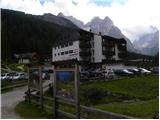 2
2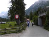 3
3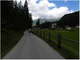 4
4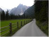 5
5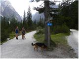 6
6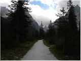 7
7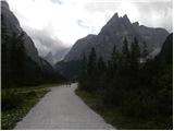 8
8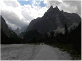 9
9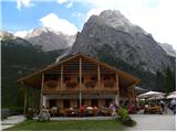 10
10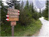 11
11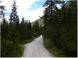 12
12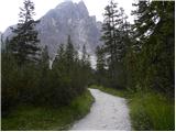 13
13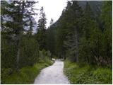 14
14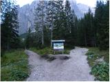 15
15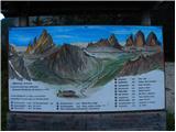 16
16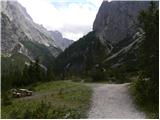 17
17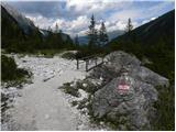 18
18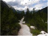 19
19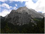 20
20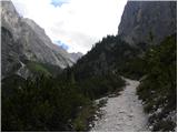 21
21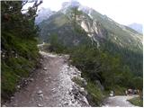 22
22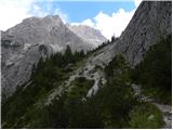 23
23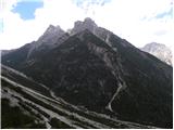 24
24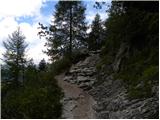 25
25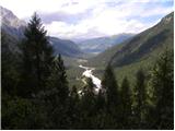 26
26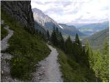 27
27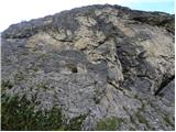 28
28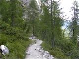 29
29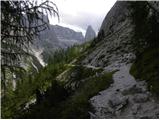 30
30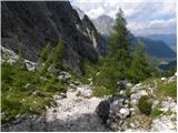 31
31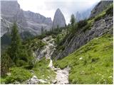 32
32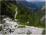 33
33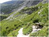 34
34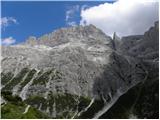 35
35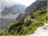 36
36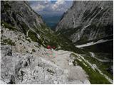 37
37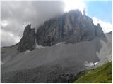 38
38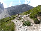 39
39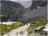 40
40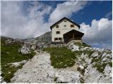 41
41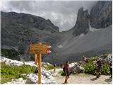 42
42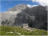 43
43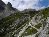 44
44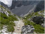 45
45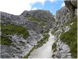 46
46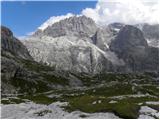 47
47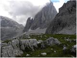 48
48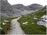 49
49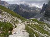 50
50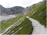 51
51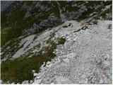 52
52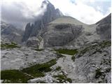 53
53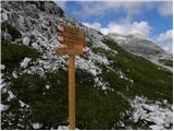 54
54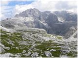 55
55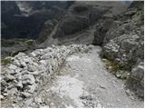 56
56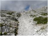 57
57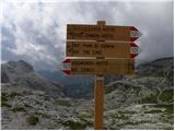 58
58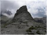 59
59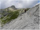 60
60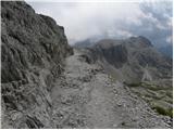 61
61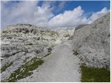 62
62 63
63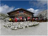 64
64
Discussion about the trip Piano Fiscalino / Fischleinboden - Rifugio Pian di Cengia
To post a comment you must log in:
If you do not yet have a username, you must first
register.